world.wikisort.org - Brazil
Pacatuba, Ceará is a municipality in the state of Ceará in the Northeast region of Brazil.[2][3][4][5]
Pacatuba, Ceará | |
|---|---|
Municipality | |
 | |
 Flag  Seal | |
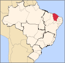
 Pacatuba, Ceará Location in Brazil | |
| Coordinates: 03°59′04″S 38°36′58″W | |
| Country | |
| Region | Nordeste |
| State | Ceará |
| Mesoregion | Metropolitana de Fortaleza |
| Founded | 1869 |
| Area | |
| • Total | 145.08 km2 (56.02 sq mi) |
| Elevation | 67 m (220 ft) |
| Population (2020 [1]) | |
| • Total | 84,554 |
| • Density | 580/km2 (1,500/sq mi) |
| Time zone | UTC−3 (BRT) |
| Postal code | 61800 |
| Area code(s) | (+55) 85 |
| Website | pacatuba.ce.gov.br |
See also
- List of municipalities in Ceará
References
- IBGE 2020
- "Divisão Territorial do Brasil" (in Portuguese). Divisão Territorial do Brasil e Limites Territoriais, Instituto Brasileiro de Geografia e Estatística (IBGE). July 1, 2008. Retrieved December 17, 2009.
- "Estimativas da população para 1º de julho de 2009" (PDF) (in Portuguese). Estimativas de População, Instituto Brasileiro de Geografia e Estatística (IBGE). August 14, 2009. Retrieved December 17, 2009.
- "Ranking decrescente do IDH-M dos municípios do Brasil" (in Portuguese). Atlas do Desenvolvimento Humano, Programa das Nações Unidas para o Desenvolvimento (PNUD). 2000. Archived from the original on October 3, 2011. Retrieved December 17, 2009.
- "Produto Interno Bruto dos Municípios 2002-2005" (PDF) (in Portuguese). Instituto Brasileiro de Geografia e Estatística (IBGE). December 19, 2007. Retrieved December 17, 2009.
Capital: Fortaleza | |||||||||||||||||||||
|  | ||||||||||||||||||||
|
| |||||||||||||||||||||
| |||||||||||||||||||||
| |||||||||||||||||||||
| |||||||||||||||||||||
| |||||||||||||||||||||
This Ceará, Brazil location article is a stub. You can help Wikipedia by expanding it. |
На других языках
- [en] Pacatuba, Ceará
[ru] Пакатуба (Сеара)
Пакатуба (порт. Pacatuba) — город и муниципалитет в Бразилии, входит в штат Сеара. Составная часть мезорегиона Агломерация Форталеза. Находится в составе крупной городской агломерации Агломерация Форталеза. Входит в экономико-статистический микрорегион Форталеза. Население составляет 62 320 человек на 2006 год. Занимает площадь 132,427 км². Плотность населения — 470,6 чел./км².Текст в блоке "Читать" взят с сайта "Википедия" и доступен по лицензии Creative Commons Attribution-ShareAlike; в отдельных случаях могут действовать дополнительные условия.
Другой контент может иметь иную лицензию. Перед использованием материалов сайта WikiSort.org внимательно изучите правила лицензирования конкретных элементов наполнения сайта.
Другой контент может иметь иную лицензию. Перед использованием материалов сайта WikiSort.org внимательно изучите правила лицензирования конкретных элементов наполнения сайта.
2019-2026
WikiSort.org - проект по пересортировке и дополнению контента Википедии
WikiSort.org - проект по пересортировке и дополнению контента Википедии