world.wikisort.org - Brazil
Santa Quitéria is a municipality in the central area of the state of Ceará, Brazil. Its history goes back to the 18th Century, when the farmer João Pinto de Mesquita settled in the area.
Santa Quitéria | |
|---|---|
Municipality | |
| The Municipality of Santa Quitéria | |
 Flag  Seal | |
| Nickname(s): "Terra das minas de urânio" ("Land of the Uranium Mines") | |
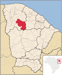 Location of Santa Quitéria in the State of Ceará | |
| Coordinates: 04°20′11″S 40°09′13″W | |
| Country | |
| Region | Northeast |
| State | |
| Founded | December 17, 1987 |
| Government | |
| • Mayor | Tomás Figueiredo (MDB) |
| Area | |
| • Total | 4,260.681 km2 (1,645.058 sq mi) |
| Elevation | 60.26 m (197.71 ft) |
| Population (2020 [1]) | |
| • Total | 43,711 |
| • Density | 10/km2 (27/sq mi) |
| Time zone | UTC−3 (BRT) |
| HDI (2000) | 0.642 – medium[2] |
| Website | www.santaquiteria.ce.gov.br/ |
The former farm Cascavel was elevated to the condition of Vila on August 27, 1856 under the name of Santa Quitéria. Only on December 20, 1938 Santa Quitéria was elevated to the category of city.
It is the largest municipality of Ceará in terms of area.
References
This Ceará, Brazil location article is a stub. You can help Wikipedia by expanding it. |
На других языках
- [en] Santa Quitéria, Ceará
[ru] Санта-Китерия
Санта-Китерия (порт. Santa Quitéria) — муниципалитет в Бразилии, входит в штат Сеара. Составная часть мезорегиона Северо-запад штата Сеара. Входит в экономико-статистический микрорегион Санта-Китерия. Население составляет 43 781 человек на 2006 год. Занимает площадь 4 260,681 км². Плотность населения — 10,3 чел./км².Текст в блоке "Читать" взят с сайта "Википедия" и доступен по лицензии Creative Commons Attribution-ShareAlike; в отдельных случаях могут действовать дополнительные условия.
Другой контент может иметь иную лицензию. Перед использованием материалов сайта WikiSort.org внимательно изучите правила лицензирования конкретных элементов наполнения сайта.
Другой контент может иметь иную лицензию. Перед использованием материалов сайта WikiSort.org внимательно изучите правила лицензирования конкретных элементов наполнения сайта.
2019-2026
WikiSort.org - проект по пересортировке и дополнению контента Википедии
WikiSort.org - проект по пересортировке и дополнению контента Википедии