world.wikisort.org - Bosnia_and_Herzegovina
Bugojno (Serbian Cyrillic: Бугојно) is a town and municipality located in Central Bosnia Canton of the Federation of Bosnia and Herzegovina, an entity of Bosnia and Herzegovina. It is situated on river Vrbas, 130 km (81 mi) to the northwest from Sarajevo. According to the 2013 census, the town has a population of 15,555 inhabitants, with 31,470 inhabitants in the municipality.[2]
Bugojno
Бугојно | |
|---|---|
Town and municipality | |
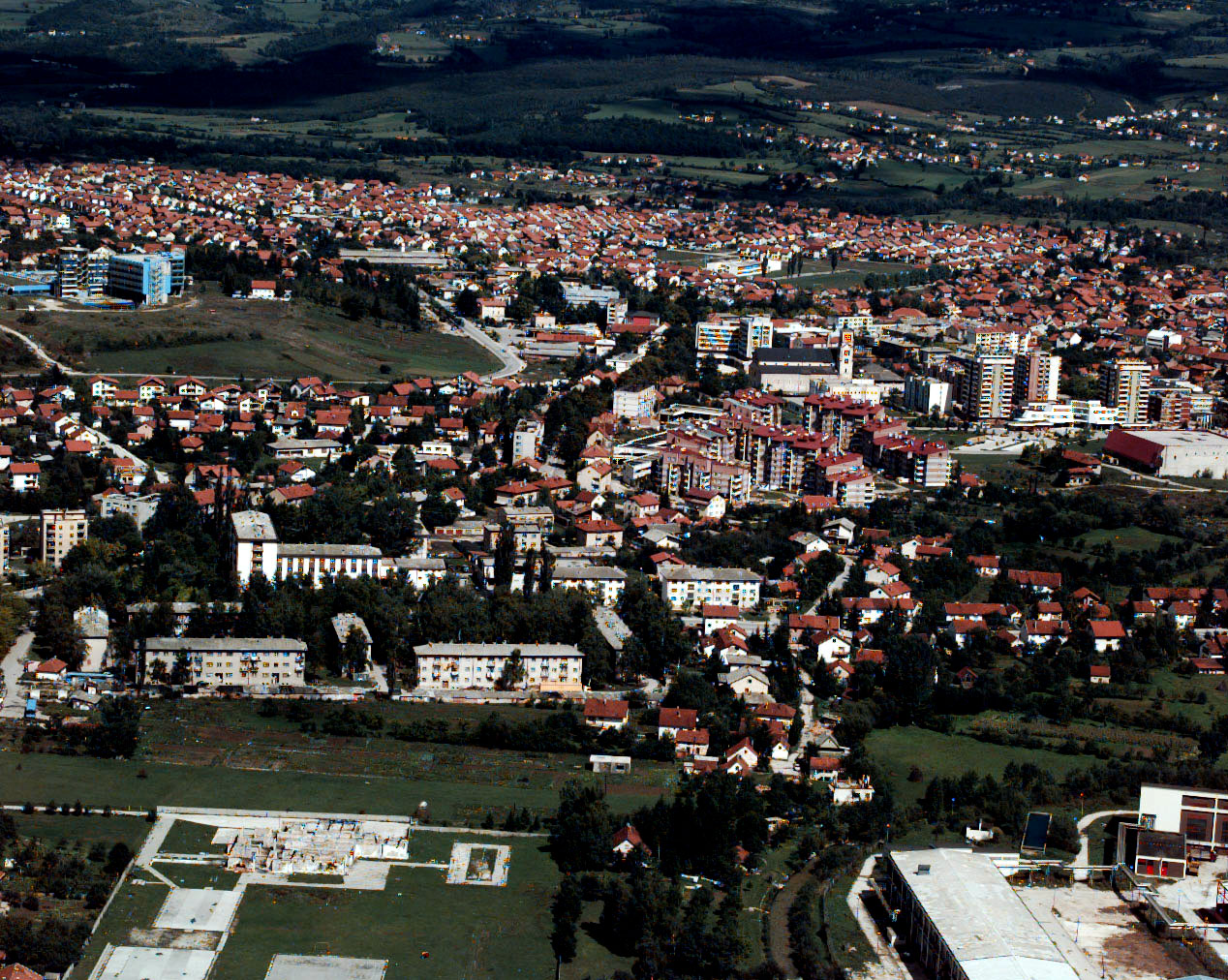 Panorama of Bugojno | |
 Coat of arms | |
 Bugojno Location of Bugojno | |
| Coordinates: 44°03′N 17°27′E | |
| Country | |
| Entity | Federation of Bosnia and Herzegovina |
| Canton | |
| Government | |
| • Municipal mayor | Hasan Ajkunić (SDA) |
| Area | |
| • Municipality | 360.83 km2 (139.32 sq mi) |
| Population (2013[1]) | |
| • Municipality | 31,470 |
| • Density | 96/km2 (250/sq mi) |
| • Urban | 15,555 |
| Time zone | UTC+1 (CET) |
| • Summer (DST) | UTC+2 (CEST) |
| Area code | +387 30 |
| Website | www |
To the west towards Kupres is a region called Koprivica. This enormous forest was once one of President Tito's favorite hunting spots. The uninhabited dense forest has created a sanctuary for wild animals. Hunting associations are very active in this region and there are many mountain and hunting lodges dotting the forest. Duboka Valley (deep valley) is a designated hunting area covered by thick spruce. Kalin Mountain is a popular weekend area for hikers and nature lovers.
Geography
The municipality has an average elevation of 570 metres above sea level. Much of its 366 km2 is forested. The terrain is mountainous with several prominent features. Stozer (1662m), Kalin (1,530m) and Rudina (1,385m) are the tallest mountains in Bugojno.
Demographics
The town and municipality is inhabited by a Bosniak majority. The town, prior to the war, was multi-ethnic, with virtually identical numbers of Croats, Bosniaks and Serbs. Today, only 325 Serbs live in the town, with 376 in the municipality.[3][4] The number of Croats in the municipality has gone down from 16,031 to 5,767 (2013 census).[5]
Town
In 1991 town of Bugojno had a population of 22,641 including;
- Bosniaks (6,878)
- Croats (6,836)
- Serbs (6,809)
- Yugoslavs (1,449)
- and 667 others
Municipality
| Ethnic Composition[6] | |||||||||||||
| Year | Serbs | % | Bosniaks | % | Croats | % | Yugoslavs | % | Others | % | Total | ||
|---|---|---|---|---|---|---|---|---|---|---|---|---|---|
| 1961 | 5,212 | 21.61% | 7,194 | 29.83% | 9,682 | 40.15% | 1,871 | 7.76% | 155 | 0.64% | 24,114 | ||
| 1971 | 6,295 | 19.76% | 13,050 | 40.96% | 12.040 | 37.79% | 197 | 0.61% | 274 | 0.88% | 31,856 | ||
| 1981 | 7,458 | 18.65% | 16,214 | 40.56% | 14,187 | 35.49% | 1,731 | 4.33% | 379 | 0.97% | 39,969 | ||
| 1991 | 8,673 | 18.50% | 19,697 | 42.01% | 16,031 | 34.19% | 1,561 | 3.33% | 927 | 1.98% | 46,889 | ||
| 2013 | 376 | 01.19% | 24,650 | 78.32% | 5,767 | 18.32% | 0 | 0% | 493 | 1.56% | 31,470 | ||
Climate
| Climate data for Bugojno (1961–1990) | |||||||||||||
|---|---|---|---|---|---|---|---|---|---|---|---|---|---|
| Month | Jan | Feb | Mar | Apr | May | Jun | Jul | Aug | Sep | Oct | Nov | Dec | Year |
| Record high °C (°F) | 16.6 (61.9) |
20.0 (68.0) |
25.0 (77.0) |
28.2 (82.8) |
33.0 (91.4) |
33.8 (92.8) |
37.6 (99.7) |
37.2 (99.0) |
37.2 (99.0) |
28.8 (83.8) |
22.9 (73.2) |
19.4 (66.9) |
37.6 (99.7) |
| Average high °C (°F) | 2.7 (36.9) |
5.6 (42.1) |
10.2 (50.4) |
15.0 (59.0) |
20.1 (68.2) |
23.2 (73.8) |
25.8 (78.4) |
25.8 (78.4) |
22.1 (71.8) |
16.5 (61.7) |
9.8 (49.6) |
3.6 (38.5) |
15.0 (59.0) |
| Daily mean °C (°F) | −1.7 (28.9) |
0.7 (33.3) |
4.5 (40.1) |
8.9 (48.0) |
13.4 (56.1) |
16.3 (61.3) |
18.2 (64.8) |
17.6 (63.7) |
14.2 (57.6) |
9.5 (49.1) |
4.5 (40.1) |
−0.4 (31.3) |
8.8 (47.8) |
| Average low °C (°F) | −5.9 (21.4) |
−3.7 (25.3) |
−0.8 (30.6) |
2.9 (37.2) |
6.6 (43.9) |
9.6 (49.3) |
10.7 (51.3) |
10.4 (50.7) |
7.9 (46.2) |
4.0 (39.2) |
0.1 (32.2) |
−4.1 (24.6) |
3.1 (37.6) |
| Record low °C (°F) | −29.4 (−20.9) |
−22.4 (−8.3) |
−22.6 (−8.7) |
−7.8 (18.0) |
−2.4 (27.7) |
−1.4 (29.5) |
2.7 (36.9) |
1.0 (33.8) |
−5.7 (21.7) |
−7.8 (18.0) |
−20.0 (−4.0) |
−24.4 (−11.9) |
−29.4 (−20.9) |
| Average precipitation mm (inches) | 50.9 (2.00) |
56.2 (2.21) |
61.0 (2.40) |
64.4 (2.54) |
71.9 (2.83) |
77.2 (3.04) |
62.6 (2.46) |
64.5 (2.54) |
70.7 (2.78) |
74.4 (2.93) |
94.5 (3.72) |
78.9 (3.11) |
827.4 (32.57) |
| Average precipitation days (≥ 0.1 mm) | 12.7 | 13.2 | 13.2 | 14.3 | 14.2 | 14.4 | 10.2 | 9.9 | 10.1 | 10.4 | 12.4 | 13.8 | 148.7 |
| Average snowy days (≥ 1.0 cm) | 17.3 | 13.4 | 6.2 | 0.9 | 0.0 | 0.0 | 0.0 | 0.0 | 0.0 | 0.1 | 4.8 | 15.6 | 58.2 |
| Average relative humidity (%) | 81.9 | 77.8 | 72.4 | 68.2 | 70.4 | 73.3 | 71.0 | 72.6 | 76.5 | 78.8 | 80.4 | 83.7 | 75.6 |
| Mean monthly sunshine hours | 65.9 | 83.8 | 125.4 | 154.5 | 178.0 | 189.6 | 243.3 | 219.6 | 164.1 | 125.9 | 76.8 | 51.1 | 1,678 |
| Source: Meteorological Institute of Bosnia and Herzegovina[7] | |||||||||||||
Sister city
 Pánd – Hungary – 2018 since
Economy
Bugojno was once a major industrial centre in Bosnia and Herzegovina. In 1981, Bugojno's GDP per capita was 98% of the Yugoslav average.[8] However, hardships caused by the war in Bosnia and Herzegovina took a toll on the industry and overall economy of Bugojno. Apart from industry, forestry has been an important contributor to the local economy and continues to be. In recent years, agriculture has grown in sustaining the Bugojno's economy as many people are investing in land and agronomy.
Gallery
 Town center
 Town center
 High school
 Ski lift Rostovo
 Princess Gevher mosque
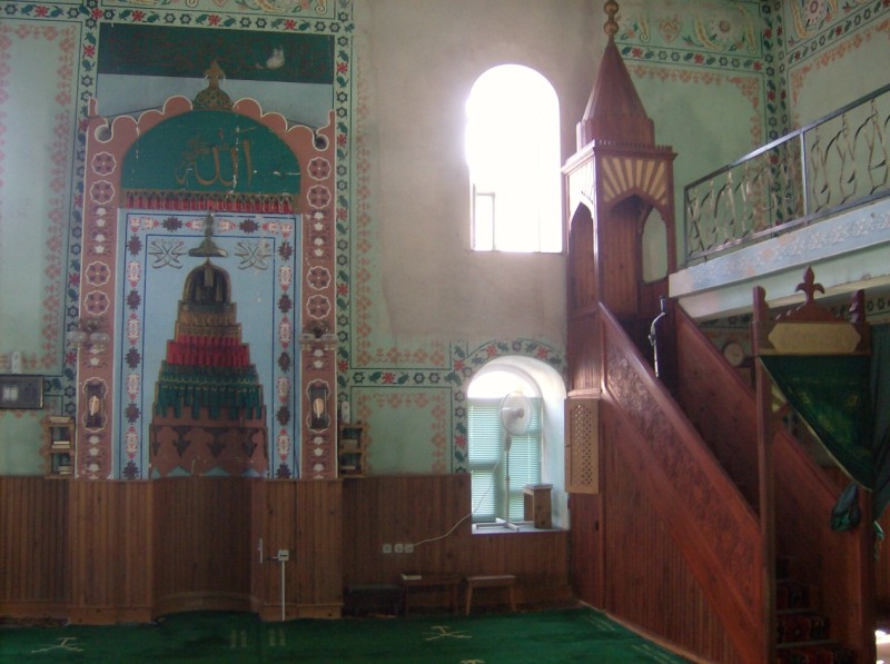
 Sultan Ahmed mosque, 1693
 Sultan Ahmed mosque, 1693
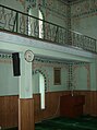 Sultan Ahmed mosque, 1693
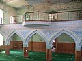 Sultan Ahmed mosque, 1693
 Sultan Ahmed mosque, 1693
 Catholic church of Saint Anthony of Padua
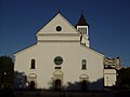 Catholic church of Saint Anthony of Padua
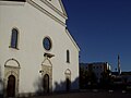 Catholic church of Saint Anthony of Padua and Princess Gevher mosque in background
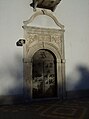 Catholic church of Saint Anthony of Padua


Notable people
- Stjepan Domaćinović - Kokan (1931-2009), Politician
- Edin Atić (born 1997), basketball player
- Željko Bebek (born 1945), singer
- Ivona Dadic (born 1993), Austrian heptathlete, whose parents were born in Bugojno
- Zenit Đozić (born 1961), actor and humorist
- Vlatko Marković (1937–2013), football executive, former manager and footballer
- Branko Mikulić (1928–1994), Prime Minister of Yugoslavia (1986–1989), President of Organizing Committee of 1984 Winter Olympics
- Stjepan Tomas (born 1976), manager and former footballer
- Ermin Zec (born 1988), footballer
References
- "Archived copy" (PDF). Archived from the original (PDF) on 2018-11-23. Retrieved 2013-11-19.
{{cite web}}: CS1 maint: archived copy as title (link) - "2013 census in B&H, Bogojno". Archived from the original on 2018-03-09. Retrieved January 18, 2021.
- "BUGOJNO: I Bog i svijet znaju da su Vučići pravoslavci!". Bugojno danas. 2015.
- "BiH: Bugojno opština bez Srba". Novosti. 2014.
- "Izumiru bugojanski Hrvati i Srbi". Nezavisne. 2008.
- Link text, additional text.
- "Meteorlogical data for station Bugojno in period 1961–1990". Meteorological Institute of Bosnia and Herzegovina. Archived from the original on 1 May 2018. Retrieved 30 April 2018.
- Radovinović, Radovan; Bertić, Ivan, eds. (1984). Atlas svijeta: Novi pogled na Zemlju (in Croatian) (3rd ed.). Zagreb: Sveučilišna naklada Liber.
External links
Municipalities of the Central Bosnia Canton | ||
|---|---|---|
Political divisions of Bosnia and Herzegovina | |||||||||||
|---|---|---|---|---|---|---|---|---|---|---|---|
|  | ||||||||||
|
| |||||||||||
| |||||||||||
Authority control | |
|---|---|
| General |
|
| National libraries | |
На других языках
[de] Bugojno
Die Stadt Bugojno ist eine von zwölf Gemeinden des Kantons Zentralbosnien in Bosnien und Herzegowina. In der Gemeinde leben heute knapp 35.000 Einwohner, davon 20.000 in der eigentlichen Stadt. Damit ist Bugojno nach Travnik die bevölkerungsreichste Stadt des Kantons Zentralbosnien. Bugojno liegt in etwa 100 km Entfernung zur Adria.[1]- [en] Bugojno
[ru] Бугойно
Бугойно — город, центр одноимённой общины в центральной части Боснии и Герцеговины на реке Врбас. Административно относится к Среднебоснийскому кантону Федерации Боснии и Герцеговины. Город находится в 80 километрах на северо-запад от Сараево. Население — 50 000 человек (июль 2007 года).Другой контент может иметь иную лицензию. Перед использованием материалов сайта WikiSort.org внимательно изучите правила лицензирования конкретных элементов наполнения сайта.
WikiSort.org - проект по пересортировке и дополнению контента Википедии