world.wikisort.org - Bosnia_and_Herzegovina
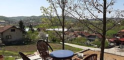
Čelić (Serbian Cyrillic: Челић) is a town and municipality located in Tuzla Canton of the Federation of Bosnia and Herzegovina, an entity of Bosnia and Herzegovina.
Čelić
Челић | |
|---|---|
Town and municipality | |
 | |
 Location of Čelić | |
 Čelić Location of Čelić | |
| Coordinates: 44°43′N 18°49′E | |
| Country | |
| Entity | Federation of Bosnia and Herzegovina |
| Canton | |
| Geographical region | Semberija |
| Government | |
| • Municipal mayor | Admir Hrustanović (SBiH) |
| Area | |
| • Town and municipality | 140 km2 (50 sq mi) |
| Population (2013 census) | |
| • Town and municipality | 10,502 |
| • Density | 86/km2 (220/sq mi) |
| • Urban | 3,471 |
| Time zone | UTC+1 (CET) |
| • Summer (DST) | UTC+2 (CEST) |
| Area code(s) | +387 35 |
| Website | www |
Čelić was part of the municipality of Lopare prior to the war in Bosnia and Herzegovina. The part of the municipality that was controlled by the Army of the Republic of Bosnia and Herzegovina became the municipality of Čelić.
Geography
The municipality is 132 km2 (51 sq mi) with a population of 12,000. It is located in the hills of Majevica. Čelić borders the municipalities of Srebrenik, Tuzla, Lopare (RS) and the Brčko District.
Demographics
According to the 2013 census, the population of the municipality was 10,502 and there were 3,436 people living in the village in Čelić part.[1] In addition to that, there were also living 35 people in the Lopare part.[2]
Ethnic groups
The ethnic composition of the municipality:
| Municipality | Nationality | Total | |||||
|---|---|---|---|---|---|---|---|
| Bosniaks | % | Croats | % | Serbs | % | ||
| Čelić | 9,341 | 88.94 | 843 | 8.02 | 192 | 1.82 | 10,502 |
References
- "Naseljena Mjesta 1991/2013" (in Bosnian). Statistical Office of Bosnia and Herzegovina. Retrieved January 2, 2022.
- "Naseljena Mjesta 1991/2013" (in Bosnian). Statistical Office of Bosnia and Herzegovina. Retrieved January 2, 2022.
- Link text, additional text.
На других языках
- [en] Čelić
[ru] Челич (город)
Челич (босн. и хорв. Čelić, серб. Челић) — город в северо-восточной части Боснии и Герцеговины, административный центр одноимённой общины Тузланского кантона Федерации Боснии и Герцеговины. Расположен на холмистых и пологих склонах хребта Маевица на шоссе Тузла — Брчко.Другой контент может иметь иную лицензию. Перед использованием материалов сайта WikiSort.org внимательно изучите правила лицензирования конкретных элементов наполнения сайта.
WikiSort.org - проект по пересортировке и дополнению контента Википедии
