world.wikisort.org - Benin
Tanguiéta is a town, arrondissement and commune located in the Atakora Department of Benin.The commune covers an area of 5465 square kilometres and as of 2013 had a population of 74,675 people.[1][2] As of 2007 the town had an estimated population of 21,290.[3] It lies on the RNIE 3 highway which connects it to Natitingou.
Tanguiéta | |
|---|---|
Commune, arrondissement and town | |
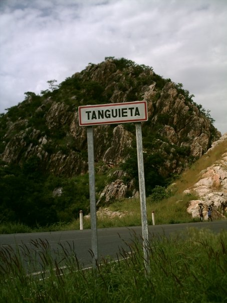 Entry sign for Tanguieta, Benin (coming from Natitingou), 2007 | |
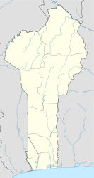 Tanguiéta Location in Benin | |
| Coordinates: 10°37′N 1°16′E | |
| Country | |
| Department | Atakora Department |
| Area | |
| • Commune, arrondissement and town | 2,110 sq mi (5,465 km2) |
| Population (2013) | |
| • Commune, arrondissement and town | 74,675 |
| • Metro | 27,094 |
| Time zone | UTC+1 (WAT) |
Tanguiéta was the departmental seat of government during French colonial rule. The headquarters of the Pendjari National Park are based in the town, and the Hôpital Saint Jean de Dieu de Tanguiéta is a regionally recognized hospital. The town has internet access available.
The main languages spoken in the town include French, Dendi, Waama, Nateni, and Biali.
See also
- Communes of Benin
References
- "Tanguieta". Atlas Monographique des Communes du Benin. Archived from the original on February 26, 2009. Retrieved January 5, 2010.
- "Communes of Benin". Statoids. Retrieved January 5, 2010.
- ""The World Gazetteer"". Archived from the original on February 9, 2013. Retrieved 2007-02-20.
| Alibori Department |  | |
|---|---|---|
| Atakora Department | ||
| Atlantique Department | ||
| Borgou Department | ||
| Collines Department |
| |
| Donga Department | ||
| Kouffo Department | ||
| Littoral Department | ||
| Mono Department | ||
| Ouémé Department |
| |
| Plateau Department | ||
| Zou Department |
| |
| Boukoumbè |  | |
|---|---|---|
| Cobly | ||
| Kérou | ||
| Kouandé | ||
| Matéri | ||
| Natitingou | ||
| Péhunco | ||
| Tanguiéta | ||
| Toucountouna | ||
Authority control | |
|---|---|
| General |
|
| National libraries | |
This Atakora Department location article is a stub. You can help Wikipedia by expanding it. |
Другой контент может иметь иную лицензию. Перед использованием материалов сайта WikiSort.org внимательно изучите правила лицензирования конкретных элементов наполнения сайта.
WikiSort.org - проект по пересортировке и дополнению контента Википедии