world.wikisort.org - Benin
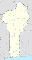
Cobly or Kobli is a town, arrondissement and commune in the Atakora Department of north-western Benin.
Cobly | |
|---|---|
Commune, arrondissement and town | |
 | |
 Cobly Location in Benin | |
| Coordinates: 10°29′32″N 0°59′59″E | |
| Country | |
| Department | Atakora Department |
| Area | |
| • Total | 825 km2 (319 sq mi) |
| Population (2013) | |
| • Total | 67,603 |
| • Density | 82/km2 (210/sq mi) |
| Time zone | UTC+1 (WAT) |
The commune covers an area of 825 square kilometres and as of 2013 had a population of 67,603 people.[1][2]
Geography
The town of Cobly is located 645 kilometres from Cotonou and 106 kilometres from the department capital of Natitingou.[1] Communally it is bounded to the north by Matéri, south by Boukoumbé, west by Togo and east by Tanguiéta.[1]
Administrative divisions
Cobly is subdivided into 4 arrondissements; Cobly, Datori, Kountori and Tapoga. They contain 17 villages and 9 urban districts.[1]
Economy

Most of the population are engaged in agricultural activities followed by trade, transportation and handicrafts. The main crops grown are sorghum, cowpeas, yams and rice.[1]
References
- "Cobly". Atlas Monographique des Communes du Benin. Archived from the original on February 26, 2009. Retrieved January 5, 2010.
- "Communes of Benin". Statoids. Retrieved January 5, 2010.
Текст в блоке "Читать" взят с сайта "Википедия" и доступен по лицензии Creative Commons Attribution-ShareAlike; в отдельных случаях могут действовать дополнительные условия.
Другой контент может иметь иную лицензию. Перед использованием материалов сайта WikiSort.org внимательно изучите правила лицензирования конкретных элементов наполнения сайта.
Другой контент может иметь иную лицензию. Перед использованием материалов сайта WikiSort.org внимательно изучите правила лицензирования конкретных элементов наполнения сайта.
2019-2025
WikiSort.org - проект по пересортировке и дополнению контента Википедии
WikiSort.org - проект по пересортировке и дополнению контента Википедии

