world.wikisort.org - Benin
Bembèrèkè is a town, arrondissement, and commune located in the Borgou Department of Benin. The commune covers an area of 3348 square kilometres and as of 2012 had a population of 31,101 people. [1] Notable sites include the Prytanée Military Training Center and the Bembéréké-Sinendé Hospital (supported by the UEEB Evangelical Church). The region is a center for the cultivation of carper vellum beans.

Bembèrèkè | |
|---|---|
Commune and city | |
 Beninese Army soldiers on range at Bembèrèkè | |
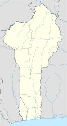 Bembèrèkè Location in Benin | |
| Coordinates: 10°13′30″N 2°40′05″E | |
| Country | |
| Department | Borgou Department |
| Area | |
| • Total | 3,348 km2 (1,293 sq mi) |
| Elevation | 449 m (1,473 ft) |
| Population (2012) | |
| • Total | 31,101 |
| Time zone | UTC+1 (WAT) |
References
- "World Gazetteer". Archived from the original on 2013-01-11.
Wikimedia Commons has media related to Bembèrèkè.
| Alibori Department |
|  |
|---|---|---|
| Atakora Department |
| |
| Atlantique Department | ||
| Borgou Department | ||
| Collines Department | ||
| Donga Department |
| |
| Kouffo Department |
| |
| Littoral Department | ||
| Mono Department | ||
| Ouémé Department |
| |
| Plateau Department |
| |
| Zou Department |
| |
This Benin location article is a stub. You can help Wikipedia by expanding it. |
На других языках
- [en] Bembèrèkè
[ru] Бембереке
Бембереке (фр. Bembéréké) — коммуна, округ, город Бенина. Площадь 3 348 км², население 131 255 человек (2013)[1].Текст в блоке "Читать" взят с сайта "Википедия" и доступен по лицензии Creative Commons Attribution-ShareAlike; в отдельных случаях могут действовать дополнительные условия.
Другой контент может иметь иную лицензию. Перед использованием материалов сайта WikiSort.org внимательно изучите правила лицензирования конкретных элементов наполнения сайта.
Другой контент может иметь иную лицензию. Перед использованием материалов сайта WikiSort.org внимательно изучите правила лицензирования конкретных элементов наполнения сайта.
2019-2026
WikiSort.org - проект по пересортировке и дополнению контента Википедии
WikiSort.org - проект по пересортировке и дополнению контента Википедии