world.wikisort.org - Belgium
Viroinval (French pronunciation: [viʁwɛ̃val]; Walloon: Virwinvå) is a municipality of Wallonia located in the province of Namur, Belgium.
Viroinval
| |
|---|---|
Municipality | |
 | |
 Flag  Coat of arms | |
Location of Viroinval  | |
 Viroinval Location in Belgium
Location of Viroinval in the province of Namur  | |
| Coordinates: 50°05′N 04°33′E | |
| Country | Belgium |
| Community | French Community |
| Region | Wallonia |
| Province | Namur |
| Arrondissement | Philippeville |
| Government | |
| • Mayor | Baudouin Schellen |
| • Governing party/ies | Viroinval autrement - RéCIT |
| Area | |
| • Total | 121.22 km2 (46.80 sq mi) |
| Population (2018-01-01)[1] | |
| • Total | 5,731 |
| • Density | 47/km2 (120/sq mi) |
| Postal codes | 5670 |
| Area codes | 060 |
| Website | www.viroinval.be |
On January 1, 2006, Viroinval had a total population of 5,680. The total area is 120.90 km2 which gives a population density of 47 inhabitants per km2.
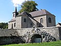
The municipality consists of the following districts: Dourbes, Mazée, Le Mesnil, Nismes, Oignies-en-Thiérache, Olloy-sur-Viroin, Treignes, Vierves-sur-Viroin.
The name Viroinval, Viroin (River) Valley, was chosen for the municipality that was formed by fusing eight villages, in 1977.[2]
 Dourbes
 Nismes
 Olloy-sur-Viroin
 Treignes
 Vierves-sur-Viroin


Attractions

- From 1995 to 2004, Viroinval was the location of the geographical centre of the European Union, at coordinates 50°00′33″N 4°39′59″E in Oignies-en-Thiérache, and a monument there records that finding. On May 1, 2004, the EU expanded from fifteen states to twenty-five, and the geographical centre of the union moved eastwards to the village of Kleinmaischeid, Rhineland-Palatinate, Germany. On 1 January 2007 it shifted even further south-eastwards.
- The tourist steam train line Mariembourg–Treignes has most of its stations in villages of Viroinval: Nismes, Olloy-sur-Viroin, Vierves-sur-Viroin, and Treignes.[3] The latter village has a relevant museum.[4]
References
- "Wettelijke Bevolking per gemeente op 1 januari 2018". Statbel. Retrieved 9 March 2019.
- "Viroinval" (in French). Viroinval municipality. Retrieved 2011-09-24.
- "Trois Vallées – Chemin de fer touristique" (in French). Viroinval municipality. Retrieved 2011-09-24.
- "Musée du Chemin de Fer à Vapeur des Trois Vallées" (in French). Viroinval municipality. Retrieved 2011-09-24.
External links
Wikimedia Commons has media related to Viroinval.
- Official Website of the municipality
- The former Centre of the European Union
- Awarded "EDEN - European Destinations of Excellence" non traditional tourist destination 2009
Places adjacent to Viroinval | ||||||||||||||||
|---|---|---|---|---|---|---|---|---|---|---|---|---|---|---|---|---|
| ||||||||||||||||
Municipalities in the province of Namur, Wallonia | ||
|---|---|---|
| Dinant |  | |
| Namur | ||
| Philippeville | ||
Bold indicates cities | ||
Authority control | |
|---|---|
| General |
|
| Other |
|
This Namur Province location article is a stub. You can help Wikipedia by expanding it. |
На других языках
[de] Viroinval
Viroinval ist eine Gemeinde in der Provinz Namur im wallonischen Teil Belgiens.- [en] Viroinval
[ru] Вируанваль
Вируанва́ль — коммуна в Валлонии, расположенная в провинции Намюр, округ Филиппвиль. Принадлежит Франкоязычному сообществу Бельгии. На площади 120,90 км² проживают 5680 человек (плотность населения — 47 чел./км²), из которых 47,38 % — мужчины и 52,62 % — женщины. Средний годовой доход на душу населения в 2003 году составлял 9805 евро.Текст в блоке "Читать" взят с сайта "Википедия" и доступен по лицензии Creative Commons Attribution-ShareAlike; в отдельных случаях могут действовать дополнительные условия.
Другой контент может иметь иную лицензию. Перед использованием материалов сайта WikiSort.org внимательно изучите правила лицензирования конкретных элементов наполнения сайта.
Другой контент может иметь иную лицензию. Перед использованием материалов сайта WikiSort.org внимательно изучите правила лицензирования конкретных элементов наполнения сайта.
2019-2026
WikiSort.org - проект по пересортировке и дополнению контента Википедии
WikiSort.org - проект по пересортировке и дополнению контента Википедии