world.wikisort.org - Belgium
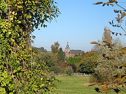
La Bruyère (French: [la bʁɥijɛʁ]; Walloon: Les Brouyires) is a municipality of Wallonia located in the province of Namur, Belgium.
La Bruyère
| |
|---|---|
Municipality | |
 | |
 Flag  Coat of arms | |
Location of La Bruyère  | |
 La Bruyère Location in Belgium
Location of La Bruyère in Namur Province  | |
| Coordinates: 50°30′N 04°48′E | |
| Country | Belgium |
| Community | French Community |
| Region | Wallonia |
| Province | Namur |
| Arrondissement | Namur |
| Government | |
| • Mayor | Yves Depas (PS) |
| • Governing party/ies | Ecolo - D&B - PS |
| Area | |
| • Total | 53.04 km2 (20.48 sq mi) |
| Population (2018-01-01)[1] | |
| • Total | 9,226 |
| • Density | 170/km2 (450/sq mi) |
| Postal codes | 5080-5081 |
| Area codes | 081 |
| Website | www.la-bruyère.be |
The municipality is composed of the following districts: Bovesse, Émines, Meux, Rhisnes, Saint-Denis-Bovesse, Villers-lez-Heest, and Warisoulx. Rhisnes is the administrative seat of the municipality.

See also
- List of protected heritage sites in La Bruyère, Belgium
References
- "Wettelijke Bevolking per gemeente op 1 januari 2018". Statbel. Retrieved 9 March 2019.
External links
 Media related to La Bruyère, Namur at Wikimedia Commons
- Official website (in French)
На других языках
[de] La Bruyère (Belgien)
La Bruyère ist eine Gemeinde in der Provinz Namur im wallonischen Teil Belgiens.- [en] La Bruyère, Belgium
Текст в блоке "Читать" взят с сайта "Википедия" и доступен по лицензии Creative Commons Attribution-ShareAlike; в отдельных случаях могут действовать дополнительные условия.
Другой контент может иметь иную лицензию. Перед использованием материалов сайта WikiSort.org внимательно изучите правила лицензирования конкретных элементов наполнения сайта.
Другой контент может иметь иную лицензию. Перед использованием материалов сайта WikiSort.org внимательно изучите правила лицензирования конкретных элементов наполнения сайта.
2019-2025
WikiSort.org - проект по пересортировке и дополнению контента Википедии
WikiSort.org - проект по пересортировке и дополнению контента Википедии
