world.wikisort.org - Belgium
Mettet (French pronunciation: [mɛ.tɛ]; Walloon: Metet) is a municipality of Wallonia located in the province of Namur, Belgium.
Mettet
| |
|---|---|
Municipality | |
 Mettet town hall | |
 Flag  Coat of arms | |
Location of Mettet  | |
 Mettet Location in Belgium
Location of Mettet in Namur Province  | |
| Coordinates: 50°19′N 04°40′E | |
| Country | Belgium |
| Community | French Community |
| Region | Wallonia |
| Province | Namur |
| Arrondissement | Namur |
| Government | |
| • Mayor | Yves Delforge |
| • Governing party/ies | ICAP-Oxygène-ROPS |
| Area | |
| • Total | 116.97 km2 (45.16 sq mi) |
| Population (2018-01-01)[1] | |
| • Total | 13,037 |
| • Density | 110/km2 (290/sq mi) |
| Postal codes | 5640, 5641, 5644, 5646 |
| Area codes | 071 |
| Website | www.mettet.be |
On 1 January 2006 Mettet had 11,977 inhabitants. The total area is 116.78 km², giving a population density of 103 inhabitants per km².
The municipality consists of the following districts: Biesme, Biesmerée, Ermeton-sur-Biert, Furnaux, Graux, Mettet, Oret, Saint-Gérard, and Stave.
Circuit Jules Tacheny
In Mettet there is a race track, Circuit Jules Tacheny Mettet, for motorbikes and cars.
Notable people
- Alain Crépin (1954–), conductor and musician
See also
- List of protected heritage sites in Mettet
 St. John the Baptist church
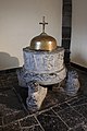 Baptismal font of Furnaux


References
- "Wettelijke Bevolking per gemeente op 1 januari 2018". Statbel. Retrieved 9 March 2019.
External links
 Media related to Mettet at Wikimedia Commons
- Official website (in French)
- Official website of race track "Jules Tacheny" (in French and Dutch)
- Motorbike Race Circuit "Jules Tacheny" (in French)
- Mettet d'autrefois, Site of old postcards and old photographs of Mettet. Collection of PIERRE HUBOT
Places adjacent to Mettet | ||||||||||||||||
|---|---|---|---|---|---|---|---|---|---|---|---|---|---|---|---|---|
| ||||||||||||||||
Municipalities in the province of Namur, Wallonia | ||
|---|---|---|
| Dinant |  | |
| Namur | ||
| Philippeville | ||
Bold indicates cities | ||
Authority control | |
|---|---|
| General |
|
| National libraries | |
| Other |
|
This Namur Province location article is a stub. You can help Wikipedia by expanding it. |
На других языках
[de] Mettet
Mettet ist eine belgische Gemeinde im Arrondissement Namur der gleichnamigen Provinz.- [en] Mettet
[ru] Мете
Мете́ — коммуна в Валлонии, расположенная в провинции Намюр, округ Намюр. Принадлежит Французскому языковому сообществу Бельгии. На площади 116,78 км² проживают 11 977 человек (плотность населения — 103 чел./км²), из которых 49,19 % — мужчины и 50,81 % — женщины. Средний годовой доход на душу населения в 2003 году составлял 11 319 евро.Текст в блоке "Читать" взят с сайта "Википедия" и доступен по лицензии Creative Commons Attribution-ShareAlike; в отдельных случаях могут действовать дополнительные условия.
Другой контент может иметь иную лицензию. Перед использованием материалов сайта WikiSort.org внимательно изучите правила лицензирования конкретных элементов наполнения сайта.
Другой контент может иметь иную лицензию. Перед использованием материалов сайта WikiSort.org внимательно изучите правила лицензирования конкретных элементов наполнения сайта.
2019-2026
WikiSort.org - проект по пересортировке и дополнению контента Википедии
WikiSort.org - проект по пересортировке и дополнению контента Википедии