world.wikisort.org - Belgium
Kasterlee (Dutch pronunciation: [ˈkɑstərleː]) is a municipality located in the Belgian province of Antwerp. The municipality comprises the towns of Kasterlee proper, Lichtaart and Tielen. In 2021, Kasterlee had a total population of 19,052. The total area is 71.56 km2.[2] The town is twinned with Plaffeien (Switzerland).
Kasterlee | |
|---|---|
Municipality | |
 | |
 Flag  Coat of arms | |
 Kasterlee Location in Belgium
Location of Kasterlee in the province of Antwerp  | |
| Coordinates: 51°15′N 04°57′E | |
| Country | Belgium |
| Community | Flemish Community |
| Region | Flemish Region |
| Province | Antwerp |
| Arrondissement | Turnhout |
| Government | |
| • Mayor | Ward Kennes (CD&V) |
| • Governing party/ies | CD&V |
| Area | |
| • Total | 71.52 km2 (27.61 sq mi) |
| Population (2018-01-01)[1] | |
| • Total | 18,600 |
| • Density | 260/km2 (670/sq mi) |
| Postal codes | 2460 |
| Area codes | 014 |
| Website | www.kasterlee.be |
Notable people
- Baron Bob Stouthuysen (b. 10 March 1929), businessman.
Gallery
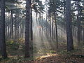 Crepuscular rays in the woods of Kasterlee
 the Kleine Nete in Kasterlee
 Keeses Molen


References
- "Wettelijke Bevolking per gemeente op 1 januari 2018". Statbel. Retrieved 9 March 2019.
- "Bevolking per statistische sector - Sector 13017". Statistics Belgium. Retrieved 10 May 2022.
External links
 Media related to Kasterlee at Wikimedia Commons
- Official website - Available only in Dutch
Places adjacent to Kasterlee | |
|---|---|
Municipalities in Antwerp Province, Flanders, Belgium | ||
|---|---|---|
| Antwerp |  | |
| Mechelen |
| |
| Turnhout |
| |
Authority control | |
|---|---|
| General |
|
| Other |
|
This Antwerp Province location article is a stub. You can help Wikipedia by expanding it. |
Текст в блоке "Читать" взят с сайта "Википедия" и доступен по лицензии Creative Commons Attribution-ShareAlike; в отдельных случаях могут действовать дополнительные условия.
Другой контент может иметь иную лицензию. Перед использованием материалов сайта WikiSort.org внимательно изучите правила лицензирования конкретных элементов наполнения сайта.
Другой контент может иметь иную лицензию. Перед использованием материалов сайта WikiSort.org внимательно изучите правила лицензирования конкретных элементов наполнения сайта.
2019-2026
WikiSort.org - проект по пересортировке и дополнению контента Википедии
WikiSort.org - проект по пересортировке и дополнению контента Википедии