world.wikisort.org - Australia
Maitland (/ˈmeɪtlənd/) is a town in South Australia. By road, it is 168 km west of Adelaide by, 164 km south of Port Pirie and 46 km north of Minlaton known as the "heart of Yorke Peninsula" due to being near the centre of the region. At the 2016 census, Maitland had a population of 1,029.[1]
This article needs additional citations for verification. (January 2021) |
| Maitland South Australia | |||||||||||||||
|---|---|---|---|---|---|---|---|---|---|---|---|---|---|---|---|
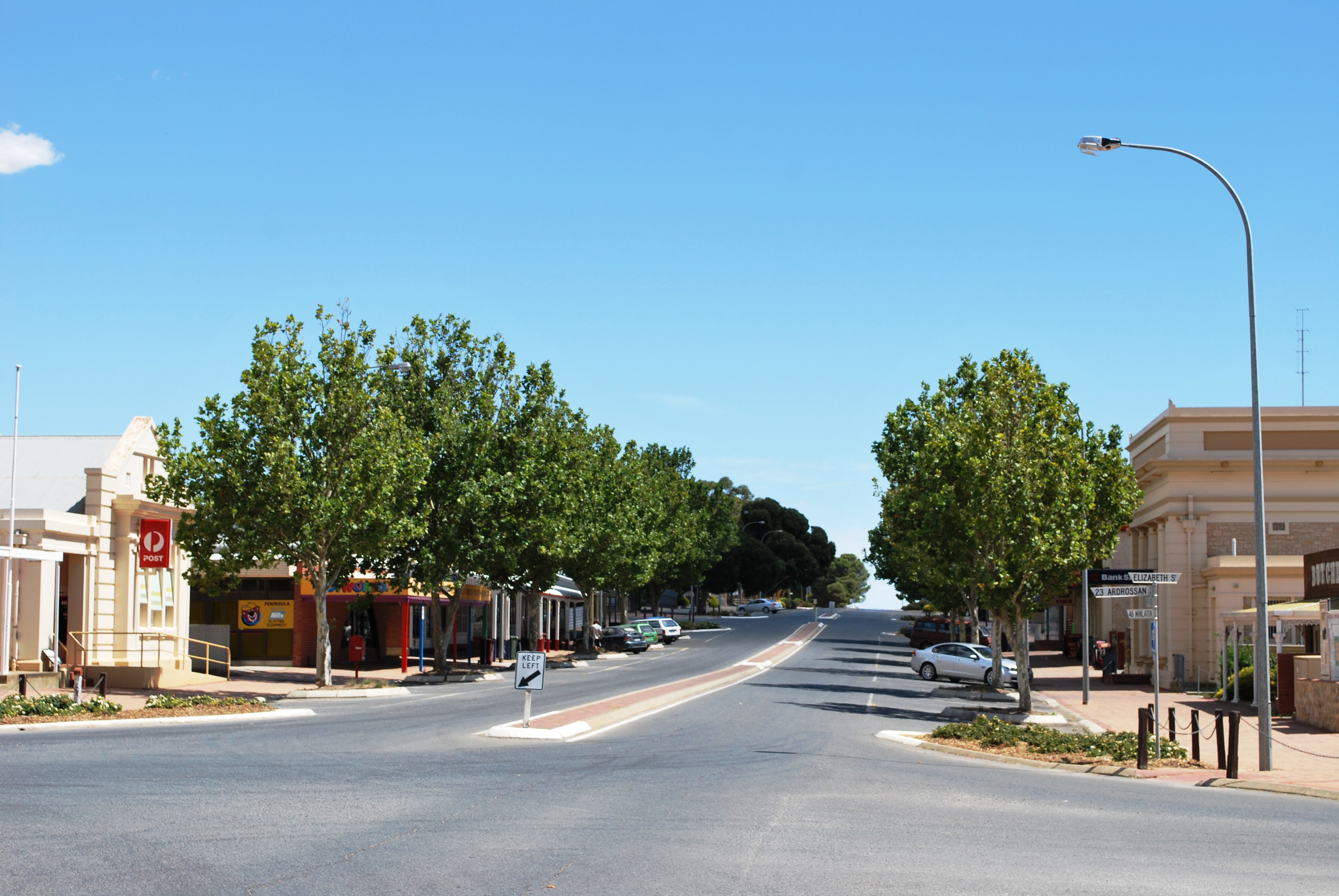 Robert St in Maitland | |||||||||||||||
 Maitland | |||||||||||||||
| Coordinates | 34°22′0″S 137°40′0″E | ||||||||||||||
| Population | 1,029 (2016 census)[1] | ||||||||||||||
| Established | 1872[2] | ||||||||||||||
| Postcode(s) | 5573 | ||||||||||||||
| Elevation | 160 m (525 ft) | ||||||||||||||
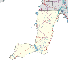
| Location | |||||||||||||||
| LGA(s) | Yorke Peninsula Council | ||||||||||||||
| Region | Yorke and Mid North[3] | ||||||||||||||
| County | Fergusson[2] | ||||||||||||||
| State electorate(s) | Narungga[4] | ||||||||||||||
| Federal division(s) | Grey | ||||||||||||||
| |||||||||||||||
| |||||||||||||||
| Footnotes | Adjoining localities[2] | ||||||||||||||
Maitland is within a short driving distance of coastal towns on either side, with Port Victoria to the west and Ardrossan to the east, each within 25 km.[citation needed] It has a grain receiving depot operated by AWB Limited, serviced only by road.[5] Maitland is also the home base of the Narungga Aboriginal Progress Association.[citation needed]
History
The town was named in 1872 after Lady Jean Maitland, [6]who died in 1766, who was the wife of the 2nd Lord of Kilkerran, Sir James Fergusson, 1688-1759 2nd Baronet of Kilkerran, the Great-Great Grandmother of governor of South Australia at this time, Sir James Fergusson 1832-1907;[7] the local aborigines calling it "madu waltu", meaning white flint.[citation needed] Maitland's urban design is patterned after Adelaide's central business district: a neat grid of streets surrounded on all four sides by parkland.[citation needed]
In October 1884 the Adelaide Observer noted:
Maitland in situated about twenty-three miles from Moonta, on Yorke's Peninsula, and is about equidistant between the two Gulfs. The town stands about 490 feet above the sea, and is surrounded by some of the richest soil on the Peninsula. The township is only about nine years old, and has made steady progress, and bids fair to be the next largest town to Moonta on the Peninsula.[8]
Climate
Maitland experiences a hot-summer mediterranean climate (Köppen climate classification: Csa), Trewartha: Csal); with hot, dry summers; mild to warm, relatively dry springs and autumns; and mild, winters with moderate precipitation.
| Climate data for Maitland, South Australia, Australia (1991-2020 normals, extremes 1879-present); 185 m AMSL | |||||||||||||
|---|---|---|---|---|---|---|---|---|---|---|---|---|---|
| Month | Jan | Feb | Mar | Apr | May | Jun | Jul | Aug | Sep | Oct | Nov | Dec | Year |
| Record high °C (°F) | 46.3 (115.3) |
43.5 (110.3) |
40.1 (104.2) |
37.0 (98.6) |
29.0 (84.2) |
25.0 (77.0) |
21.8 (71.2) |
28.0 (82.4) |
33.8 (92.8) |
37.9 (100.2) |
42.4 (108.3) |
46.0 (114.8) |
46.3 (115.3) |
| Mean maximum °C (°F) | 38.3 (100.9) |
36.5 (97.7) |
33.3 (91.9) |
29.1 (84.4) |
22.9 (73.2) |
18.1 (64.6) |
16.9 (62.4) |
19.5 (67.1) |
24.4 (75.9) |
29.0 (84.2) |
33.9 (93.0) |
36.0 (96.8) |
38.3 (100.9) |
| Average high °C (°F) | 30.3 (86.5) |
29.3 (84.7) |
26.6 (79.9) |
23.1 (73.6) |
18.8 (65.8) |
15.6 (60.1) |
14.8 (58.6) |
16.1 (61.0) |
19.1 (66.4) |
22.5 (72.5) |
26.2 (79.2) |
28.0 (82.4) |
22.5 (72.6) |
| Daily mean °C (°F) | 23.3 (73.9) |
22.8 (73.0) |
20.7 (69.3) |
18.0 (64.4) |
14.7 (58.5) |
11.9 (53.4) |
11.1 (52.0) |
11.9 (53.4) |
14.1 (57.4) |
16.5 (61.7) |
19.6 (67.3) |
21.2 (70.2) |
17.2 (62.9) |
| Average low °C (°F) | 16.3 (61.3) |
16.2 (61.2) |
14.8 (58.6) |
12.8 (55.0) |
10.5 (50.9) |
8.1 (46.6) |
7.4 (45.3) |
7.6 (45.7) |
9.1 (48.4) |
10.5 (50.9) |
13.0 (55.4) |
14.4 (57.9) |
11.7 (53.1) |
| Mean minimum °C (°F) | 11.5 (52.7) |
11.7 (53.1) |
10.7 (51.3) |
9.0 (48.2) |
6.8 (44.2) |
4.7 (40.5) |
4.4 (39.9) |
4.5 (40.1) |
5.5 (41.9) |
6.4 (43.5) |
8.1 (46.6) |
9.8 (49.6) |
4.4 (39.9) |
| Record low °C (°F) | 7.7 (45.9) |
8.9 (48.0) |
7.2 (45.0) |
4.4 (39.9) |
4.0 (39.2) |
0.0 (32.0) |
0.0 (32.0) |
1.1 (34.0) |
1.1 (34.0) |
1.8 (35.2) |
4.4 (39.9) |
6.5 (43.7) |
0.0 (32.0) |
| Average precipitation mm (inches) | 15.9 (0.63) |
21.0 (0.83) |
23.1 (0.91) |
38.4 (1.51) |
56.9 (2.24) |
68.5 (2.70) |
62.4 (2.46) |
58.3 (2.30) |
46.6 (1.83) |
36.7 (1.44) |
25.9 (1.02) |
28.8 (1.13) |
482.5 (19) |
| Average precipitation days (≥ 1.0 mm) | 3.1 | 2.6 | 3.6 | 5.3 | 8.8 | 11.3 | 11.7 | 10.7 | 8.8 | 5.8 | 4.8 | 4.1 | 80.6 |
| Average relative humidity (%) | 44.0 | 49.0 | 51.0 | 54.0 | 66.0 | 73.5 | 73.5 | 67.0 | 60.5 | 51.5 | 47.5 | 45.5 | 56.9 |
| Average dew point °C (°F) | 10.1 (50.2) |
11.3 (52.3) |
9.6 (49.3) |
9.1 (48.4) |
8.8 (47.8) |
7.7 (45.9) |
7.0 (44.6) |
6.6 (43.9) |
7.3 (45.1) |
6.7 (44.1) |
8.1 (46.6) |
8.7 (47.7) |
8.4 (47.2) |
| Source 1: Australian Bureau of Meteorology (1991-2020 normals)[9] | |||||||||||||
| Source 2: Australian Bureau of Meteorology (1879-present extremes)[10] | |||||||||||||
Media
Maitland was home to a newspaper called the Maitland Watch (22 December 1911 – 26 June 1969). In 1969, the newspaper merged with Yorketown's the Pioneer (1898–1969) to become the short-lived Yorke Peninsula News Pictorial (3 July 1969 – 28 May 1970), which was then incorporated into the Yorke Peninsula Country Times from June 1970.[11]
See also
- List of cities and towns in South Australia
- John Shannon (Australian politician)
References
- Australian Bureau of Statistics (27 June 2017). "Maitland (State Suburb)". 2016 Census QuickStats. Retrieved 4 July 2017.
- "Search result(s) for Maitland (LOCB) (Record No. SA0042104) with the following layers being selected - "Suburbs and Localities", "Counties", "Hundreds", "Place names (gazetteer)" and "Road labels"". Property Location Browser. Government of South Australia. Archived from the original on 12 October 2016. Retrieved 29 April 2017.
- "Yorke and Mid North SA Government region" (PDF). The Government of South Australia. Retrieved 28 April 2017.
- Narungga (Map). Electoral District Boundaries Commission. 2016. Retrieved 1 March 2018.
- "Maitland GrainFlow Centre". AWB Limited. Retrieved 15 October 2006.
- "Jean Maitland, only child b. 7 Dec 1703 d. 29 Mar 1766: MacFarlane Clan & Families Genealogy".
- "Sir James Fergusson [Ferguson], of Kilkerran, 6th Baronet b. 18 Mar 1832 d. 14 Jan 1907 Jamaica, West Indies: MacFarlane Clan & Families Genealogy".
- "MAITLAND". Adelaide Observer. Vol. XLI, no. 2246. South Australia. 18 October 1884. p. 13. Retrieved 13 May 2019 – via National Library of Australia.
- "Maitland, SA Climate (1991-2020 normals)". Australian Bureau of Meteorology. Retrieved 4 June 2022.
- "Maitland, SA Climate (1879-present extremes)". Australian Bureau of Meteorology. Retrieved 4 June 2022.
- Laube, Anthony. "LibGuides: SA Newspapers: M-N". guides.slsa.sa.gov.au. Retrieved 18 August 2018.
External links
- Harvest Corner Website Yorke Peninsula Visitor Information Centre at Minlaton
Yorke Peninsula, South Australia | |||||||
|---|---|---|---|---|---|---|---|
| Major Townships | |||||||
| Minor Townships | |||||||
| Governance |
| ||||||
| Coastal features |
| ||||||
| Protected areas |
| ||||||
| Adjacent islands | |||||||
| Related and uncategorised |
| ||||||
| |||||||
This South Australia geography article is a stub. You can help Wikipedia by expanding it. |
Другой контент может иметь иную лицензию. Перед использованием материалов сайта WikiSort.org внимательно изучите правила лицензирования конкретных элементов наполнения сайта.
WikiSort.org - проект по пересортировке и дополнению контента Википедии