world.wikisort.org - Australia
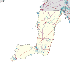
Corny Point is a locality in the Australian state of South Australia located about 7.5 kilometres (4.7 miles) to the east of the north-western tip of the Yorke Peninsula.[1][9] It was named after the nearby headland, Corny Point.[1] The first pastoral lease was taken up in 1846 by James Coutts.[10][11]
| Corny Point South Australia | |||||||||||||||
|---|---|---|---|---|---|---|---|---|---|---|---|---|---|---|---|
 The General Store at Corny Point | |||||||||||||||
 Corny Point | |||||||||||||||
| Coordinates | 34°55′32″S 137°04′53″E[1] | ||||||||||||||
| Population | 105 (2016 census)[2] | ||||||||||||||
| Established | 1881[3] 27 May 1999 (locality)[4] | ||||||||||||||
| Postcode(s) | 5575[5] | ||||||||||||||
| Time zone | ACST (UTC+9:30) | ||||||||||||||
| • Summer (DST) | ACST (UTC+10:30) | ||||||||||||||
| LGA(s) | Yorke Peninsula Council | ||||||||||||||
| Region | Yorke and Mid North[6][1] | ||||||||||||||
| County | Fergusson[1] | ||||||||||||||
| State electorate(s) | Narungga[7] | ||||||||||||||
| Federal division(s) | Grey[8] | ||||||||||||||
| |||||||||||||||
| Footnotes | Adjoining localities[1] | ||||||||||||||

The 2016 Australian census which was conducted in August 2016 reports that Corny Point had 105 people living within its boundaries.[2]
Corny Point is located within the federal division of Grey, the state electoral district of Narungga and the local government area of the Yorke Peninsula Council.[1][7][8]
See also
- List of cities and towns in South Australia
- Thidna Conservation Park
- Carribie Conservation Park
References
- "Search results for 'Corny Point, LOCB' with the following datasets selected - 'Suburbs and localities', 'Counties', 'Government Towns', 'Hundreds', 'Local Government Areas', 'SA Government Regions' and 'Gazetteer'". Location SA Map Viewer. South Australian Government. Retrieved 18 April 2019.
- Australian Bureau of Statistics (27 June 2017). "Corny Point (State Suburb)". 2016 Census QuickStats. Retrieved 18 April 2019.
- "Post Office List". Retrieved 26 February 2021.
- Kentish, P.M. (27 May 1999). "GEOGRAPHICAL NAMES ACT 1991 Notice to Assign Boundaries and Names to Places (...within the District Council of Yorke Peninsula...)" (PDF). The South Australian Government Gazette. South Australian Government. p. 2696. Retrieved 17 April 2019.
- "Australia Post: Postcode Search". Retrieved 9 December 2009.
- "Yorke and Mid North SA Government region" (PDF). The Government of South Australia. Retrieved 17 April 2017.
- Narungga (Map). Electoral District Boundaries Commission. 2016. Retrieved 1 March 2018.
- "Federal electoral division of Grey" (PDF). Australian Electoral Commission. Retrieved 24 July 2015.
- Boating Industry Association of South Australia (BIA); South Australia. Department for Environment and Heritage (2005), South Australia's waters an atlas & guide, Boating Industry Association of South Australia, p. 201, ISBN 978-1-86254-680-6
- "South Australia - Corny Point". Archived from the original on 27 July 2011. Retrieved 15 December 2009.
- "Corny Point". SA Memory. State Library of South Australia. Retrieved 21 June 2020.
External links
Wikimedia Commons has media related to Corny Point, South Australia.
Yorke Peninsula, South Australia | |||||||
|---|---|---|---|---|---|---|---|
| Major Townships |
| ||||||
| Minor Townships |
| ||||||
| Governance |
| ||||||
| Coastal features |
| ||||||
| Protected areas |
| ||||||
| Adjacent islands | |||||||
| Related and uncategorised |
| ||||||
| |||||||
This South Australia geography article is a stub. You can help Wikipedia by expanding it. |
Текст в блоке "Читать" взят с сайта "Википедия" и доступен по лицензии Creative Commons Attribution-ShareAlike; в отдельных случаях могут действовать дополнительные условия.
Другой контент может иметь иную лицензию. Перед использованием материалов сайта WikiSort.org внимательно изучите правила лицензирования конкретных элементов наполнения сайта.
Другой контент может иметь иную лицензию. Перед использованием материалов сайта WikiSort.org внимательно изучите правила лицензирования конкретных элементов наполнения сайта.
2019-2025
WikiSort.org - проект по пересортировке и дополнению контента Википедии
WikiSort.org - проект по пересортировке и дополнению контента Википедии