world.wikisort.org - Australia
Warooka is a town on the Yorke Peninsula in South Australia, known as the 'Gateway to the bottom end'.[5]
| Warooka South Australia | |||||||||||||||
|---|---|---|---|---|---|---|---|---|---|---|---|---|---|---|---|
 Main street | |||||||||||||||
 Warooka | |||||||||||||||
| Coordinates | 34°59′24″S 137°23′56″E | ||||||||||||||
| Population | 348 (2016 census)[1] | ||||||||||||||
| Postcode(s) | 5577 | ||||||||||||||
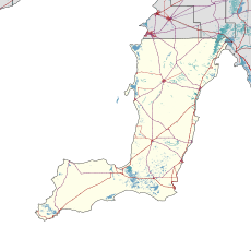
| Location |
| ||||||||||||||
| LGA(s) | Yorke Peninsula Council | ||||||||||||||
| State electorate(s) | Narungga[2] | ||||||||||||||
| Federal division(s) | Grey[3] | ||||||||||||||
| |||||||||||||||
At the 2016 census, Warooka had a population of 348.[1]
See also
- List of cities and towns in South Australia
References
- Australian Bureau of Statistics (27 June 2017). "Warooka (State Suburb)". 2016 Census QuickStats. Retrieved 5 April 2018.
- Narungga (Map). Electoral District Boundaries Commission. 2016. Retrieved 1 March 2018.
- "Federal electoral division of Grey" (PDF). Australian Electoral Commission. Retrieved 24 July 2015.
- "New Ward Structure 2014". Yorke Peninsula Council. Retrieved 21 October 2015.
- "2905.0 - Statistical Geography: Volume 2 -- Census Geographic Areas, Australia, 2006". Australian Bureau of Statistics. Retrieved 8 December 2009.
External links
![]() Media related to Warooka, South Australia at Wikimedia Commons
Media related to Warooka, South Australia at Wikimedia Commons
Yorke Peninsula, South Australia | |||||||
|---|---|---|---|---|---|---|---|
| Major Townships |
| ||||||
| Minor Townships |
| ||||||
| Governance |
| ||||||
| Coastal features |
| ||||||
| Protected areas |
| ||||||
| Adjacent islands | |||||||
| Related and uncategorised |
| ||||||
| |||||||
This South Australia geography article is a stub. You can help Wikipedia by expanding it. |
Текст в блоке "Читать" взят с сайта "Википедия" и доступен по лицензии Creative Commons Attribution-ShareAlike; в отдельных случаях могут действовать дополнительные условия.
Другой контент может иметь иную лицензию. Перед использованием материалов сайта WikiSort.org внимательно изучите правила лицензирования конкретных элементов наполнения сайта.
Другой контент может иметь иную лицензию. Перед использованием материалов сайта WikiSort.org внимательно изучите правила лицензирования конкретных элементов наполнения сайта.
2019-2025
WikiSort.org - проект по пересортировке и дополнению контента Википедии
WikiSort.org - проект по пересортировке и дополнению контента Википедии