world.wikisort.org - Australia
Arthurton is a town and locality in the Australian state of South Australia.[1] At the 2016 census, Arthurton had a population of 148.[2]
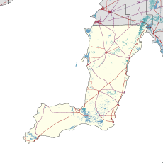
| Arthurton South Australia | |||||||||||||||
|---|---|---|---|---|---|---|---|---|---|---|---|---|---|---|---|
 Arthurton | |||||||||||||||
| Coordinates | 34°15′38″S 137°45′15″E[1] | ||||||||||||||
| Population | 148 (2016 census)[2] | ||||||||||||||
| Established | 25 January 1877 (town) 27 May 1999 (locality)[3][1] | ||||||||||||||
| Time zone | ACST (UTC+9:30) | ||||||||||||||
| • Summer (DST) | ACDT (UTC+10:30) | ||||||||||||||
| LGA(s) | Yorke Peninsula Council | ||||||||||||||
| Region | Yorke and Mid North[4] | ||||||||||||||
| County | Daly[1] | ||||||||||||||
| State electorate(s) | Narungga[5] | ||||||||||||||
| Federal division(s) | Grey[6] | ||||||||||||||
| |||||||||||||||
| Footnotes | Adjoining localities[1] | ||||||||||||||
Arthurton was established on 25 January 1877.[3][1] It was named after Arthur, the son of South Australian Governor Anthony Musgrave,[1] who insisted on this name after it had already been named "Kalkabury".[7]
See also
- List of cities and towns in South Australia
References
- "Search results for "Arthurton, LOCB" with the following datasets selected - 'Suburbs and localities', 'Counties', 'Government Towns', 'Hundreds', 'Local Government Areas', 'SA Government Regions' and 'Gazetteer'". Location SA Map Viewer. Government of South Australia. Retrieved 7 May 2019.
- Australian Bureau of Statistics (27 June 2017). "Arthurton". 2016 Census QuickStats. Retrieved 7 May 2019.
- Musgrave Jun., A. (25 January 1877). "Untitled proclamation re the Township of Arthurton" (PDF). The South Australian Government Gazette. Government of South Australia. p. 168. Retrieved 7 May 2019.
- "Yorke and Mid North SA Government region" (PDF). The Government of South Australia. Retrieved 17 April 2017.
- Narungga (Map). Electoral District Boundaries Commission. 2016. Retrieved 1 March 2018.
- "Federal electoral division of Grey" (PDF). Australian Electoral Commission. Retrieved 24 July 2015.
- "Manning index of place names". State Library of South Australia. Retrieved 22 June 2015.
This South Australia geography article is a stub. You can help Wikipedia by expanding it. |
Текст в блоке "Читать" взят с сайта "Википедия" и доступен по лицензии Creative Commons Attribution-ShareAlike; в отдельных случаях могут действовать дополнительные условия.
Другой контент может иметь иную лицензию. Перед использованием материалов сайта WikiSort.org внимательно изучите правила лицензирования конкретных элементов наполнения сайта.
Другой контент может иметь иную лицензию. Перед использованием материалов сайта WikiSort.org внимательно изучите правила лицензирования конкретных элементов наполнения сайта.
2019-2026
WikiSort.org - проект по пересортировке и дополнению контента Википедии
WikiSort.org - проект по пересортировке и дополнению контента Википедии