world.wikisort.org - Angola
Ganda is a town and municipality in Benguela Province in Angola.[3] The municipality had a population of 235,486 in 2014.[1]
Ganda | |
|---|---|
Municipality and town | |
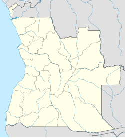 Ganda Location in Angola | |
| Coordinates: 13°01′S 14°38′E | |
| Country | |
| Province | Benguela Province |
| Area | |
| • Municipality and town | 1,860 sq mi (4,817 km2) |
| Population (2014 Census)[1] | |
| • Municipality and town | 235,486 |
| • Density | 130/sq mi (49/km2) |
| • Urban | 65,000 |
| Time zone | UTC+1 (WAT) |
| Climate | Aw |
History
During the colonial period, the town was called Vila Mariano Machado having been promoted to such category on June 24, 1969.[4]
Transport
Railway
It lies on the central line of Angolan Railways where there is a junction.
References
- "Resultados Definitivos Recenseamento Geral da População e Habitação – 2014 Província de Benguela" (PDF). Instituto Nacional de Estatística, República de Angola. Retrieved 3 May 2020.
- Citypopulation.de Population of cities & urban localities in Angola
- "City councils of Angola". Statoids. Retrieved April 7, 2009.
- "Benguela: Município da Ganda assinala 45 anos de existência" (in Portuguese). PortaldeAngola.com. 24 Jun 2014. Retrieved 22 Mar 2016.
| Bengo Province |
|
|---|---|
| Benguela Province | |
| Bié Province | |
| Cabinda Province | |
| Cuando Cubango Province | |
| Cuanza Norte Province | |
| Cuanza Sul Province | |
| Cunene Province | |
| Huambo Province | |
| Huíla Province | |
| Luanda Province |
|
| Lunda Norte Province | |
| Lunda Sul Province | |
| Malanje Province | |
| Moxico Province |
|
| Namibe Province | |
| Uíge Province | |
| Zaire Province | |
Capital: Benguela | |
| Benguela |
|
| Baía Farta |
|
| Balombo |
|
| Bocoio | |
| Caimbambo |
|
| Catumbela | |
| Chongorói |
|
| Cubal |
|
| Ganda | |
| Lobito |
|
This Angola location article is a stub. You can help Wikipedia by expanding it. |
На других языках
[de] Ganda (Angola)
Ganda ist eine Stadt in Angola.- [en] Ganda, Angola
[ru] Ганда (муниципалитет)
Ганда (порт. Ganda) — муниципалитет в Анголе, входит в состав провинции Бенгела. Площадь — 4817 км2. Население на 2006 год — 207 625 человек. Плотность населения — 43,1 человек/км2. Крупнейший город — Ганда с населением 26 763 человек[1].Текст в блоке "Читать" взят с сайта "Википедия" и доступен по лицензии Creative Commons Attribution-ShareAlike; в отдельных случаях могут действовать дополнительные условия.
Другой контент может иметь иную лицензию. Перед использованием материалов сайта WikiSort.org внимательно изучите правила лицензирования конкретных элементов наполнения сайта.
Другой контент может иметь иную лицензию. Перед использованием материалов сайта WikiSort.org внимательно изучите правила лицензирования конкретных элементов наполнения сайта.
2019-2026
WikiSort.org - проект по пересортировке и дополнению контента Википедии
WikiSort.org - проект по пересортировке и дополнению контента Википедии