world.wikisort.org - Angola
Cahama is a town, with a population of 12,767 (2014 census),[2] and a municipality of Cunene Province, Angola. The population of the municipality was 70,061 according to the 2014 census[1] in an area of 9,700 km2. The municipality consists of the communes Cahama and Otchinjau.[3] There is an airport (FN17) to the north of the town.
Cahama | |
|---|---|
Municipality and town | |
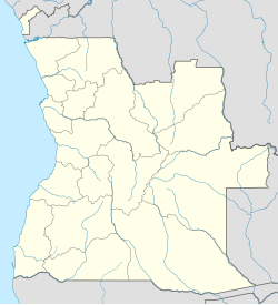 Cahama Location in Angola | |
| Coordinates: 16°17′S 14°19′E | |
| Country | |
| Province | Cunene |
| Area | |
| • Total | 9,700 km2 (3,700 sq mi) |
| Population (2014 Census)[1] | |
| • Total | 70,061 |
| • Density | 7.2/km2 (19/sq mi) |
| Time zone | UTC+1 (WAT) |
| Climate | BSh |
References
- "Resultados Definitivos Recenseamento Geral da População e Habitação – 2014 Província do Cunene" (PDF). Instituto Nacional de Estatística, República de Angola. Retrieved 3 May 2020.
- Citypopulation.de Population of cities & urban localities in Angola
- Census 2014, preliminary results
| Bengo Province |
|
|---|---|
| Benguela Province |
|
| Bié Province | |
| Cabinda Province |
|
| Cuando Cubango Province | |
| Cuanza Norte Province |
|
| Cuanza Sul Province | |
| Cunene Province | |
| Huambo Province |
|
| Huíla Province | |
| Luanda Province |
|
| Lunda Norte Province | |
| Lunda Sul Province | |
| Malanje Province | |
| Moxico Province |
|
| Namibe Province | |
| Uíge Province | |
| Zaire Province | |
Capital: Ondjiva | |
| Cahama |
|
| Cuanhama |
|
| Curoca |
|
| Cuvelai |
|
| Namacunde | |
| Ombadja | |
This Angola location article is a stub. You can help Wikipedia by expanding it. |
Текст в блоке "Читать" взят с сайта "Википедия" и доступен по лицензии Creative Commons Attribution-ShareAlike; в отдельных случаях могут действовать дополнительные условия.
Другой контент может иметь иную лицензию. Перед использованием материалов сайта WikiSort.org внимательно изучите правила лицензирования конкретных элементов наполнения сайта.
Другой контент может иметь иную лицензию. Перед использованием материалов сайта WikiSort.org внимательно изучите правила лицензирования конкретных элементов наполнения сайта.
2019-2026
WikiSort.org - проект по пересортировке и дополнению контента Википедии
WikiSort.org - проект по пересортировке и дополнению контента Википедии