world.wikisort.org - Afghanistan
Charkint, or Chahar Kint, (Dari: چارکنت) is a district in Balkh Province, Afghanistan. It has a population of 32,306.[1] The district administration is located in Shar Shar area of Charkint district, which means "four clusters/towns" - from Persian chahār, "four", and Sogdian[2] kand, "town" (Turkicized to kint). The area of the district is 1,357 square kilometres (524 sq mi).
Charkint
چارکنت | |
|---|---|
District | |
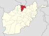
 Charkint Location within Afghanistan | |
| Coordinates: 36°30′00″N 67°20′00″E | |
| Country | |
| Province | Balkh Province |
| Area | |
| • Total | 1,357 km2 (524 sq mi) |
| Population | |
| • Total | 32,306 |
See also
- Districts of Afghanistan
- Balkh Province
References
- http://www.mrrd.gov.af/nabdp/Provincial%20Profiles/Balkh%20PDP%20Provincial%20profile.pdf Archived 2010-07-07 at the Wayback Machine Ministry of Rural Rehabilitation and Development of Afghanistan
- Room, Adrian (2006). Placenames of the World: Origins and Meanings of the Names for 6,600 Countries, Cities, Territories, Natural Features and Historic Sites (2nd ed.). London: McFarland. p. 330. ISBN 0-7864-2248-3.
Samarkand. The city derives its name from [...] Sogdian kand, "fort", "town".
External links
Balkh Province | ||
|---|---|---|
Capital: Balkh | ||
| Districts |
|  |
| Landforms | ||
| Landmarks and culture |
| |
This Balkh Province, Afghanistan location article is a stub. You can help Wikipedia by expanding it. |
Текст в блоке "Читать" взят с сайта "Википедия" и доступен по лицензии Creative Commons Attribution-ShareAlike; в отдельных случаях могут действовать дополнительные условия.
Другой контент может иметь иную лицензию. Перед использованием материалов сайта WikiSort.org внимательно изучите правила лицензирования конкретных элементов наполнения сайта.
Другой контент может иметь иную лицензию. Перед использованием материалов сайта WikiSort.org внимательно изучите правила лицензирования конкретных элементов наполнения сайта.
2019-2026
WikiSort.org - проект по пересортировке и дополнению контента Википедии
WikiSort.org - проект по пересортировке и дополнению контента Википедии