world.wikisort.org - Afghanistan
Dashti Qala District (دشت قلعه) is a district of Takhar Province, Afghanistan. It split from Khwaja Ghar District in June 2005.[7] This district borders Tajikistan. Ai-Khanoum, probably founded by the Seleucid Empire, is located in this district. In 2018, this district was considered contested between the government and the Taliban.[8]
Dashti Qala District | |
|---|---|
District | |
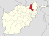
 Location of the district in Takhar Province | |
| Coordinates: 37°8′35″N 69°27′13″E | |
| Country | |
| Province | Takhār Province |
| Recognized | January 2004[1] |
| Government | |
| • Police Commander | Abdul Raouf Hamidi[2] |
| Area | |
| • Total | 270 km2 (100 sq mi) |
| Elevation | 455 m (1,493 ft) |
| Population (2020) | |
| • Total | 41,659[4] |
| • Density | 220/km2 (600/sq mi) |
| Population total is of 2020, and the density is of 2015 | |
| Ethnicity | |
| • Uzbek | 60% |
| • Tajik | 35% |
| • Pashtun | 5% |
| Time zone | UTC+4:30 (Afghanistan Standard Time) |
| Post Code | 3759[6] |
Geography
Dashti Qala District has an area of 270 square kilometers,[3] comparatively equivalent to Niue.[9] The Panj River borders the district, and the Kokcha River crosses Dashti Qala.[10] The climate of the district is classified as cold, semi-arid steppe on the Köppen–Geiger climate classification system.[11]
Location
The district is surrounded by Darqad to the northwest, Khwaja Bahauddin to the north, Rustaq to the east, Khwaja Ghar to the south, and Khatlon province (Tajikistan) to the west.[12] The Panj River forms the border between Khatlon Province and Dashti Qala.[10]
Demographics
Dashti Qala has a gender ratio of 103 males for every 100 females, matching the province. Dashti Qala has a young population, with an average age of 15.8 years.[13] 84.3% of the population have never completed a class (which is 74.2% of males and 95% of females). 44.7% of Dashti Qala's population did not work prior to the United Nations Population Fund survey in 2015. Of that, 44.7%, 90% were unable to work. Dashti Qala has 31.5% of children under age 5. The average household size is 6.9 people.
Economy
Wood is the main source of energy for heating and cooking. Most inhabitants use the sun for light.[13] Dashti Qala receives 95.2% of its water from dug wells. 99.3% of houses are made of wood and dirt. Meanwhile, 24.6% of the households have an improved sanitation facility. About half of the houses have two rooms.
See also
- Districts of Afghanistan
- Takhar Province
References
- "Map of Afghanistan". maps.arcgis.com. Retrieved 29 July 2020.
- Ajmal Kakar (31 December 2019). "Taliban closing in on bazaar". pajhwok.com. Pajhwok Afghan News. Retrieved 1 July 2020.
- "Takhar: A Socio-Economic and Demographic Profile" (PDF). University of California, Davis. Retrieved 13 July 2020.
- "Mapping Taliban Control". longwarjournal.org. Retrieved 1 July 2020.
- "Dasht e Qala Agha" (PDF). Archived from the original (PDF) on 1 February 2014. Retrieved 30 June 2020.
- "Dashti Qala Post Codes". worldpostalcode.com. Retrieved 1 July 2020.
- "398 District Division Matching to 329 District Division". aims.org. Archived from the original on 22 March 2016. Retrieved 30 June 2020.
- "Quarterly Report to the United States Congress" (PDF). SIGAR. 30 January 2019. p. 71. Retrieved 30 June 2020.
- "Island Directory Tables: Islands by Land Area". United Nations Environment Program. 18 February 1998. Retrieved 13 July 2020.
263.7 sq.km. Niue
- "Dasht-e-qala". Google Maps. Retrieved 1 July 2020.
- Beck, Hylke E.; Zimmermann, Niklaus E.; McVicar, Tim R.; Vergopolan, Noemi; Berg, Alexis; Wood, Eric F. (30 October 2018). "Present and future Köppen-Geiger climate classification maps at 1-km resolution". Scientific Data. 5: 180214. Bibcode:2018NatSD...580214B. doi:10.1038/sdata.2018.214. PMC 6207062. PMID 30375988.
- "Takhar Socio-Demographic and Economic Survey 2015" (PDF). UNFPA. p. 19. Retrieved 13 February 2020.
- "Takhar Socio-Demographic and Economic Survey 2015" (PDF). UNFPA. Retrieved 13 February 2020.
Takhar Province | ||
|---|---|---|
Capital: Taloqan | ||
| Districts |
|  |
| Populated Places |
| |
| Other |
| |
Другой контент может иметь иную лицензию. Перед использованием материалов сайта WikiSort.org внимательно изучите правила лицензирования конкретных элементов наполнения сайта.
WikiSort.org - проект по пересортировке и дополнению контента Википедии