world.wikisort.org - Afghanistan
Khamyab District is a frontier district in the province of Jowzjan in Afghanistan. It shares borders with Turkmenistan to the north and west, Khwaja Du Koh district to the south and the Mingajik and Qarqin districts to the east. As of 2006, the population is 12,400. The district center is the village of Khamyab (Kham-e Ab). The Amu Darya river flows in the northern end of the district and forms part of the international border. Within the district is the westernmost point of the river on Afghan territory, and the area here is also the lowest point in the country (about 255 m above sea level). The riverbank in Khamyab and further downstream in Qarqin has suffered from erosion on the Afghan side for decades, with the emergence of islands and a moving borderline.[2][3] The floods have damaged agricultural lands of locals.[4]
Khamyab
خمیاب | |
|---|---|
District | |
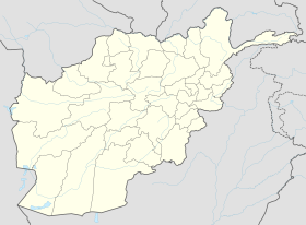 Khamyab Location within Afghanistan[1] | |
| Coordinates: 37°19′N 65°43′E | |
| Country | |
| Province | Jowzjan Province |
| Population (2006) | |
| • Total | 12,400 |
References
- "District Names". National Democratic Institute. Archived from the original on 29 January 2016. Retrieved 18 February 2016.
- "Good News from Qarqeen".
- https://reliefweb.int/sites/reliefweb.int/files/resources/MHB%20June%202012.pdf [bare URL PDF]
- "Archived copy" (PDF). Archived from the original (PDF) on 3 January 2019. Retrieved 3 January 2019.
{{cite web}}: CS1 maint: archived copy as title (link)
District Map
- Map of Settlements[permanent dead link] AIMS, August 2002
Jowzjan Province | ||
|---|---|---|
Capital: Sheberghan | ||
| Districts |
|  |
| Populated places |
| |
This Jowzjan Province, Afghanistan location article is a stub. You can help Wikipedia by expanding it. |
Другой контент может иметь иную лицензию. Перед использованием материалов сайта WikiSort.org внимательно изучите правила лицензирования конкретных элементов наполнения сайта.
WikiSort.org - проект по пересортировке и дополнению контента Википедии