world.wikisort.org - Afghanistan
Sangi Takht or Sang‐e‐Takht (Dari: سنگ تخت) is a district in Daykundi Province, Afghanistan.[2] It was created in 2005 from Daykundi district.
This article needs additional citations for verification. (May 2015) |
Sang-e-Takht
سنگ تخت | |
|---|---|
District | |
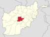
 Sang-e-Takht Location within Afghanistan [1] | |
| Coordinates: 34°11′24″N 65°54′36″E | |
| Country | |
| Province | Daykundi Province |
The Sangtakht-Bandar District has 290 villages. It has an area of 1,095 square kilometres (423 sq mi) and a population of 78,900. This district is limited by the Ghor Province and the Ashtarlay District of Daikundi.
The people of Sangtakht-Bandar District are typically farmers. This district lacks an asphalt road[citation needed] and its government office does not have the building.
A few villages in the district are Santakht, Bandar, Seyahchob, and Dorob.
References
- "District Names". National Democratic Institute. Retrieved 6 May 2015.
- "Daykundi Province ‐ Socio‐demographic and Economic Survey Highlights" (PDF). Central Statistics Organization of Afghanistan. Archived from the original (PDF) on 18 May 2015. Retrieved 5 May 2015.
Daykundi Province | ||
|---|---|---|
Capital: Nili | ||
| Districts |
|  |
| Landforms | ||
| Other |
| |
This Daykundi Province, Afghanistan location article is a stub. You can help Wikipedia by expanding it. |
Текст в блоке "Читать" взят с сайта "Википедия" и доступен по лицензии Creative Commons Attribution-ShareAlike; в отдельных случаях могут действовать дополнительные условия.
Другой контент может иметь иную лицензию. Перед использованием материалов сайта WikiSort.org внимательно изучите правила лицензирования конкретных элементов наполнения сайта.
Другой контент может иметь иную лицензию. Перед использованием материалов сайта WikiSort.org внимательно изучите правила лицензирования конкретных элементов наполнения сайта.
2019-2025
WikiSort.org - проект по пересортировке и дополнению контента Википедии
WikiSort.org - проект по пересортировке и дополнению контента Википедии