world.wikisort.org - USA
Westchester is a census-designated place (CDP) and neighborhood in Miami-Dade County, Florida. Prior to the 2020 U.S. Census, neighboring University Park CDP was merged into Westchester CDP, effectively doubling its geography and population.[3] Per the 2020 census, the population was 56,384.[4]
Westchester, Florida | |
|---|---|
Census-designated place | |
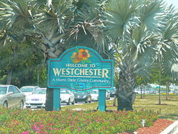
 Sign marking entrance to Westchester on Bird Road, just west of the Palmetto Expressway | |
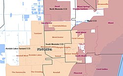
 Map of Westchester CDP after merging with University Park CDP in 2020 | |
| Coordinates: 25°44′49″N 80°20′13″W | |
| Country | |
| State | |
| County | |
| Established | 1860 |
| Area | |
| • Total | 8.11 sq mi (20.99 km2) |
| • Land | 7.95 sq mi (20.60 km2) |
| • Water | 0.15 sq mi (0.40 km2) |
| Elevation | 3 ft (1 m) |
| Population (2020) | |
| • Total | 56,384 |
| • Density | 7,089.65/sq mi (2,737.34/km2) |
| Time zone | UTC-5 (Eastern (EST)) |
| • Summer (DST) | UTC-4 (EDT) |
| ZIP Code | 33165 |
| Area code | 305 |
| FIPS code | 12-76075[2] |
| GNIS feature ID | 2403012 |
Geography
Westchester is located at 25°44′49″N 80°20′13″W,[5] with an elevation of 3 feet (0.91 m).[6]
According to the United States Census Bureau, the CDP has a total area of 8.11 square miles (21.0 km2), nearly all of it land.
Demographics
| Historical population | |||
|---|---|---|---|
| Census | Pop. | %± | |
| 1980 | 29,272 | — | |
| 1990 | 29,883 | 2.1% | |
| 2000 | 30,271 | 1.3% | |
| 2010 | 29,862 | −1.4% | |
| 2020 | 56,384 | 88.8% | |
| U.S. Decennial Census[7] 2010[8] 2020[9] In 2020, University Park CDP was merged into Westchester CDP. | |||
2020 census
| Race / Ethnicity | Pop 2010[8] | Pop 2020[9] | % 2010 | % 2020 |
|---|---|---|---|---|
| White alone (NH) | 2,404 | 4,005 | 8.05% | 7.10% |
| Black or African American alone (NH) | 73 | 1,264 | 0.24% | 2.24% |
| Native American or Alaska Native alone (NH) | 9 | 15 | 0.03% | 0.03% |
| Asian alone (NH) | 114 | 724 | 0.38% | 1.28% |
| Pacific Islander alone (NH) | 0 | 9 | 0.00% | 0.02% |
| Some Other Race alone (NH) | 6 | 154 | 0.02% | 0.27% |
| Mixed Race/Multi-Racial (NH) | 45 | 337 | 0.15% | 0.60% |
| Hispanic or Latino (any race) | 27,211 | 49,876 | 91.12% | 88.46% |
| Total | 27,211 | 56,384 | 100.00% | 100.00% |
Note: the US Census treats Hispanic/Latino as an ethnic category. This table excludes Latinos from the racial categories and assigns them to a separate category. Hispanics/Latinos can be of any race.
As of the 2020 United States census, there were 56,384 people, 8,831 households, and 6,980 families residing in the CDP.
2000 census
As of the census[2] of 2000, there were 30,271 people, 9,764 households, and 7,947 families residing in the CDP. The population density was 7,539.9 people per square mile (2,914.6/km2). There were 9,938 housing units at an average density of 2,475.4/sq mi (956.9/km2). The racial makeup of the CDP was 93.78% White (13.7% were Non-Hispanic White,)[10] 0.61% African American, 0.04% Native American, 0.51% Asian, 2.81% from other races, and 2.23% from two or more races. Hispanic or Latino of any race were 85.31% of the population.
There were 9,764 households, out of which 28.0% had children under the age of 18 living with them, 60.5% were married couples living together, 15.7% had a female householder with no husband present, and 18.6% were non-families. 14.8% of all households were made up of individuals, and 8.6% had someone living alone who was 65 years of age or older. The average household size was 3.07 and the average family size was 3.33.
In the CDP, the population was spread out, with 18.7% under the age of 18, 7.2% from 18 to 24, 26.7% from 25 to 44, 24.4% from 45 to 64, and 23.0% who were 65 years of age or older. The median age was 43 years. For every 100 females, there were 87.2 males. For every 100 females age 18 and over, there were 83.4 males.
The median income for a household in the CDP was $40,762, and the median income for a family was $44,863. Males had a median income of $29,629 versus $24,235 for females. The per capita income for the CDP was $17,264. About 8.5% of families and 11.8% of the population were below the poverty line, including 13.0% of those under age 18 and 13.0% of those age 65 or over.
As of 2000, speakers of Spanish accounted for 88.81% of residents (many of whom also speak English); those who spoke only English accounted for 10.78% of the population.[11]
As of 2000, Westchester had the highest percentage of Cuban residents in the US, with 65.69% of the populace (the second highest percentage was Hialeah, which made up 62.12% of its populace.)[12] It had the eighteenth highest percentage of Nicaraguan residents in the US, at 2.25% of the population,[13] and the ninety-third highest percentage of Colombian residents in the US, at 1.77% of its population (tied with South Miami and Princeton, FL.)[14]
Government and infrastructure
The Miami-Dade Fire Rescue operates Station 3 Tropical Park in Westchester.[15]
Education
The community of Westchester is home to eight public schools administered by Miami-Dade County Public Schools, four Catholic private elementary and secondary schools, one private Roman Catholic college, and one public university.
Public schools
- High schools
- Miami Coral Park High School[16]
- Southwest Miami Senior High School (Olympia Heights, serves southern portions of Westchester)[17]
- K-8 schools
- Everglades K-8 Center[18]
- Middle schools
- Rockway Middle School
- West Miami Middle School (outside of the CDP but serving a section of the CDP[19])
- Elementary schools
- Banyan Elementary School
- Coral Park Elementary School[20]
- Emerson Elementary School[21]
- Rockway Elementary School[22]
- Olympia Heights Elementary School (in University Park CDP, serves a southwest section of Westchester CDP)[23]
Private schools
Roman Catholic private schools are operated by and/or are affiliated with the Roman Catholic Archdiocese of Miami.
- Christopher Columbus High School - Catholic private school[16]
- St. Brendan High School - Catholic private school[16][24]
- St. Agatha Catholic School[25][26] (Catholic private school; in University Park CDP)
- St. Brendan Elementary School[27] (Catholic private school)
- King's Christian
- Gladeview Christian
- Florida Christian School - Olympia Heights
Universities and Colleges
- Florida International University (University Park)
- St. John Vianney College Seminary - Catholic private college[16]
Public libraries
Miami-Dade Public Library operates the Westchester Regional Library.[28]
Miscellaneous education
The Miami Hoshuko, a supplementary weekend Japanese school, holds its classes at the Iglesia Bautista de Coral Park ("Coral Park Baptist Church") in Westchester.[16][29] The school offices are located in Doral.[29][30] The school was established in 1984.[31]
See also
References
- "2020 U.S. Gazetteer Files". United States Census Bureau. Retrieved December 2, 2021.
- "U.S. Census website". United States Census Bureau. Retrieved 2008-01-31.
- "2020 Geography Changes". United States Census Bureau. Retrieved May 15, 2022.
Compare the following:- "2020 CENSUS - CENSUS BLOCK MAP: Westchester CDP, FL" (PDF). U.S. Census Bureau. Retrieved 2022-09-28.
- "2010 CENSUS - CENSUS BLOCK MAP: Westchester CDP, FL" (PDF). U.S. Census Bureau. Retrieved 2022-09-28.
- "2010 CENSUS - CENSUS BLOCK MAP: University Park CDP, FL" (PDF). U.S. Census Bureau. Retrieved 2022-09-28.
- "Westchester CDP, Florida". United States Census Bureau. Retrieved April 15, 2022.
- "US Gazetteer files: 2010, 2000, and 1990". United States Census Bureau. 2011-02-12. Retrieved 2011-04-23.
- "Westchester, FL Profile: Facts, Map & Data". florida.hometownlocator.com.
- "Decennial Census of Population and Housing by Decades". US Census Bureau.
- "P2 HISPANIC OR LATINO, AND NOT HISPANIC OR LATINO BY RACE – 2010: DEC Redistricting Data (PL 94-171) – Westchester CDP, Florida". United States Census Bureau.
- "P2 HISPANIC OR LATINO, AND NOT HISPANIC OR LATINO BY RACE – 2020: DEC Redistricting Data (PL 94-171) – Westchester CDP, Florida". United States Census Bureau.
- "Demographics of Westchester, FL". MuniNetGuide.com. Retrieved 2007-11-12.
- "MLA Data Center Results of Westchester, FL". Modern Language Association. Retrieved 2007-11-12.
- "Ancestry Map of Cuban Communities". Epodunk.com. Retrieved 2007-11-12.
- "Ancestry Map of Nicaraguan Communities". Epodunk.com. Archived from the original on 2010-10-17. Retrieved 2007-11-12.
- "Ancestry Map of Colombian Communities". Epodunk.com. Retrieved 2007-11-12.
- "Stations & Units." Miami-Dade Fire Rescue. Retrieved on September 16, 2012.
- "2010 Block Census Map Westchester, Florida" (Archive). U.S. Census Bureau. Retrieved on April 30, 2014.
- "Dadeschools.net - SOUTHWEST MIAMI SHS Legal Boundaries Description".
- "EK8 Home". evergladesk8.dadeschools.net.
- "Dadeschools.net - WEST MIAMI MS Legal Boundaries Description".
- "Coral Park Elementary School - Home". coralparkelementary.dadeschools.net.
- "Emerson Elementary School". emerson.dadeschools.net.
- "Rockway Elementary - Home of the Falcons". rockwayelementary.dadeschools.net.
- "Dadeschools.net - OLYMPIA HEIGHTS ES Legal Boundaries Description".
- Home page. St. Brendan High School. Retrieved on January 3, 2015. "2950 SW 87 Avenue, Miami, FL 33165"
- "St. Agatha Catholic School". stagathaonline.org.
- "Home". St. Agatha Catholic School. Retrieved 2020-05-06.
1111 SW 107th Ave Miami, FL 33174
- Compare to the CDP map - http://www.stbrendanmiami.org/Home.htm [dead link]
- "Westchester Regional Library". Miami-Dade Public Library. Retrieved 2021-06-29.
Address 9445 Coral Way Miami, FL 33165
- "ホーム" ("Home"). Miami Hoshuko. Retrieved on April 30, 2014. "借用校・校舎 Iglesia Bautisita de Coral Park 8755 SW 16 Street Miami, FL. 33165" and "補習校事務所 Miami Hoshuko, INC. 3403 NW 82 Ave, Suite 340 Miami, FL. 33122"
- "Map of the City of Doral Archived 2013-01-20 at archive.today." (Archive) City of Doral. Retrieved on September 16, 2012.
- Cassola, Jose (2005-03-27). "Students are helping to bridge cultures". The Miami Herald. Miami, Florida. p. 41. - Clipping from Newspapers.com.
Further reading
- "CENSUS 2000 BLOCK MAP: WESTCHESTER CDP" (PDF). U.S. Census Bureau.
- "1990 COUNTY BLOCK MAP (RECREATED): DADE County" (PDF). U.S. Census Bureau. - Westchester is on pages 71 and 86
External links
- History and Development of the Westchester community - Florida International University
На других языках
[de] Westchester (Florida)
Westchester ist ein census-designated place (CDP) im Miami-Dade County im US-Bundesstaat Florida. Das U.S. Census Bureau hat bei der Volkszählung 2020 eine Einwohnerzahl von 56.384[1] ermittelt.- [en] Westchester, Florida
[it] Westchester (Florida)
Westchester è un Census-designated place degli Stati Uniti d'America situato nella parte centrale della Contea di Miami-Dade dello Stato della Florida. Secondo le stime del 2010, la città ha una popolazione di 30.271 abitanti su una superficie di 10,40 km². [1][ru] Уэстчестер (Флорида)
Уэстчестер (англ. Westchester) — статистически обособленная местность, расположенная в округе Майами-Дейд (штат Флорида, США) с населением в 30 271 человек по статистическим данным переписи 2000 года.Другой контент может иметь иную лицензию. Перед использованием материалов сайта WikiSort.org внимательно изучите правила лицензирования конкретных элементов наполнения сайта.
WikiSort.org - проект по пересортировке и дополнению контента Википедии
