world.wikisort.org - USA
Naranja is a census-designated place (CDP) in Miami-Dade County, Florida, United States. Many orange groves were once located in this area, so the community name came from the Spanish word for orange, "naranja", but the actual pronunciation is (Na-Ran-Jah) among the local residents, which is the Portuguese pronunciation.[4] Naranja was also a stop for the Florida East Coast Railroad that once ran through this area. The population was 8,303 at the 2010 census.[5]
Naranja, Florida | |
|---|---|
CDP | |
 Location in Miami-Dade County and the state of Florida | |
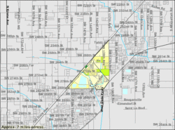 U.S. Census Bureau map showing CDP boundaries | |
| Coordinates: 25°31′N 80°25′W | |
| Country | |
| State | |
| County | Miami-Dade |
| Area | |
| • Total | 1.68 sq mi (4.36 km2) |
| • Land | 1.50 sq mi (3.88 km2) |
| • Water | 0.18 sq mi (0.48 km2) |
| Elevation | 7 ft (2 m) |
| Population (2020) | |
| • Total | 13,509 |
| • Density | 9,012.01/sq mi (3,480.67/km2) |
| Time zone | UTC-5 (Eastern (EST)) |
| • Summer (DST) | UTC-4 (EDT) |
| ZIP codes | 33032, 33033, 33092 |
| Area code | 305 |
| FIPS code | 12-47700[2] |
| GNIS feature ID | 0287532[3] |
Geography
Naranja is located at 25°31′N 80°25′W (25.5174, -80.4217).[6]
According to the United States Census Bureau, the CDP has a total area of 1.7 square miles (4.4 km2), of which, 1.5 square miles (3.9 km2) of it is land and 0.2 square miles (0.52 km2) of it (8.98%) is water.
Demographics
| Historical population | |||
|---|---|---|---|
| Census | Pop. | %± | |
| 1960 | 2,309 | — | |
| 1990 | 5,790 | — | |
| 2000 | 4,034 | −30.3% | |
| 2010 | 8,303 | 105.8% | |
| 2020 | 13,509 | 62.7% | |
| source:[7][8][9] | |||
2020 census
| Race | Pop 2010[10] | Pop 2020[11] | % 2010 | % 2020 |
|---|---|---|---|---|
| White (NH) | 519 | 696 | 6.25% | 5.15% |
| Black or African American (NH) | 3,172 | 4,150 | 38.20% | 30.72% |
| Native American or Alaska Native (NH) | 11 | 14 | 0.13% | 0.10% |
| Asian (NH) | 193 | 224 | 2.32% | 1.66% |
| Pacific Islander (NH) | 1 | 2 | 0.01% | 0.01% |
| Some Other Race (NH) | 31 | 89 | 0.37% | 0.66% |
| Mixed Race/Multi-Racial (NH) | 91 | 203 | 1.10% | 1.50% |
| Hispanic or Latino (any race) | 4,285 | 8,131 | 51.61% | 60.19% |
| Total | 8,303 | 13,509 | 100.00% | 100.00% |
Note: the US Census treats Hispanic/Latino as an ethnic category. This table excludes Latinos from the racial categories and assigns them to a separate category. Hispanics/Latinos can be of any race.
As of the census[2] of 2000, there were 4,034 people, 1,196 households, and 875 families residing in the CDP. The population density was 2,654.6 inhabitants per square mile (1,024.9/km2). There were 1,630 housing units at an average density of 1,072.7 per square mile (414.2/km2). The racial makeup of the CDP was 32.99% White (of which 12.7% were Non-Hispanic Whites,)[12] 57.54% African American, 0.42% Native American, 1.39% Asian, 0.15% Pacific Islander, 3.89% from other races, and 3.62% from two or more races. Hispanic or Latino of any race were 26.97% of the population.
There were 1,196 households, out of which 48.7% had children under the age of 18 living with them, 30.4% were married couples living together, 36.0% had a female householder with no husband present, and 26.8% were non-families. 20.6% of all households were made up of individuals, and 5.9% had someone living alone who was 65 years of age or older. The average household size was 3.23 and the average family size was 3.73.
In the CDP, the population was spread out, with 39.5% under the age of 18, 11.3% from 18 to 24, 27.8% from 25 to 44, 14.0% from 45 to 64, and 7.4% who were 65 years of age or older. The median age was 24 years. For every 100 females, there were 90.6 males. For every 100 females age 18 and over, there were 82.7 males.
The median income for a household in the CDP was $18,825, and the median income for a family was $19,443. Males had a median income of $22,614 versus $19,167 for females. The per capita income for the CDP was $7,346. About 42.3% of families and 50.5% of the population were below the poverty line, including 62.7% of those under age 18 and 19.8% of those age 65 or over.
As of 2000, speakers of English as a first language accounted for 66.25% of residents, while Spanish made up 28.14%, French Creole was at 4.64%, and Tagalog was the mother tongue of 0.95% of the population.[13]
As of 2000, Naranja had the highest percentage of Trinidadian and Tobagonian residents in the US, with 2.70% of the populace (tied with Lakeview, NY.)[14] It had the sixty-first highest percentage of Cuban residents in the US, at 5.90% of the population,[15] and the forty-second highest percentage of Haitian residents in the US, at 4.30% of its population.[16] It also had the thirty-fifth most Jamaicans in the US, at 3.80% (tied with the borough of Brooklyn, NY and Stone Mountain, GA,)[17] while it had the thirty-third highest percentage of Nicaraguans, at 1.26% of all residents (tied with San Bruno, California.)[18]
Education
Miami-Dade County Public Schools operates area public schools.
Dr. William A. Chapman Elementary School, which opened in 1976, serves the Naranja community,[19] and is located in the CDP.[20][21] Also serving the Naranja community is, Coconut Palm K-8 Academy, which replaced the former Naranja Elementary School. This school is located approximately 3 miles from the former Naranja Elementary School.
Young Men’s Academy for Academic and Civic Development (YMAACD) at Miami Douglas MacArthur Senior High School South (MacArthur South), an alternative school, was scheduled to move to the Naranja area for the 2009-2010 school year, in the location of the former Naranja Elementary School.[22] The name has since been changed to Miami Macarthur Educational Center.
Miami MacArthur South Senior High School is also in the CDP.[20][23] This is a public, alternative school located in Naranja, Florida. It has approximately 107 students in grades 6-12 with a teacher student ratio of 5-1. According to state test scores, at least 10% of the students are proficient in math and 10% in reading.
Notable people
- Jamal Carter (born 1994), American football player
See also
- Naranja-Princeton, a single census area recorded during the 1980 Census.
References
- "2020 U.S. Gazetteer Files". United States Census Bureau. Retrieved October 31, 2021.
- "U.S. Census website". United States Census Bureau. Retrieved 2008-01-31.
- "US Board on Geographic Names". United States Geological Survey. 2007-10-25. Retrieved 2008-01-31.
- Bach, Trevor (2015-03-25). "In Naranja, Residents Struggle With Violence and Decrepit Buildings". Miami New Times. Retrieved 2017-02-04.
- "Naranja CDP, Florida". United States Census Bureau. Retrieved 19 March 2016.
- "US Gazetteer files: 2010, 2000, and 1990". United States Census Bureau. 2011-02-12. Retrieved 2011-04-23.
- "CENSUS OF POPULATION AND HOUSING (1790-2000)". U.S. Census Bureau. Retrieved 2010-07-31.
- Not enumerated separately in 1970.
- In 1980, Naranja combined with Princeton to form Naranja-Princeton CDP, which enumerated a population of 10,381.
- "P2 HISPANIC OR LATINO, AND NOT HISPANIC OR LATINO BY RACE - 2010: DEC Redistricting Data (PL 94-171) - Naranja CDP, Florida". United States Census Bureau.
- "P2 HISPANIC OR LATINO, AND NOT HISPANIC OR LATINO BY RACE - 2020: DEC Redistricting Data (PL 94-171) - Naranja CDP, Florida". United States Census Bureau.
- "Demographics of Naranja, FL". MuniNetGuide.com. Archived from the original on 2008-06-08. Retrieved 2007-11-07.
- "MLA Data Center Results of Naranja, FL". Epodunk.com. Retrieved 2007-11-07.
- "Ancestry Map of Trinidadian & Tobagonian Communities". Epodunk.com. Archived from the original on 2007-10-11. Retrieved 2007-11-07.
- "Ancestry Map of Cuban Communities". Epodunk.com. Retrieved 2007-11-07.
- "Ancestry Map of Haitian Communities". Epodunk.com. Archived from the original on 2012-09-23. Retrieved 2007-11-07.
- "Ancestry Map of Jamaican Communities". Epodunk.com. Archived from the original on 2007-10-11. Retrieved 2007-11-07.
- "Ancestry Map of Nicaraguan Communities". Epodunk.com. Archived from the original on 2010-10-17. Retrieved 2007-11-07.
- "Executive Summary Dr. William A. Chapman Elementary School Miami-Dade County Public Schools." AdvanceEd. p. 2 (PDF p. 4/7). Retrieved on January 3, 2016. "Dr. William A. Chapman Elementary School is the central focal point of pride within the Naranja community."
- "2010 CENSUS - CENSUS BLOCK MAP: Naranja CDP, FL" (Archive). U.S. Census Bureau. Retrieved on January 3, 2015.
- "About Our School." Dr. William A. Chapman Elementary School. Retrieved on January 3, 2016.
- "FLORIDA DIFFERENTIATED ACCOUNTABILITY PROGRAM 2009 – 2010 SCHOOL IMPROVEMENT PLAN School Name: YOUNG MENS ACADEMY FOR ACADEMIC AND CIVIC DEVELOPMENT AT MIAMI DOUGLAS MACARTHUR SOUTH SENIOR HIGH" (Archive). State of Florida. Last modified September 8, 2009. p. 1. Retrieved on January 3, 2016.
- Home page. Miami MacArthur South Senior High School. Retrieved on January 3, 2016. "Miami Macarthur South: 13990 SW 264 St, Naranja, FL 33032"
Municipalities and communities of Miami-Dade County, Florida, United States | ||
|---|---|---|
County seat: Miami | ||
| Cities |  | |
| Towns | ||
| Villages | ||
| CDPs |
| |
| Unincorporated communities |
| |
| Ghost town |
| |
| Indian reservation |
| |
| Footnotes | ‡This populated place also has portions in an adjacent county or counties | |
| ||
На других языках
[de] Naranja
Naranja (spanisch für Orange) ist ein census-designated place (CDP) im Miami-Dade County im US-Bundesstaat Florida mit 8303 Einwohnern (Stand: 2010).- [en] Naranja, Florida
[ru] Наранья (Флорида)
Нара́нья (англ. Naranja) — статистически обособленная местность, расположенная в округе Майами-Дейд (штат Флорида, США) с населением в 4034 человека по статистическим данным переписи 2000 года.Другой контент может иметь иную лицензию. Перед использованием материалов сайта WikiSort.org внимательно изучите правила лицензирования конкретных элементов наполнения сайта.
WikiSort.org - проект по пересортировке и дополнению контента Википедии