world.wikisort.org - USA
Wapakoneta, (/ˌwɔːpəkəˈnɛtə/, local pronunciation: [wɒpəkəˈnɛɾə]) is a city in and the county seat of Auglaize County,[4] Ohio, United States, about 56 miles (90 km) north of Dayton and 83 miles (134 km) south of Toledo. The population was 9,867 at the 2010 census. It is the principal city of and is included in the Wapakoneta, Ohio Micropolitan Area, which is included in the Lima–Van Wert–Wapakoneta, OH, Combined Statistical Area.
Wapakoneta, Ohio | |
|---|---|
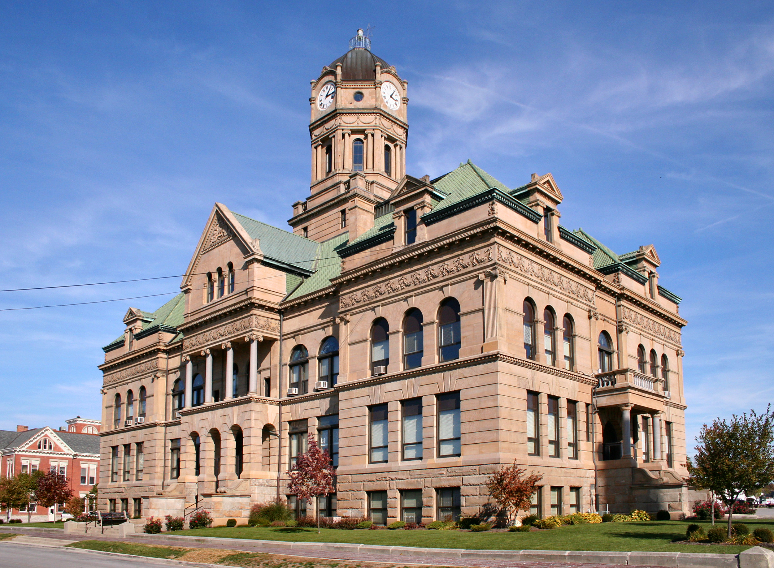 Auglaize County courthouse | |
 Seal | |
| Nickname(s): Home of the First Man on the Moon, Home of Neil Armstrong, Moon City, Wapak | |
 Location of Wapakoneta, Ohio | |
 Location of Wapakoneta in Auglaize County | |
 Wapakoneta, Ohio Location in U.S. | |
| Coordinates: 40°34′33″N 84°11′34″W | |
| Country | United States |
| State | Ohio |
| County | Auglaize |
| Founded | 1782 |
| Incorporated | March 2, 1849 |
| Government | |
| • Mayor | Thomas A. Stinebaugh (R) |
| Area | |
| • Total | 6.61 sq mi (17.13 km2) |
| • Land | 6.56 sq mi (17.00 km2) |
| • Water | 0.05 sq mi (0.13 km2) |
| Elevation | 895 ft (272 m) |
| Population (2020) | |
| • Total | 9,957 |
| • Density | 1,517.14/sq mi (585.79/km2) |
| Time zone | UTC-5 (EST) |
| • Summer (DST) | UTC-4 (EDT) |
| ZIP codes | 45895 |
| Area code(s) | 419, 567 |
| FIPS code | 39-80766[2] |
| GNIS feature ID | 1070980[3] |
| Website | http://www.wapakoneta.net |
History
In 1748, the French built a trading post (Fort au Glaize, also known as "Wapakoneta Trading Post" or "AuGlaize Trading Post") about a half-mile northeast of the future site of Wapakoneta. After being re-established in 1760 as "Francis Duchouquet's Trading Post," the British later took over this territory after the French ceded it following defeat in the Seven Years' War. Neither they nor the later Americans (after independence) built a succeeding fort here. French-Canadian traders later reestablished a trading post at the site in 1784, which was abandoned after the Battle of Fallen Timbers in 1794.[5]
The city itself was established in the 1780s as a Shawnee settlement called "Waughpaughkonnetta" (possibly derived from the Shawnee word "Wa-po'kanite," meaning "the place of white bones"). After the Shawnee tribe was removed to Kansas in 1831, Wapakoneta was platted in 1833 and later named as the seat of Auglaize County in 1848.[6]
Geography
According to the United States Census Bureau, the city has an area of 6.26 square miles (16.21 km2), of which 6.21 square miles (16.08 km2) is land and 0.05 square miles (0.13 km2) is water.[7]
Wapakoneta is on the Auglaize River and includes parts of Duchouquet, Pusheta, and Moulton Townships.
Demographics
| Historical population | |||
|---|---|---|---|
| Census | Pop. | %± | |
| 1850 | 504 | — | |
| 1860 | 900 | 78.6% | |
| 1870 | 2,150 | 138.9% | |
| 1880 | 2,705 | 25.8% | |
| 1890 | 3,616 | 33.7% | |
| 1900 | 3,915 | 8.3% | |
| 1910 | 5,349 | 36.6% | |
| 1920 | 5,295 | −1.0% | |
| 1930 | 5,378 | 1.6% | |
| 1940 | 5,225 | −2.8% | |
| 1950 | 5,797 | 10.9% | |
| 1960 | 6,756 | 16.5% | |
| 1970 | 7,324 | 8.4% | |
| 1980 | 8,402 | 14.7% | |
| 1990 | 9,214 | 9.7% | |
| 2000 | 9,474 | 2.8% | |
| 2010 | 9,867 | 4.1% | |
| 2020 | 9,957 | 0.9% | |
| 2021 (est.) | 9,840 | −1.2% | |
| Sources:[2][8][9][10][11][12][13][14] | |||
2010 census
As of the census[15] of 2010, there were 9,867 people, 4,037 households, and 2,614 families residing in the city. The population density was 1,588.9 inhabitants per square mile (613.5/km2). There were 4,332 housing units at an average density of 697.6 per square mile (269.3/km2). The racial makeup of the city was 97.1% White, 0.4% African American, 0.3% Native American, 0.4% Asian, 0.6% from other races, and 1.2% from two or more races. Hispanic or Latino of any race were 1.6% of the population.
There were 4,037 households, of which 32.6% had children under the age of 18 living with them, 46.7% were married couples living together, 12.8% had a female householder with no husband present, 5.3% had a male householder with no wife present, and 35.2% were non-families. 30.5% of all households were made up of individuals, and 13.1% had someone living alone who was 65 years of age or older. The average household size was 2.39 and the average family size was 2.95.
The median age in the city was 37 years. 25.2% of residents were under the age of 18; 8.6% were between the ages of 18 and 24; 26% were from 25 to 44; 24.4% were from 45 to 64; and 15.6% were 65 years of age or older. The gender makeup of the city was 47.8% male and 52.2% female.
2000 census
As of the census[2] of 2000, there were 9,474 people, 3,803 households, and 2,540 families residing in the city. The population density was 1,674.7 people per square mile (646.3/km2). There were 4,057 housing units at an average density of 717.2 per square mile (276.8/km2). The racial makeup of the city was 97.96% White, 0.19% African American, 0.26% Native American, 0.39% Asian, 0.05% Pacific Islander, 0.37% from other races, and 0.77% from two or more races. Hispanic or Latino of any race were 0.87% of the population.
There were 3,803 households, out of which 33.1% had children under the age of 18 living with them, 51.4% were married couples living together, 11.2% had a female householder with no husband present, and 33.2% were non-families. 28.9% of all households were made up of individuals, and 11.9% had someone living alone who was 65 years of age or older. The average household size was 2.43 and the average family size was 2.99.
In the city, the population was spread out, with 26.2% under the age of 18, 9.7% from 18 to 24, 28.4% from 25 to 44, 20.2% from 45 to 64, and 15.6% who were 65 years of age or older. The median age was 35 years. For every 100 females, there were 89.7 males. For every 100 females age 18 and over, there were 85.9 males.
The median income for a household in the city was $38,531, and the median income for a family was $45,456. Males had a median income of $34,523 versus $23,478 for females. The per capita income for the city was $18,976. About 8.4% of families and 8.9% of the population were below the poverty line, including 11.6% of those under age 18 and 9.3% of those age 65 or over.
Sister cities
Wapakoneta has one sister city, as designated by the Sister Cities International:
|
Lengerich's neighboring municipalities, Ladbergen and Lienen, are sister cities with Wapakoneta's neighbors New Knoxville and Saint Marys, respectively.
Education
Wapakoneta is home to Wapakoneta High School. The city has a public library, the main branch of the Auglaize County Public Library.[16]
Notable people
- Neil Armstrong, NASA Gemini 8/Apollo 11 astronaut, first man on the Moon
- Charles Brading, pharmacist and politician
- Kent Boyd, dancer, runner-up SYTYCD
- Jennifer Crusie, romance novel writer
- George Russell Davis, Associate Justice of the Arizona Territorial Supreme Court
- Bob Ewing, Major League Baseball player
- Dan Newland, journalist, translator, and writer
- Dudley Nichols, Oscar-winning screenwriter
Wapakoneta is Armstrong's birthplace, and has several places named after him, such as the Armstrong Air and Space Museum, operated by the Ohio Historical Society, and Neil Armstrong Airport.
Popular culture
In the film Third Finger, Left Hand (1940), Melvyn Douglas's character is from Wapakoneta, and the film ends at the Wapakoneta railroad station.
Gallery
 Auglaize County courthouse
 Wapakoneta's historic downtown

See also
- United Remnant Band of the Shawnee Nation
References
- "ArcGIS REST Services Directory". United States Census Bureau. Retrieved September 20, 2022.
- "U.S. Census website". United States Census Bureau. Retrieved 2008-01-31.
- "US Board on Geographic Names". United States Geological Survey. 2007-10-25. Retrieved 2008-01-31.
- "Find a County". National Association of Counties. Retrieved 2011-06-07.
- Ohio Forts
- History -- Wapakoneta Area Chamber of Commerce
- "US Gazetteer files 2010". United States Census Bureau. Archived from the original on 2012-01-25. Retrieved 2013-01-06.
- "Population of Civil Divisions Less than Counties" (PDF). Statistics of the Population of the United States at the Ninth Census. U.S. Census Bureau. 1870. Archived from the original (PDF) on January 25, 2005. Retrieved 28 November 2013.
- "Population of Civil Divisions Less than Counties" (PDF). Statistics of the Population of the United States at the Tenth Census. U.S. Census Bureau. 1880. Retrieved 28 November 2013.
- "Population: Ohio" (PDF). 1910 U.S. Census. U.S. Census Bureau. Retrieved 28 November 2013.
- "Population: Ohio" (PDF). 1930 US Census. U.S. Census Bureau. Retrieved 28 November 2013.
- "Number of Inhabitants: Ohio" (PDF). 18th Census of the United States. U.S. Census Bureau. 1960. Retrieved 17 May 2020.
- "Ohio: Population and Housing Unit Counts" (PDF). U.S. Census Bureau. Retrieved 22 November 2013.
- "Wapakoneta city, Ohio". census.gov. Retrieved July 7, 2022.
- "U.S. Census website". United States Census Bureau. Retrieved 2013-01-06.
- "Hours & Locations". Auglaize County Libraries. Retrieved 25 February 2018.
External links
- City Website
- Wapakoneta Area Economic Development Council
- Wapakoneta Area Chamber of Commerce
- Wapakoneta Daily News
Municipalities and communities of Auglaize County, Ohio, United States | ||
|---|---|---|
County seat: Wapakoneta | ||
| Cities |  | |
| Villages | ||
| Townships | ||
| CDPs |
| |
| Unincorporated communities |
| |
| Footnotes | ‡This populated place also has portions in an adjacent county or counties | |
| ||
Authority control | |
|---|---|
| General | |
| National libraries | |
| Other |
|
На других языках
[de] Wapakoneta
Wapakoneta ist eine Stadt in Auglaize County, Ohio. Sie ist die Geburtsstadt des Astronauten Neil Armstrong und Sitz der Countyverwaltung (County Seat) des Auglaize Countys. Nach der Volkszählung im Jahr 2000 hat sie 9474 Einwohner.- [en] Wapakoneta, Ohio
[es] Wapakoneta
Wapakoneta es una ciudad ubicada en el condado de Auglaize en el estado estadounidense de Ohio. En el Censo de 2010 tenía una población de 9867 habitantes.[3] Tiene una población estimada, a mediados de 2019, de 9698 habitantes.[4]Другой контент может иметь иную лицензию. Перед использованием материалов сайта WikiSort.org внимательно изучите правила лицензирования конкретных элементов наполнения сайта.
WikiSort.org - проект по пересортировке и дополнению контента Википедии