world.wikisort.org - USA
Findlay (/ˈfɪnli/ FIN-lee) is a city in and the county seat of Hancock County, Ohio, United States.[4] The second-largest city in Northwest Ohio, Findlay lies about 40 miles (64 km) south of Toledo. The population was 40,313 at the 2020 census.[5] It is home to the University of Findlay and is the principal city of the Findlay, OH Micropolitan Statistical Area.
Findlay, Ohio | |
|---|---|
City | |
| City of Findlay | |
 Downtown Findlay | |
| Nickname(s): Flag City, USA | |
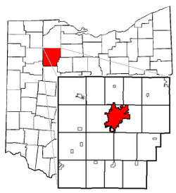 Findlay's position within Hancock County (foreground) and Ohio (background) | |
| Coordinates: 41°2′34″N 83°38′32″W | |
| Country | United States |
| State | Ohio |
| County | Hancock |
| Government | |
| • Mayor | Christina Muryn (R) |
| Area | |
| • Total | 19.77 sq mi (51.21 km2) |
| • Land | 19.64 sq mi (50.87 km2) |
| • Water | 0.13 sq mi (0.34 km2) |
| Elevation | 778 ft (237 m) |
| Population (2020) | |
| • Total | 40,313 |
| • Density | 2,052.49/sq mi (792.49/km2) |
| Time zone | UTC-5 (Eastern (EST)) |
| • Summer (DST) | UTC-4 (EDT) |
| ZIP codes | 45839-45840 |
| Area code(s) | 419, 567 |
| FIPS code | 39-27048[3] |
| GNIS feature ID | 1040439[2] |
| Website | www.FindlayOhio.com |
Findlay is the headquarters of Fortune 1000 companies Marathon Petroleum and Cooper Tire & Rubber Company, who rank 22 and 830 on the list respectively.
History

In the War of 1812, Colonel James Findlay of Cincinnati built a road and a stockade to transport and shelter troops in the Great Black Swamp region. This stockade was named Fort Findlay in his honor.[6][7] At the conclusion of the war, the community of Findlay was born. The first town lots were laid out in 1821 by the future Ohio Governor Joseph Vance and Elnathan Corry.
Before the Civil War, Findlay was a stop for slaves along the Underground Railroad.[8][9]
In 1861, David Ross Locke moved to Findlay where he served as editor for the Hancock Jeffersonian newspaper until he left in 1865.[10] It was in the Hancock Jeffersonian that Locke penned the first of his Nasby letters.[11]
During the 1880s, Findlay was a booming center of oil and natural gas production, though the supply of petroleum had dwindled by the early 20th century.
Findlay hosted the highly competitive Ohio State Music Festival in 1884. A young cornet player, Warren G. Harding, and his Citizens' Cornet Band of Marion placed third in the competition.[12] Harding would go on to be elected the 29th President of the United States.

On March 31, 1892, the only known lynching in the history of Hancock County occurred when a mob of 1,000 men, many "respectable citizens", broke into the county jail in Findlay. They lynched Mr. Lytle, who had seriously (but not fatally as believed at the time)[13] injured his wife and two daughters with a hatchet the day before, by hanging him twice (first from the bridge, then a telegraph pole) and finally shooting his body over a dozen times. The authorities had intended to secretly convey the prisoner to a suburb at 1 o'clock, where a train was to have been taken for Lima, but their plans were frustrated by the mob.[14]
In 1908, American songwriter Tell Taylor wrote the standard, "Down by the Old Mill Stream" while fishing along the Blanchard River in Findlay. The song was published in 1910.
A disaster occurred during the 1936 Independence Day celebration, where a stray firework fell into a crowd, injuring 16 people and attracting national media attention.[15][16]
For three months in the early 1960s, Findlay had the distinction of being the only community in the world where touch-tone telephone service was available. Touch-tone service was first introduced there on November 1, 1960.[17]
In 2007, a flood that crested at 18.46 feet caused around 100 million dollars in damage. The flood was nearly as strong as the 1913 flood.[18]
The city was officially recognized as "Flag City, USA" on May 7, 1974, a distinction which it maintains to this day.[19]
Geography

Findlay is located at 41°02′34″N 83°38′32″W (41.042843, −83.642216).[20]
According to the United States Census Bureau, the city has a total area of 19.25 square miles (49.86 km2), of which 19.13 square miles (49.55 km2) is land and 0.12 square miles (0.31 km2) is water.[21]
The Blanchard River travels through Findlay, flowing east to west.
The Findlay Reservoir No. 2 is the largest above ground reservoir in the state of Ohio with a capacity of approximately 5 billion US gallons (19,000,000 m3) of water.[22]
Climate
| Climate data for Findlay, Ohio (1991–2020) | |||||||||||||
|---|---|---|---|---|---|---|---|---|---|---|---|---|---|
| Month | Jan | Feb | Mar | Apr | May | Jun | Jul | Aug | Sep | Oct | Nov | Dec | Year |
| Average high °F (°C) | 33.6 (0.9) |
37.0 (2.8) |
47.4 (8.6) |
60.8 (16.0) |
72.1 (22.3) |
80.8 (27.1) |
84.0 (28.9) |
82.1 (27.8) |
76.3 (24.6) |
63.7 (17.6) |
49.8 (9.9) |
38.3 (3.5) |
60.5 (15.8) |
| Daily mean °F (°C) | 26.4 (−3.1) |
29.2 (−1.6) |
38.3 (3.5) |
50.1 (10.1) |
61.5 (16.4) |
70.7 (21.5) |
74.1 (23.4) |
72.3 (22.4) |
65.6 (18.7) |
53.8 (12.1) |
41.5 (5.3) |
31.6 (−0.2) |
51.3 (10.7) |
| Average low °F (°C) | 19.1 (−7.2) |
21.4 (−5.9) |
29.3 (−1.5) |
39.5 (4.2) |
50.8 (10.4) |
60.6 (15.9) |
64.1 (17.8) |
62.4 (16.9) |
55.0 (12.8) |
43.9 (6.6) |
33.2 (0.7) |
24.9 (−3.9) |
42.0 (5.6) |
| Average precipitation inches (mm) | 2.59 (66) |
2.19 (56) |
2.55 (65) |
3.77 (96) |
4.07 (103) |
4.19 (106) |
3.90 (99) |
3.70 (94) |
2.91 (74) |
2.71 (69) |
2.61 (66) |
2.48 (63) |
37.67 (957) |
| Average snowfall inches (cm) | 8.1 (21) |
4.3 (11) |
4.3 (11) |
0.9 (2.3) |
0.0 (0.0) |
0.0 (0.0) |
0.0 (0.0) |
0.0 (0.0) |
0.0 (0.0) |
0.2 (0.51) |
1.4 (3.6) |
4.6 (12) |
23.8 (61.41) |
| Source: NOAA[23] | |||||||||||||
Demographics
| Historical population | |||
|---|---|---|---|
| Census | Pop. | %± | |
| 1830 | 52 | — | |
| 1840 | 469 | 801.9% | |
| 1850 | 1,256 | 167.8% | |
| 1860 | 2,467 | 96.4% | |
| 1870 | 3,315 | 34.4% | |
| 1880 | 4,633 | 39.8% | |
| 1890 | 18,553 | 300.5% | |
| 1900 | 17,613 | −5.1% | |
| 1910 | 14,858 | −15.6% | |
| 1920 | 17,021 | 14.6% | |
| 1930 | 19,363 | 13.8% | |
| 1940 | 20,228 | 4.5% | |
| 1950 | 23,845 | 17.9% | |
| 1960 | 30,344 | 27.3% | |
| 1970 | 35,800 | 18.0% | |
| 1980 | 35,533 | −0.7% | |
| 1990 | 35,703 | 0.5% | |
| 2000 | 38,967 | 9.1% | |
| 2010 | 41,202 | 5.7% | |
| 2020 | 40,313 | −2.2% | |
| Sources:[3][24][25][5] | |||
2010 census
As of the census[26] of 2010, there were 41,202 people, 17,354 households, and 10,329 families residing in the city. The population density was 2,153.8 inhabitants per square mile (831.6/km2). There were 19,318 housing units at an average density of 1,009.8 per square mile (389.9/km2). The racial makeup of the city was 91.2% White, 2.2% African American, 0.3% Native American, 2.5% Asian, 1.7% from other races, and 2.1% from two or more races. Hispanic or Latino of any race were 5.7% of the population.
There were 17,354 households, of which 28.3% had children under the age of 18 living with them, 43.1% were married couples living together, 11.8% had a female householder with no husband present, 4.6% had a male householder with no wife present, and 40.5% were non-families. 32.6% of all households were made up of individuals, and 10.9% had someone living alone who was 65 years of age or older. The average household size was 2.29 and the average family size was 2.87.
The median age in the city was 35.9 years. 22.2% of residents were under the age of 18; 12.9% were between the ages of 18 and 24; 25.5% were from 25 to 44; 25.0% were from 45 to 64; and 14.5% were 65 years of age or older. The gender makeup of the city was 47.6% male and 52.4% female.
2000 census
As of the census[3] of 2000, there were 38,967 people, 15,905 households, and 10,004 families residing in the city. The population density was 2,266.3 people per square mile (875.2/km2). There were 17,152 housing units at an average density of 997.6 per square mile (385.2/km2). The racial makeup of the city was 93.70% White, 1.40% African American, 0.19% Native American, 1.76% Asian, 0.03% Pacific Islander, 1.66% from other races, and 1.26% from two or more races. Hispanic or Latino of any race were 3.95% of the population.
There were 15,905 households, out of which 29.2% had children under the age of 18 living with them, 49.3% were married couples living together, 9.9% had a female householder with no husband present, and 37.1% were non-families. 30.2% of all households were made up of individuals, and 10.2% had someone living alone who was 65 years of age or older. The average household size was 2.36 and the average family size was 2.93.
In the city the population was spread out, with 23.8% under the age of 18, 11.9% from 18 to 24, 28.7% from 25 to 44, 21.4% from 45 to 64, and 14.2% who were 65 years of age or older. The median age was 35 years. For every 100 females, there were 91.3 males. For every 100 females age 18 and over, there were 87.9 males.
The median income for a household in the city was $40,883, and the median income for a family was $49,986. Males had a median income of $36,150 versus $23,797 for females. The per capita income for the city was $21,328. About 5.9% of families and 9.1% of the population were below the poverty line, including 11.0% of those under age 18 and 6.1% of those age 65 or over.
Economy

Findlay is the headquarters of the Cooper Tire & Rubber Company, founded in 1914, which specializes in the design, manufacture, marketing, and sales of replacement automobile and truck tires, and subsidiaries that specialize in medium truck, motorcycle, and racing tires.
Findlay was the longtime headquarters of the Marathon Oil Corporation from 1905 until 1990 when it moved its offices to Houston, TX. Marathon Petroleum Company, a former subsidiary of Marathon Oil, maintained its main office in Findlay after Marathon Oil moved. On July 1, 2011, Marathon Petroleum became an independent entity, with headquarters in Findlay.
The city's major shopping center is Findlay Village Mall, opened in 1962.
Findlay is home to a Kohl's department store distribution center, which is Kohl's oldest distribution center after the recent closing of the original one in Wisconsin.
Findlay is home to the Whirlpool dishwasher manufacturing plant and distribution center. This plant is considered to be the largest dishwasher plant in the world (based on production).[27]
Findlay is home to several other major distribution centers including Best Buy, Lowe's, and Campbell Soup Company.[28]
Largest employers
According to the City of Findlay 2019 Comprehensive Annual Financial Report (CAFR),[29] the following companies are the top employers in the city:
| # | Employer | Number of employees |
|---|---|---|
| 1 | Marathon Petroleum | 2,500 |
| 2 | Whirlpool | 2,225 |
| 3 | Cooper Tire & Rubber | 1,755 |
| 4 | Blanchard Valley Regional Health Center | 1,051 |
| 5 | Findlay City Schools | 832 |
| 6 | Lowe's Distribution Center | 653 |
| 7 | University of Findlay | 579 |
| 8 | Nissin Brake | 536 |
| 9 | Hancock County | 527 |
| 10 | Roki America | 447 |
Government
This section needs expansion. You can help by adding to it. (February 2022) |

Findlay has a City Council and Mayor.
Education
Primary and secondary
There are three intermediate (3–5) buildings and three primary (K-2) buildings within the city of Findlay.[30]
For decades, students attended one of three junior high schools: Donnell (Atoms), Central (Spartans), or Glenwood (Eagles). The original Donnell School building located on Baldwin Avenue was razed in 2012 to make room for the construction of a new building, which began usage in January 2013. Another new school built directly behind the original Glenwood building on North Main Street officially opened and began usage in January 2013. The building known as Central, located on West Main Cross, was originally Findlay's high school (until the current high school was built in 1963). Once the two new middle schools were opened, part of Central was razed, leaving only the auditorium. A new Performing Arts Center (funded mainly by Marathon Petroleum) was constructed by refurbishing and renovating Central's auditorium, finishing in December 2015.[31]
Findlay High School is a comprehensive high school with an enrollment of 1,632 students in grades 9–12. Of the 130 professional staff, 87 have master's degrees or beyond. Accreditation has been granted by AdvancEd Accreditation.[32]
Postsecondary

The city is home to the University of Findlay, a private liberal arts college with an enrollment of over 4,100 students,[33] and Owens Community College, a state school with an enrollment of 2,391 students.[34] The University of Findlay is best known for its programs in Education (undergraduate and Master's) and the equestrian studies programs. Students enrolled in the Pre-Veterinary or western equestrian studies have access to a 152-acre farm operated by the university. Those students who are pursuing a degree in English equestrian studies have access to a separate rural facility composed of 32-acres, which includes the University Equine Veterinary Services Inc.[35]
Winebrenner Theological Seminary also makes its home in Findlay, adjacent to the university. Findlay also had a branch location of Brown Mackie College prior to 2017.
Public Library
The city has the main branch of the Findlay-Hancock County Public Library.[36] The library was established on April 16, 1888, and was originally housed in the Hancock County Courthouse basement until it was able to move into an old post office building in 1935.[37] The main library building was renovated in 1991, and again in 2009 after a major flood.[37] The library announced in March 2019 it would end the process of charging late fees.[38]
Transportation
Findlay Airport does not have regularly scheduled passenger flights.[39]
Interstate 75, US 68, and US 224 are major highways that pass through the city. State routes in the city of Findlay include: Ohio State Route 12, Ohio State Route 15, Ohio State Route 568, and Ohio State Route 37.
There were three major cab companies based in and operated in and around Findlay and Handcock County. The most notable are Accurate Cab co which went out of business in 2019–2020, USA Cab and Trinity Express Cab. While Black & White Transportation Cab will operate in Findlay, they are based out of Toledo, Ohio.
Historically, the Baltimore & Ohio, the New York Central and the Nickel Plate Road operated passenger train service through Findlay. The last trains were the Nickel Plate's St. Louis - Muncie - Cleveland trains (#9, Blue Arrow westbound and #10, Blue Dart eastbound).[40] These trains ended in 1959.
Culture
Annual activities

- Springtime in Ohio craft show – May
- Boogie on Main Street – June[41]
- Riverside Wine festival – June[42]
- Flag City BalloonFest – August[43]
- Rib-Off on Broadway – August[44]
- The Hancock County Fair – Labor Day weekend
- Oktoberfest – September[45]
- Christmas in October craft show – October
- Findlay | Hancock County Halloween Parade – October[46]
- Pride in the Park – July
Sports
- The University of Findlay participates in Division II athletics as a member of the Great Midwest Athletic Conference.
- The University of Findlay Men's Basketball team became NCAA Division II National Champions for the 2008–2009 season on March 28, 2009, in Springfield, Massachusetts, capping off a perfect season (36–0).
- From 2006 to 2008, the city was home to the Findlay Freedom, a low level professional ice hockey team.
- Beginning in 2008, the Findlay Grrrowl played Junior A hockey at The Cube Ice Arena at the Hancock Rec Center. In 2009 the Grrrowl won the United Junior Hockey League's only championship beating the Jamestown Jets two games to one. The UJHL and an attempted successor folded the next year
- Findlay was home to minor league baseball. The Findlay Browns was the final nickname of the minor league baseball teams based in Findlay between 1895 and 1941. Findlay teams played as members of the Interstate League in 1895, Buckeye League in 1915 and Ohio State League from 1937 to 1941. The Findlay Browns were an affiliate of the St. Louis Browns in 1937 and 1938.[47]
Notable people
- Peggy Kirk Bell, golfer, winner of the 1949 Titleholders Championship
- Willard Harrison Bennett, inventor of the radio frequency mass spectrometer
- Joshua Brodbeck, international concert organist
- Aaron Craft, college basketball player for Ohio State, Big Ten leader in steals
- Gavin Creel, Tony Award-winning Broadway actor and singer
- Russel Crouse, Broadway playwright, The Sound of Music, State of the Union and Call Me Madam
- Jo Ann Davidson, Ohio's first female Speaker of the House
- James C. Donnell, president of The Ohio Oil Company (now Marathon Oil)
- Marie Dressler, actress and silent film star
- Tennyson Guyer, Congressman
- Ray Harroun, race car developer and driver, and first Indianapolis 500 winner
- Cliff Hite, Ohio state senator, high school football coach of Ben Roethlisberger
- Michael Holmes, saxophonist
- Josh Huston, former kicker in the National Football League (NFL)[48]
- Grant "Home Run" Johnson, Negro league baseball player and manager
- John Kidd, professional football player (punter) in the NFL[49]
- Dave Laut, shot-putter who won bronze at the 1984 Summer Olympics[50]
- Mark Metcalf, actor
- Marilyn Miller, Broadway star of the 1920s
- William Mungen, U.S. Representative, lawyer, Union Army colonel
- Dan O'Brien, cattleman and author
- Michael G. Oxley, Congressman (1981–2006), co-author of Sarbanes–Oxley Act, Executive Vice President of NASDAQ
- Lamont Paris, men's college basketball coach at University of Tennessee at Chattanooga[51]
- Tot Pressnell, pitcher for the Brooklyn Dodgers and Chicago Cubs[52][53]
- James Purdy, novelist, short-story writer, poet, and playwright
- Bill Redpath, treasurer and former chairman, Libertarian Party (United States)
- Howard Taylor Ricketts, pathologist who discovered the causative agent of Rocky Mountain spotted fever, Rickettsia rickettsii, which was also named after him
- Ben Roethlisberger, professional football player in the NFL for the Pittsburgh Steelers
- Philip Sugden, artist and painter
- Tell Taylor, composer of "Down by the Old Mill Stream"
- Landon Tewers, musician known for The Plot In You
References
- "ArcGIS REST Services Directory". United States Census Bureau. Retrieved September 20, 2022.
- "US Board on Geographic Names". United States Geological Survey. October 25, 2007. Retrieved January 31, 2008.
- "U.S. Census website". United States Census Bureau. Retrieved January 31, 2008.
- "Find a County". National Association of Counties. Archived from the original on May 31, 2011. Retrieved June 7, 2011.
- "2020 Population and Housing State Data". Retrieved February 19, 2022.
- Gannett, Henry (1905). The Origin of Certain Place Names in the United States. Govt. Print. Off. p. 126.
- Kilbourn, John (1833). The Ohio Gazetteer, or, a Topographical Dictionary. Scott and Wright. p. 195. Retrieved December 12, 2013.
- "The Underground Railroad in Hancock County Historical Marker". hmdb.org. Retrieved September 11, 2019.
- Preston, E. Delorus (October 1, 1932). "The Underground Railroad in Northwest Ohio". The Journal of Negro History. 17 (4): 409–436. doi:10.2307/2714557. ISSN 0022-2992.
- "The Hancock Jeffersonian. [volume]". National Endowment for the Humanities. Retrieved September 13, 2020.
- Taft, William (June 1957). "David Ross Locke: Forgotten Editor". Journalism & Mass Communication Quarterly. 34 (2): 202–207. Retrieved September 13, 2020.
- Adams (1964, 1939), Incredible Era, p. 3
- "Penalty Paid". Kokomo Daily Gazette Tribune. April 1, 1892. p. 1.
- "MURDERER LYTLE LYNCHED.; TAKEN FROM JAIL AND HANGED -- TWO OF HIS VICTIMS DYING". The New York Times. April 1, 1892. ISSN 0362-4331. Retrieved November 20, 2021.
- "Large Number Loose Lives Over Fourth". Floyd Press. Floyd, Virginia. July 9, 1936. p. 1. Retrieved August 20, 2022.
- "TWO KILLED BY FIREWORKS; Bomb Explodes in Findlay, Ohio, Crowd Injuring Sixteen". The New York Times. July 6, 1936. Retrieved August 20, 2022.
- "1960–1970: A decade of Findlay "firsts" | Findlay Bicentennial". findlay200plus.com. Retrieved July 21, 2019.
- Rosenkrans, Nolan. "Findlay floods often in course of history". Toledo Blade. Retrieved October 23, 2019.
- "Flag City USA City of Findlay, OH". findlayohio.com. Retrieved July 21, 2019.
- "US Gazetteer files: 2010, 2000, and 1990". United States Census Bureau. February 12, 2011. Retrieved April 23, 2011.
- "US Gazetteer files 2010". United States Census Bureau. Archived from the original on January 25, 2012. Retrieved January 6, 2013.
- "Findlay Reservoirs 1 and 2". wildlife.ohiodnr.gov/. Retrieved December 10, 2016.
- "NOAA NCEI U.S. Climate Normals Quick Access". NOAA. Retrieved July 8, 2022.
- "Number of Inhabitants: Ohio" (PDF). 18th Census of the United States. U.S. Census Bureau. 1960. Retrieved April 26, 2020.
- "Ohio: Population and Housing Unit Counts" (PDF). U.S. Census Bureau. Retrieved November 22, 2013.
- "U.S. Census website". United States Census Bureau. Retrieved January 6, 2013.
- "A Whirlpool revolution". reliableplant.com. July 1, 2005. Retrieved February 6, 2013.
- "Campbell Soup Building $44M Distribution Center in Ohio". Food Logistics. August 10, 2017.
- "CAFR2019.pdf".
- "Choose Findlay City Schools". findlaycityschools.org.
- Kempf, Jessica. "A LOOK INSIDE THE MARATHON CENTER FOR THE PERFORMING ARTS". Findlay Area Family. Great Scott Community Markets. Retrieved June 26, 2018.
- "FHSProfile" (PDF). fhs.fcs.org. Archived from the original (PDF) on December 21, 2016. Retrieved December 9, 2016.
- "University of Findlay's Annual Report 2015-16". findlay.edu. Retrieved December 9, 2016.
- "Master Fact Sheet-2012" (PDF). owens.edu. Archived from the original (PDF) on June 15, 2013. Retrieved February 7, 2013.
- "Equestrian/Pre-vet Farms". Archived from the original on December 20, 2012.
- "Hours and Locations". Findlay-Hancock County Public Library. Retrieved February 25, 2018.
- "Library History Findlay-Hancock County Public Library". findlaylibrary.org. Retrieved July 21, 2019.
- "Library directors: Fine-free move long overdue | the Courier".
- "Findlay Airport (KFDY)". City of Findlay. City of Findlay Ohio. Archived from the original on April 27, 2017. Retrieved April 2, 2017.
- "New York, Chicago and St. Louis Railroad, Table 2". Official Guide of the Railways. National Railway Publication Company. 91 (3). August 1958.
- "Boogie on Main Street Findlay Ohio The Arts Partnership". artspartnership.com. October 17, 2012. Archived from the original on April 7, 2013. Retrieved February 6, 2013.
- "Riverside Wine Festival Findlay Ohio The Arts Partnership". artspartnership.com. October 19, 2012. Archived from the original on February 15, 2013. Retrieved February 6, 2013.
- "Findlay's Hot Air BalloonFest". touring-ohio.com. Archived from the original on October 2, 2011. Retrieved November 23, 2011.
- "Rib Off on Broadway Findlay Ohio The Arts Partnership". artspartnership.com. July 30, 2012. Archived from the original on April 7, 2013. Retrieved February 6, 2013.
- "Findlay Oktoberfest". downtownfindlay.com. Retrieved November 29, 2016.
- "Findlay / Hancock County Halloween Parade". hancockleadership.org. Retrieved November 29, 2016.
- "1941 Ohio State League". Baseball-Reference.com.
- Thursday's sports transactions. Archived January 31, 2013, at archive.today Pittsburgh Tribune-Review. Retrieved 7 November 2006.
- Chuck Jaffe (October 14, 1983). "NU punting is Kidd stuff". The Michigan Daily. p. 13.
- "Dave Laut Bio, Stats, and Results". Olympics at Sports-Reference.com. Archived from the original on April 17, 2020.
- "Paris named Chattanooga head men's basketball coach". University of Wisconsin.
- "Tot Pressnell Stats, Video Highlights, Photos, Bio". Major League Baseball.
- Tot Pressnell at the SABR Baseball Biography Project, by David Fleitz, Retrieved October 19, 2013.
External links
 Findlay travel guide from Wikivoyage
- City of Findlay, Ohio
- www.FindlayHancockED.com
Municipalities and communities of Hancock County, Ohio, United States | ||
|---|---|---|
County seat: Findlay | ||
| Cities |  | |
| Villages | ||
| Townships | ||
| Unincorporated communities |
| |
| Footnotes | ‡This populated place also has portions in an adjacent county or counties | |
| ||
Authority control | |
|---|---|
| General | |
| National libraries | |
| Other |
|
На других языках
- [en] Findlay, Ohio
[ru] Финдли (Огайо)
Фи́ндли (англ. Findlay) — город в США, центр округа Хэнкок, штат Огайо. Согласно результатам прошедшей в 2010 году переписи населения, население города составляет 41202 человека, что на 5,7 % больше, чем в 2000 году[2]. Площадь города составляет 44,8 кв. км, из которых 44,5 кв. км приходятся на сушу, а 0,3 кв. км — на воду; город стоит на реке Блэнкард[3].Другой контент может иметь иную лицензию. Перед использованием материалов сайта WikiSort.org внимательно изучите правила лицензирования конкретных элементов наполнения сайта.
WikiSort.org - проект по пересортировке и дополнению контента Википедии