world.wikisort.org - USA
Hillsboro is a city in and the county seat of Highland County, Ohio, United States[4] approximately 35 mi (56 km) west of Chillicothe, and 50 miles east of Cincinnati. The population was 6,605 at the 2010 census.
Hillsboro, Ohio | |
|---|---|
City | |
 High Street; the tall structure is the Bell Opera House | |
| Motto: "Where Pride Rings True..." | |
 Location in Ohio | |
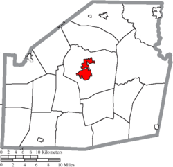 Location of Hillsboro in Highland County | |
| Coordinates: 39°12′21″N 83°36′50″W | |
| Country | United States |
| State | Ohio |
| County | Highland |
| Government | |
| • Mayor | Justin Harsha |
| Area | |
| • Total | 5.47 sq mi (14.18 km2) |
| • Land | 5.47 sq mi (14.18 km2) |
| • Water | 0.00 sq mi (0.00 km2) 0% |
| Elevation | 1,122 ft (342 m) |
| Population (2020) | |
| • Total | 6,481 |
| • Density | 1,183.74/sq mi (457.07/km2) |
| census | |
| Time zone | UTC-4 (EST) |
| • Summer (DST) | UTC-4 (EDT) |
| Zip code | 45133 |
| Area code(s) | 937, 326 |
| FIPS code | 39-35560[2] |
| GNIS feature ID | 1064840[3] |
| Website | http://www.hillsboroohio.net/ |
History

Hillsboro was platted in 1807, and most likely named for the hills near the original town site.[5] One of the late 19th century's largest reform organizations, the Woman's Christian Temperance Union that went on to play important roles in achieving women's suffrage and prohibition, was founded in Hillsboro in 1873.
Since 1976 the city hosts the "Festival of the Bells" during the fourth of July weekend. Hillsboro was famous for the production of steel alloy bells, which were shipped around the world. [6]
Geography
Hillsboro is located at 39°12′21″N 83°36′50″W (39.205764, -83.613764).[7]
According to the United States Census Bureau, the city has a total area of 5.43 square miles (14.06 km2), all land.[8]
Hillsboro is located at the junction of U.S. Routes 50 and 62 and State Routes 73, 124, 138, and 247.
The largest city near Hillsboro is Dayton with a distance of 56.3 miles. Followed by Cincinnati at 59.7 miles and then Columbus at 66.0 miles.
Climate
| Climate data for Hillsboro, Ohio (1991–2020) | |||||||||||||
|---|---|---|---|---|---|---|---|---|---|---|---|---|---|
| Month | Jan | Feb | Mar | Apr | May | Jun | Jul | Aug | Sep | Oct | Nov | Dec | Year |
| Average high °F (°C) | 38.8 (3.8) |
42.5 (5.8) |
52.5 (11.4) |
64.7 (18.2) |
73.6 (23.1) |
81.5 (27.5) |
84.6 (29.2) |
83.4 (28.6) |
78.0 (25.6) |
66.7 (19.3) |
53.8 (12.1) |
43.1 (6.2) |
63.6 (17.6) |
| Daily mean °F (°C) | 29.1 (−1.6) |
32.0 (0.0) |
40.9 (4.9) |
52.0 (11.1) |
61.8 (16.6) |
70.0 (21.1) |
73.2 (22.9) |
71.8 (22.1) |
65.5 (18.6) |
54.3 (12.4) |
42.7 (5.9) |
33.8 (1.0) |
52.3 (11.3) |
| Average low °F (°C) | 19.4 (−7.0) |
21.5 (−5.8) |
29.4 (−1.4) |
39.2 (4.0) |
49.9 (9.9) |
58.5 (14.7) |
61.8 (16.6) |
60.2 (15.7) |
53.0 (11.7) |
41.8 (5.4) |
31.6 (−0.2) |
24.6 (−4.1) |
40.9 (5.0) |
| Average precipitation inches (mm) | 3.44 (87) |
3.26 (83) |
4.20 (107) |
4.85 (123) |
5.06 (129) |
4.82 (122) |
4.25 (108) |
3.72 (94) |
3.17 (81) |
3.19 (81) |
3.10 (79) |
3.62 (92) |
46.68 (1,186) |
| Average snowfall inches (cm) | 6.9 (18) |
5.0 (13) |
3.4 (8.6) |
0.2 (0.51) |
0.0 (0.0) |
0.0 (0.0) |
0.0 (0.0) |
0.0 (0.0) |
0.0 (0.0) |
0.2 (0.51) |
0.2 (0.51) |
2.2 (5.6) |
18.1 (46.73) |
| Source: NOAA[9] | |||||||||||||
Demographics
| Historical population | |||
|---|---|---|---|
| Census | Pop. | %± | |
| 1810 | 220 | — | |
| 1820 | 508 | 130.9% | |
| 1830 | 566 | 11.4% | |
| 1840 | 1,021 | 80.4% | |
| 1850 | 1,392 | 36.3% | |
| 1860 | 2,171 | 56.0% | |
| 1870 | 2,818 | 29.8% | |
| 1880 | 3,234 | 14.8% | |
| 1890 | 3,620 | 11.9% | |
| 1900 | 4,535 | 25.3% | |
| 1910 | 4,296 | −5.3% | |
| 1920 | 4,356 | 1.4% | |
| 1930 | 4,040 | −7.3% | |
| 1940 | 4,713 | 16.7% | |
| 1950 | 5,126 | 8.8% | |
| 1960 | 5,474 | 6.8% | |
| 1970 | 5,584 | 2.0% | |
| 1980 | 6,356 | 13.8% | |
| 1990 | 6,235 | −1.9% | |
| 2000 | 6,368 | 2.1% | |
| 2010 | 6,605 | 3.7% | |
| 2020 | 6,481 | −1.9% | |
| 2021 (est.) | 6,483 | 0.0% | |
| Sources:[2][10][11][12][13][14][15][16] | |||
2010 census
As of the census[17] of 2010, there were 6,605 people, 2,755 households, and 1,612 families living in the city. The population density was 1,216.4 inhabitants per square mile (469.7/km2). There were 3,181 housing units at an average density of 585.8 per square mile (226.2/km2). The racial makeup of the city was 90.0% White, 5.8% African American, 0.3% Native American, 0.8% Asian, 0.2% from other races, and 2.9% from two or more races. Hispanic or Latino of any race were 1.3% of the population.
There were 2,755 households, of which 30.5% had children under the age of 18 living with them, 37.7% were married couples living together, 16.5% had a female householder with no husband present, 4.3% had a male householder with no wife present, and 41.5% were non-families. 37.1% of all households were made up of individuals, and 18.2% had someone living alone who was 65 years of age or older. The average household size was 2.28 and the average family size was 2.97.
The median age in the city was 38.7 years. 24.3% of residents were under the age of 18; 9.1% were between the ages of 18 and 24; 24.1% were from 25 to 44; 22.4% were from 45 to 64; and 20.1% were 65 years of age or older. The gender makeup of the city was 44.9% male and 55.1% female.
2000 census
As of the census[2] of 2000, there were 6,368 people, 2,686 households, and 1,633 families living in the city. The population density was 1,227.1 people per square mile (473.7/km2). There were 2,971 housing units at an average density of 572.5 per square mile (221.0/km2). The racial makeup of the city was 90.58% White, 6.39% African American, 0.20% Native American, 1.07% Asian, 0.03% Pacific Islander, 0.38% from other races, and 1.35% from two or more races. Hispanic or Latino of any race were 0.94% of the population.
There were 2,686 households, out of which 28.6% had children under the age of 18 living with them, 43.8% were married couples living together, 13.6% had a female householder with no husband present, and 39.2% were non-families. 35.8% of all households were made up of individuals, and 18.2% had someone living alone who was 65 years of age or older. The average household size was 2.26 and the average family size was 2.93.
In the city, the population was spread out, with 24.2% under the age of 18, 9.9% from 18 to 24, 23.9% from 25 to 44, 20.7% from 45 to 64, and 21.3% who were 65 years of age or older. The median age was 39 years. For every 100 females, there were 82.8 males. For every 100 females age 18 and over, there were 75.9 males.
The median income for a household in the city was $25,998, and the median income for a family was $34,750. Males had a median income of $30,984 versus $22,665 for females. The per capita income for the city was $15,400. About 13.5% of families and 18.1% of the population were below the poverty line, including 27.6% of those under age 18 and 11.7% of those age 65 or over.
Education
Hillsboro City Schools operates two public elementary schools, one middle school, and Hillsboro High School.[18] Parochial schools in Hillsboro include Hillsboro Christian Academy[19] and St. Mary Catholic Elementary School.[20]
The Central Campus of Southern State Community College is located within the city.[21]
Hillsboro has a public library, a branch of the Highland County District Library.[22]
Media
Newspapers
- The Highland County Press — weekly
- The Times-Gazette — daily except Sunday and Monday
Radio
- WLRU-LP - Catholic programming[23]
- WSRW — country music format
Notable people
- John J. Ballentine, U.S. Navy admiral
- R. N. Baskin, mayor of Salt Lake City (1892 – 1895)
- Milton Caniff, cartoonist (Terry and the Pirates, Steve Canyon)
- Joe Crawford, Major League Baseball Player
- Jonas R. Emrie, U.S. Representative, and postmaster of Hillsboro (1939 - 1941)
- Hugh Fullerton, sportswriter who exposed the 1919 Black Sox Scandal
- Drew Hastings, comedian and former mayor of the city
- Joseph J. McDowell, U.S. Representative
- Bob McEwen, U.S. Representative (1981 - 1993)
- William H. McSurely, Illinois state legislator and judge
- Jacob J. Pugsley, U.S. Representative
- Moses F. Shinn, Methodist Episcopal Church minister
- John Armstrong Smith, U.S. Representative (1869 - 1873)
- Eliza Thompson, temperance advocate who inspired the founding of the Woman's Christian Temperance Union.
- Allen Trimble, 8th & 10th Governor of Ohio (1822, 1826 - 1830)
- Kirby White, MLB player
- Wilbur M. White, U.S. Representative
- Jimmy Yeary, country singer and songwriter
- Daniel Gingerich, puppy mill operator[24][25][26][27]
References
- "ArcGIS REST Services Directory". United States Census Bureau. Retrieved September 20, 2022.
- "U.S. Census website". United States Census Bureau. Retrieved 2008-01-31.
- "US Board on Geographic Names". United States Geological Survey. 2007-10-25. Retrieved 2008-01-31.
- "Find a County". National Association of Counties. Archived from the original on May 31, 2011. Retrieved 2011-06-07.
- Overman, William Daniel (1958). Ohio Town Names. Akron, OH: Atlantic Press. p. 60.
- "Hillsboro Ohio". touringohio.com. Retrieved 2021-12-30.
- "US Gazetteer files: 2010, 2000, and 1990". United States Census Bureau. 2011-02-12. Retrieved 2011-04-23.
- "US Gazetteer files 2010". United States Census Bureau. Archived from the original on January 12, 2012. Retrieved 2013-01-06.
- "NOAA NCEI U.S. Climate Normals Quick Access". NOAA. Retrieved 2022-08-22.
- "Population of Civil Divisions Less than Counties" (PDF). Statistics of the Population of the United States at the Ninth Census. U.S. Census Bureau. 1870. Retrieved 17 May 2020.
- "Population of Civil Divisions Less than Counties" (PDF). Statistics of the Population of the United States at the Tenth Census. U.S. Census Bureau. 1880. Retrieved 28 November 2013.
- "Population: Ohio" (PDF). 1910 U.S. Census. U.S. Census Bureau. Retrieved 28 November 2013.
- "Population: Ohio" (PDF). 1930 US Census. U.S. Census Bureau. Retrieved 28 November 2013.
- "Number of Inhabitants: Ohio" (PDF). 18th Census of the United States. U.S. Census Bureau. 1960. Retrieved 17 May 2020.
- "Ohio: Population and Housing Unit Counts" (PDF). U.S. Census Bureau. Retrieved 22 November 2013.
- "Hillsboro city, Ohio". census.gov. Retrieved July 1, 2022.
- "U.S. Census website". United States Census Bureau. Retrieved 2013-01-06.
- "Hillsboro City School District". GreatSchools. Retrieved 25 February 2018.
- "Homepage". Hillsboro Christian Academy. Retrieved 25 February 2018.
- "Homepage". St. Mary Catholic Elementary School. Retrieved 25 February 2018.
- "Campus Locations". Southern State Community College. Retrieved 25 February 2018.
- "Hours & Locations". Highland County District Library. Retrieved 25 February 2018.
- FCC Internet Services Staff. "Station Search Details". fcc.gov. Retrieved 8 March 2015.
- Stratton, James (22 March 2022). "Former Iowa puppy mill owner pleads guilty, will spend time in jail". KCCI. Corydon, Iowa. Retrieved 22 March 2022.
- Fernando, Christine (5 November 2021). "Iowa breeder banned from selling dogs after 500 rescued amid 'horrific' conditions". USA TODAY. Retrieved 22 March 2022.
- Kauffman, Clark (18 October 2021). "Judge balks at puppy mill owner's request to send 453 dogs to Indiana". Des Moines Register. Retrieved 22 March 2022.
- Stratton, James (25 February 2022). "Daniel Gingerich, southern Iowa puppy mill owner, turns himself in". KCCI. Retrieved 22 March 2022.
External links
Municipalities and communities of Highland County, Ohio, United States | ||
|---|---|---|
County seat: Hillsboro | ||
| City |  | |
| Villages | ||
| Townships | ||
| CDPs | ||
| Unincorporated communities |
| |
| Footnotes | ‡This populated place also has portions in an adjacent county or counties | |
| ||
Authority control | |
|---|---|
| General | |
| National libraries | |
| Other |
|
На других языках
[de] Hillsboro (Ohio)
Hillsboro ist eine Stadt (mit dem Status „City“) und Verwaltungssitz des Highland County im US-amerikanischen Bundesstaat Ohio. Im Jahr 2010 hatte Hillsboro 6605 Einwohner.[1]- [en] Hillsboro, Ohio
Другой контент может иметь иную лицензию. Перед использованием материалов сайта WikiSort.org внимательно изучите правила лицензирования конкретных элементов наполнения сайта.
WikiSort.org - проект по пересортировке и дополнению контента Википедии