world.wikisort.org - USA
Pulaski County is located in the U.S. state of Arkansas with a population of 399,125, making it the most populous county in Arkansas.[1] Its county seat is Little Rock,[2] which is also Arkansas's capital and largest city. Pulaski County is Arkansas's fifth county, formed on December 15, 1818, alongside Clark and Hempstead Counties. The county is named for Casimir Pulaski, a Polish volunteer who saved George Washington's life during the American Revolutionary War. Pulaski County is included in the Little Rock–North Little Rock–Conway, AR Metropolitan Statistical Area which had 731,612 people in the 2015 census estimates. The Little Rock, North Little Rock Combined Statistical Area had 904,469 people in the 2015 census estimates.
Pulaski County | |
|---|---|
U.S. county | |
 Pulaski County Courthouse, in downtown Little Rock | |
 Flag  Seal | |
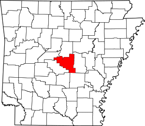 Location within the U.S. state of Arkansas | |
 Arkansas's location within the U.S. | |
| Coordinates: 34°44′32″N 92°17′09″W | |
| Country | |
| State | |
| Founded | December 15, 1818 |
| Named for | Casimir Pulaski |
| Seat | Little Rock |
| Largest city | Little Rock |
| Area | |
| • Total | 808 sq mi (2,090 km2) |
| • Land | 760 sq mi (2,000 km2) |
| • Water | 48 sq mi (120 km2) 5.9%% |
| Population (2020) | |
| • Total | 399,125 |
| • Density | 490/sq mi (190/km2) |
| Time zone | UTC−6 (Central) |
| • Summer (DST) | UTC−5 (CDT) |
| Congressional district | 2nd |
| Website | pulaskicounty |
History
This section needs expansion. You can help by adding to it. (April 2019) |
U. M. Rose, a pro-Confederate attorney, was county chancellor (judge and chief county executive) from 1860 until the fall of Little Rock to Union forces on September 1, 1863.
An 1863 American Civil War battle, the Battle of Bayou Fourche, occurred a few days later in Pulaski County.
Pulaski County was home to Willow Springs Water Park, one of the oldest water parks in the nation, which opened in 1928 and closed in 2013.
Geography
According to the U.S. Census Bureau, the county has a total area of 808 square miles (2,090 km2), of which 760 square miles (2,000 km2) is land and 48 square miles (120 km2) (5.9%) is water.[3]
Major highways
 I-30
I-30 I-40
I-40 Future I-57
 I-430
I-430 I-440
I-440 I-530
I-530 I-630
I-630 U.S. Highway 65
 U.S. Highway 67
 U.S. Highway 70
 U.S. Highway 165
 U.S. Highway 167
 Highway 5
 Highway 10
 Highway 100
 Highway 161
 Highway 300
 Highway 338
 Highway 365
 Highway 367
Adjacent counties
- Faulkner County (north)
- Lonoke County (east)
- Grant County (south)
- Jefferson County (south)
- Saline County (west)
- Perry County (northwest)
National protected areas
- Little Rock Central High School National Historic Site
Demographics
| Historical population | |||
|---|---|---|---|
| Census | Pop. | %± | |
| 1830 | 2,395 | — | |
| 1840 | 5,350 | 123.4% | |
| 1850 | 5,657 | 5.7% | |
| 1860 | 11,699 | 106.8% | |
| 1870 | 32,066 | 174.1% | |
| 1880 | 32,616 | 1.7% | |
| 1890 | 47,329 | 45.1% | |
| 1900 | 63,179 | 33.5% | |
| 1910 | 86,751 | 37.3% | |
| 1920 | 109,464 | 26.2% | |
| 1930 | 137,727 | 25.8% | |
| 1940 | 156,085 | 13.3% | |
| 1950 | 196,685 | 26.0% | |
| 1960 | 242,980 | 23.5% | |
| 1970 | 287,189 | 18.2% | |
| 1980 | 340,613 | 18.6% | |
| 1990 | 349,660 | 2.7% | |
| 2000 | 361,474 | 3.4% | |
| 2010 | 382,748 | 5.9% | |
| 2020 | 399,125 | 4.3% | |
| U.S. Decennial Census[4] 1790–1960[5] 1900–1990[6] 1990–2000[7] 2010–2020[8] 2020[1] | |||
![Age pyramid Pulaski County[9]](http://upload.wikimedia.org/wikipedia/commons/thumb/9/90/USA_Pulaski_County%2C_Arkansas_age_pyramid.svg/150px-USA_Pulaski_County%2C_Arkansas_age_pyramid.svg.png)
2020 census
| Race | Number | Percentage |
|---|---|---|
| White (non-Hispanic) | 193,993 | 48.6% |
| Black or African American (non-Hispanic) | 142,139 | 35.61% |
| Native American | 1,169 | 0.29% |
| Asian | 9,933 | 2.49% |
| Pacific Islander | 208 | 0.05% |
| Other/Mixed | 18,530 | 4.64% |
| Hispanic or Latino | 33,153 | 8.31% |
As of the 2020 United States census, there were 399,125 people, 158,000 households, and 93,080 families residing in the county.
2000 census
As of the 2000 United States Census,[11] there were 361,474 people, 147,942 households, and 95,718 families residing in the county. The population density was 469 inhabitants per square mile (181/km2). There were 161,135 housing units at an average density of 209 per square mile (81/km2). The racial makeup of the county was 63.96% White, 31.87% Black or African American, 0.39% Native American, 1.25% Asian, 0.04% Pacific Islander, 1.09% from other races, and 1.40% from two or more races. 2.44% of the population were Hispanic or Latino of any race.
There were 147,942 households, out of which 30.50% had children under the age of 18 living with them, 45.90% were married couples living together, 15.10% had a female householder with no husband present, and 35.30% were non-families. 30.00% of all households were made up of individuals, and 8.80% had someone living alone who was 65 years of age or older. The average household size was 2.39 and the average family size was 2.98.
In the county, the population was spread out, with 25.20% under the age of 18, 9.60% from 18 to 24, 31.10% from 25 to 44, 22.60% from 45 to 64, and 11.50% who were 65 years of age or older. The median age was 35 years. For every 100 females, there were 92.00 males. For every 100 females age 18 and over, there were 88.20 males.
The median income for a household in the county was $38,120, and the median income for a family was $46,523. Males had a median income of $33,131 versus $25,943 for females. The per capita income for the county was $21,466. About 10.40% of families and 13.30% of the population were below the poverty line, including 19.90% of those under age 18 and 9.80% of those age 65 or over.
Government and infrastructure
This section needs expansion. You can help by adding to it. (August 2018) |
The Arkansas Department of Correction Wrightsville Unit is in Wrightsville.[12]
Politics
Pulaski County is one of the most Democratic counties in Arkansas and the Southern United States. The city of North Little Rock was ranked the most liberal community in the state.[13]
In the Reconstruction Era following the Civil War, Republicans carried the county in every presidential election from 1868 to 1888.[citation needed] Since then, Republicans have only won the county four times: 1956, 1972, 1984, and 1988, all national Republican landslides.[citation needed]
Pulaski County has followed in the footsteps of most urban counties across the country, especially in the era of Barack Obama's presidency and post-presidency that has seen urban areas turn bluer and rural areas, such as virtually all of Arkansas, get even redder and more conservative. Donald Trump, the two-time winner of the state with over 60% of the vote, only garnered about 38% in this county, among his worst performances in a state that has strongly turned against the Democrats in the 21st century. Joe Biden's 59.9% share in 2020 is the highest for a Democrat in the county since 1976, besting even native son Bill Clinton in both 1992 and 1996.[citation needed]
| Year | Republican | Democratic | Third party | |||
|---|---|---|---|---|---|---|
| No. | % | No. | % | No. | % | |
| 2020 | 63,687 | 37.47% | 101,947 | 59.98% | 4,322 | 2.54% |
| 2016 | 61,257 | 38.34% | 89,574 | 56.06% | 8,945 | 5.60% |
| 2012 | 68,984 | 43.28% | 87,248 | 54.74% | 3,149 | 1.98% |
| 2008 | 70,212 | 43.52% | 88,854 | 55.07% | 2,277 | 1.41% |
| 2004 | 67,903 | 44.20% | 84,532 | 55.03% | 1,185 | 0.77% |
| 2000 | 55,866 | 43.94% | 68,320 | 53.73% | 2,965 | 2.33% |
| 1996 | 44,780 | 35.06% | 75,084 | 58.78% | 7,869 | 6.16% |
| 1992 | 47,789 | 34.89% | 79,482 | 58.03% | 9,686 | 7.07% |
| 1988 | 70,562 | 54.98% | 55,857 | 43.53% | 1,914 | 1.49% |
| 1984 | 77,651 | 58.20% | 54,237 | 40.65% | 1,530 | 1.15% |
| 1980 | 52,125 | 46.15% | 54,839 | 48.56% | 5,973 | 5.29% |
| 1976 | 37,690 | 37.14% | 63,541 | 62.62% | 244 | 0.24% |
| 1972 | 57,576 | 62.95% | 33,611 | 36.75% | 281 | 0.31% |
| 1968 | 26,709 | 33.32% | 27,597 | 34.43% | 25,844 | 32.24% |
| 1964 | 38,312 | 48.32% | 40,535 | 51.12% | 442 | 0.56% |
| 1960 | 22,146 | 39.70% | 26,034 | 46.67% | 7,608 | 13.64% |
| 1956 | 25,702 | 51.10% | 23,372 | 46.46% | 1,227 | 2.44% |
| 1952 | 23,460 | 48.59% | 24,448 | 50.63% | 378 | 0.78% |
| 1948 | 5,910 | 23.99% | 13,120 | 53.25% | 5,609 | 22.76% |
| 1944 | 6,069 | 26.87% | 16,470 | 72.91% | 50 | 0.22% |
| 1940 | 2,955 | 17.15% | 14,219 | 82.52% | 56 | 0.33% |
| 1936 | 1,320 | 10.29% | 11,482 | 89.49% | 28 | 0.22% |
| 1932 | 2,281 | 13.87% | 14,049 | 85.46% | 110 | 0.67% |
| 1928 | 4,880 | 34.55% | 9,215 | 65.24% | 29 | 0.21% |
| 1924 | 2,729 | 28.36% | 5,706 | 59.30% | 1,187 | 12.34% |
| 1920 | 3,711 | 35.80% | 6,506 | 62.76% | 150 | 1.45% |
| 1916 | 2,593 | 30.15% | 6,008 | 69.85% | 0 | 0.00% |
| 1912 | 1,044 | 16.76% | 3,369 | 54.09% | 1,815 | 29.14% |
| 1908 | 3,533 | 45.68% | 3,893 | 50.33% | 309 | 3.99% |
| 1904 | 2,450 | 42.44% | 3,099 | 53.68% | 224 | 3.88% |
| 1900 | 1,932 | 41.85% | 2,609 | 56.52% | 75 | 1.62% |
| 1896 | 1,754 | 35.84% | 3,021 | 61.73% | 119 | 2.43% |
| 1892 | 2,492 | 39.07% | 3,392 | 53.18% | 494 | 7.75% |
Education
- Tertiary
- Pulaski Technical College is a two-year community college and technical school that offers seven locations throughout the county, including a flagship campus in western North Little Rock.
- Four-year postsecondary institutions include the University of Arkansas at Little Rock, the University of Arkansas System's only metropolitan campus, the United Methodist Church-affiliated Philander Smith College, Arkansas Baptist College, and the University of Arkansas for Medical Sciences — all located in Little Rock.
School districts include:[15]
- Jacksonville North Pulaski School District
- Little Rock School District
- North Little Rock School District
- Pulaski County Special School District
- East End School District
- State-operated schools
- Arkansas School for the Blind
- Arkansas School for the Deaf
Communities
Cities
- Cammack Village
- Jacksonville
- Little Rock (county seat)
- Maumelle
- North Little Rock
- Sherwood
- Wrightsville
Town
Census-designated places
- College Station
- Gibson
- Hensley
- Landmark
- McAlmont
- Natural Steps
- Roland
- Scott
- Sweet Home
- Woodson
Other communities
- Crystal Hill
- Gravel Ridge
- Ironton
- Little Italy
- Mabelvale
- Marche
- Pankey
- Woodyardville
Townships
Townships in Arkansas are the divisions of a county. Each township includes unincorporated areas and some may have incorporated towns or cities within part of their space. Townships have limited purposes in modern times. However, the US Census does list Arkansas population based on townships (often referred to as "minor civil divisions"). Townships are also of value for historical purposes in terms of genealogical research. Each town or city is within one or more townships in an Arkansas county based on census maps. Pulaski County only has two townships, as of 2010. They are listed below.[16][17]
| Township | FIPS code | ANSI code (GNIS ID) |
Population center(s) |
Pop. (2010) |
Pop. density (/mi2) |
Pop. density (/km2) |
Land area (mi2) |
Land area (km2) |
Water area (mi2) |
Water area (km2) |
Geographic coordinates |
|---|---|---|---|---|---|---|---|---|---|---|---|
| Big Rock | 05-90300 | 69013 | Alexander, Cammack Village, Little Rock, Wrightsville | 219,984 | 506.7 | 195.6 | 404.014 | 1,046 | 30.148 | 78.08 | 34°44′30″N 92°24′43″W |
| Hill | 05-91731 | 69014 | Jacksonville, Maumelle, North Little Rock, Sherwood | 162,764 | 435.8 | 168.3 | 355.750 | 921.4 | 17.753 | 45.98 | 34°48′12″N 92°11′32″W |
| Source: U.S. Census Bureau[18][19] | |||||||||||
Notable people
- Granville Ryles (1831-1909), minister, farmer and state legislator in Arkansas
See also
- List of lakes in Pulaski County, Arkansas
- National Register of Historic Places listings in Pulaski County, Arkansas
References
- "2020 Census Data". data.census.gov.
- "Find a County". National Association of Counties. Retrieved June 7, 2011.
- "2010 Census Gazetteer Files". United States Census Bureau. August 22, 2012. Retrieved August 27, 2015.
- "U.S. Decennial Census". United States Census Bureau. Retrieved August 27, 2015.
- "Historical Census Browser". University of Virginia Library. Retrieved August 27, 2015.
- Forstall, Richard L., ed. (March 27, 1995). "Population of Counties by Decennial Census: 1900 to 1990". United States Census Bureau. Retrieved August 27, 2015.
- "Census 2000 PHC-T-4. Ranking Tables for Counties: 1990 and 2000" (PDF). United States Census Bureau. April 2, 2001. Retrieved August 27, 2015.
- "State & County QuickFacts". United States Census Bureau. Archived from the original on June 7, 2011. Retrieved April 22, 2016.
- Based on 2000 census data
- "Explore Census Data". data.census.gov. Retrieved December 31, 2021.
- "U.S. Census website". United States Census Bureau. Retrieved January 31, 2008.
- Facilities 5. Arkansas Department of Corrections. Retrieved on March 8, 2011.
- Kiersz, Hunter Walker, Andy. "Here Are The Most Liberal And Most Conservative Towns In Each State". Business Insider. Retrieved July 5, 2020.
- "Dave Leip's Atlas of U.S. Presidential Elections". Retrieved November 15, 2016.
- "2020 CENSUS - SCHOOL DISTRICT REFERENCE MAP: Pulaski County, AR" (PDF). U.S. Census Bureau. Retrieved July 20, 2022. - Text list
- 2011 Boundary and Annexation Survey (BAS): Pulaski County, AR (PDF) (Map). U. S. Census Bureau. Archived from the original (PDF) on October 19, 2012. Retrieved August 24, 2011.
- "Arkansas: 2010 Census Block Maps - County Subdivision". United States Census Bureau. Retrieved June 28, 2014.
- "County Subdivisions: Arkansas". Census 2010 U.S. Gazetteer Files. United States Census Bureau. Archived from the original (TXT) on May 31, 2014. Retrieved June 28, 2014.
- "Census 2010 U.S. Gazetteer Files". United States Census Bureau. Retrieved June 28, 2014.
External links
- Pulaski County Government
- Pulaski County, Arkansas in Encyclopedia of Arkansas
Places adjacent to Pulaski County, Arkansas | ||||||||||||||||
|---|---|---|---|---|---|---|---|---|---|---|---|---|---|---|---|---|
| ||||||||||||||||
Municipalities and communities of Pulaski County, Arkansas, United States | ||
|---|---|---|
County seat: Little Rock | ||
| Cities |  | |
| CDPs |
| |
| Other unincorporated communities | ||
| Footnotes | ‡This populated place also has portions in an adjacent county or counties | |
| ||
State of Arkansas | |
|---|---|
Little Rock (capital) | |
| Topics |
|
| Society |
|
| Regions |
|
| Metros |
|
| Largest cities | |
| Counties |
|
Authority control | |
|---|---|
| General | |
| National libraries | |
| Other |
|
На других языках
- [en] Pulaski County, Arkansas
[ru] Пьюласки (округ, Арканзас)
Пьюла́ски[1] (англ. Pulaski County) — округ, расположенный в штате Арканзас, США с населением в 361 474 человек по статистическим данным переписи 2000 года. Столица округа находится в городе Литтл-Рок, который также является крупнейшим городом штата Арканзас и его столицей.Другой контент может иметь иную лицензию. Перед использованием материалов сайта WikiSort.org внимательно изучите правила лицензирования конкретных элементов наполнения сайта.
WikiSort.org - проект по пересортировке и дополнению контента Википедии