world.wikisort.org - USA
Lafayette County /lɑːˈfeɪɛt/ is a county located in the U.S. state of Arkansas. As of the 2010 census, the population was 7,645,[2] making it the third-least populous county in Arkansas. The county seat is Lewisville.[3] Lafayette County was formed on October 15, 1827, and named in honor of the Marquis de Lafayette,[4] a French military hero of the American Revolutionary War. It is a dry county; therefore, the sale of alcohol is prohibited.[citation needed]
Lafayette County | |
|---|---|
County | |
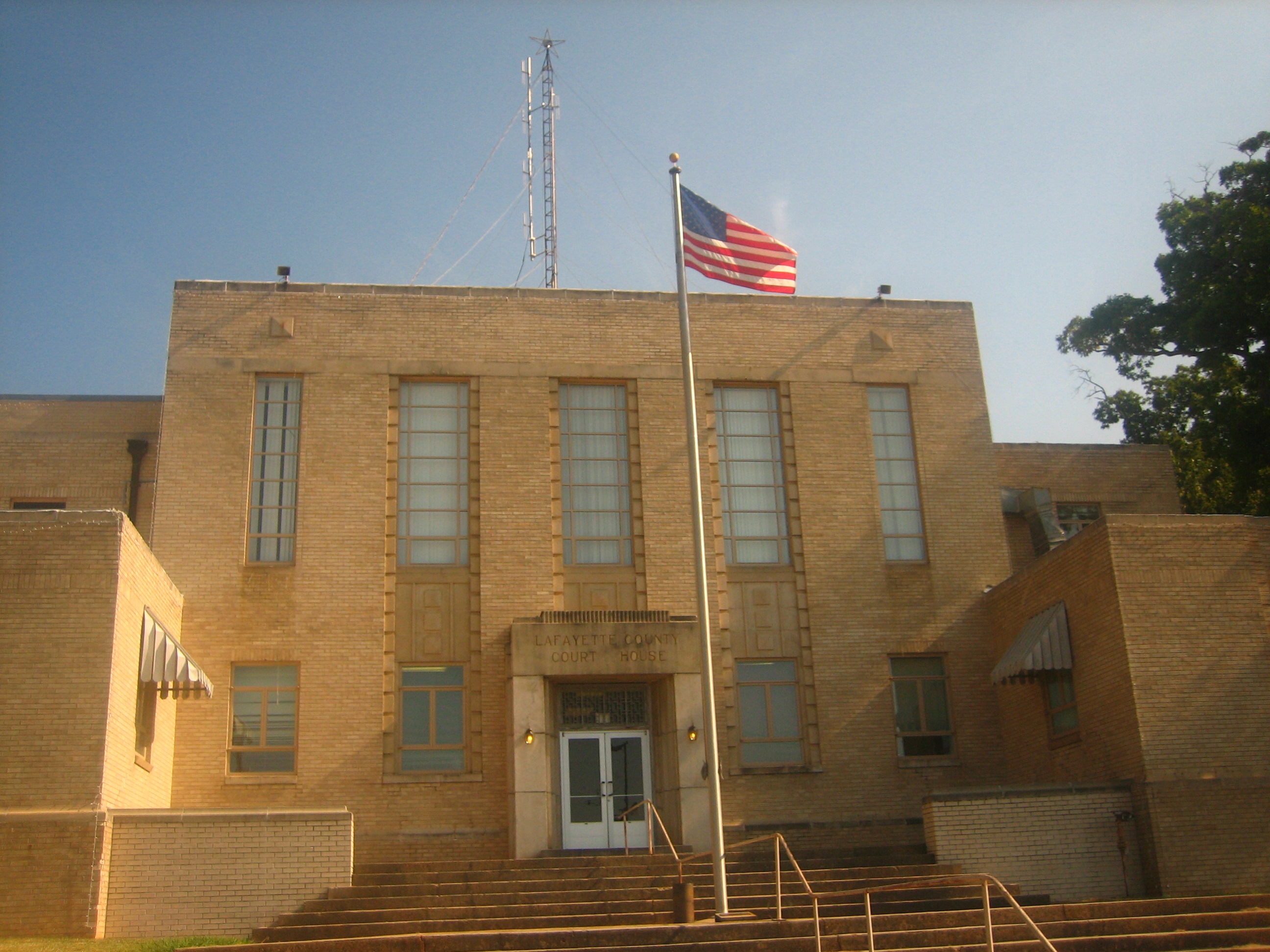 Lafayette County Courthouse, Lewisville | |
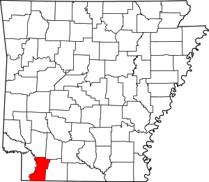 Location within the U.S. state of Arkansas | |
 Arkansas's location within the U.S. | |
| Coordinates: 33°15′51″N 93°35′34″W | |
| Country | |
| State | |
| Founded | October 15, 1827 |
| Named for | Marquis de Lafayette |
| Seat | Lewisville |
| Largest town | Stamps |
| Area | |
| • Total | 545 sq mi (1,410 km2) |
| • Land | 528 sq mi (1,370 km2) |
| • Water | 17 sq mi (40 km2) 3.1%% |
| Population (2010) | |
| • Total | 7,645 |
| • Estimate (2019)[1] | 6,624 |
| • Density | 14/sq mi (5.4/km2) |
| Time zone | UTC−6 (Central) |
| • Summer (DST) | UTC−5 (CDT) |
| ZIP Codes | 71826, 71827, 71845, 71860, 71861 |
| Area code | 870 |
| Congressional district | 4th |
| Website | www |
Geography
According to the U.S. Census Bureau, the county has a total area of 545 square miles (1,410 km2), of which 528 square miles (1,370 km2) is land and 17 square miles (44 km2) (3.1%) is water.[5] It is the smallest county in Arkansas by area.[citation needed]
Major highways
 U.S. Highway 82
 Highway 29
 Highway 53
 Highway 160
Adjacent counties
- Hempstead County (north)
- Nevada County (northeast)
- Columbia County (east)
- Webster Parish, Louisiana (southeast)
- Bossier Parish, Louisiana (south)
- Caddo Parish, Louisiana (southwest)
- Miller County (west)
Demographics
| Historical population | |||
|---|---|---|---|
| Census | Pop. | %± | |
| 1830 | 748 | — | |
| 1840 | 2,200 | 194.1% | |
| 1850 | 5,220 | 137.3% | |
| 1860 | 8,464 | 62.1% | |
| 1870 | 9,139 | 8.0% | |
| 1880 | 5,730 | −37.3% | |
| 1890 | 7,700 | 34.4% | |
| 1900 | 10,594 | 37.6% | |
| 1910 | 13,741 | 29.7% | |
| 1920 | 15,522 | 13.0% | |
| 1930 | 16,934 | 9.1% | |
| 1940 | 16,851 | −0.5% | |
| 1950 | 13,203 | −21.6% | |
| 1960 | 11,030 | −16.5% | |
| 1970 | 10,018 | −9.2% | |
| 1980 | 10,213 | 1.9% | |
| 1990 | 9,643 | −5.6% | |
| 2000 | 8,559 | −11.2% | |
| 2010 | 7,645 | −10.7% | |
| 2020 | 6,308 | −17.5% | |
| U.S. Decennial Census[6] 1790–1960[7] 1900–1990[8] 1990–2000[9] 2010–2016[2] | |||
![Age pyramid Lafayette County[10]](http://upload.wikimedia.org/wikipedia/commons/thumb/a/a1/USA_Lafayette_County%2C_Arkansas_age_pyramid.svg/150px-USA_Lafayette_County%2C_Arkansas_age_pyramid.svg.png)
2020 census
| Race | Number | Percentage |
|---|---|---|
| White (non-Hispanic) | 3,870 | 61.35% |
| Black or African American (non-Hispanic) | 2,043 | 32.39% |
| Native American | 29 | 0.46% |
| Asian | 32 | 0.51% |
| Pacific Islander | 5 | 0.08% |
| Other/Mixed | 184 | 2.92% |
| Hispanic or Latino | 145 | 2.3% |
As of the 2020 United States census, there were 6,308 people, 2,784 households, and 1,801 families residing in the county.
2000 census
As of the 2000 United States Census,[12] there were 8,559 people, 3,434 households, and 2,376 families residing in the county. The population density was 16 people per square mile (6/km2). There were 4,560 housing units at an average density of 9 per square mile (3/km2). The racial makeup of the county was 62.08% White, 36.49% Black or African American, 0.37% Native American, 0.22% Asian, 0.01% Pacific Islander, 0.20% from other races, and 0.63% from two or more races. 1.03% of the population were Hispanic or Latino of any race.
There were 3,434 households, out of which 27.90% had children under the age of 18 living with them, 50.60% were married couples living together, 14.40% had a female householder with no husband present, and 30.80% were non-families. 28.40% of all households were made up of individuals, and 14.60% had someone living alone who was 65 years of age or older. The average household size was 2.46 and the average family size was 3.00.
In the county, the population was spread out, with 25.40% under the age of 18, 8.10% from 18 to 24, 24.40% from 25 to 44, 24.40% from 45 to 64, and 17.70% who were 65 years of age or older. The median age was 39 years. For every 100 females, there were 93.60 males. For every 100 females age 18 and over, there were 87.80 males.
The median income for a household in the county was $24,831, and the median income for a family was $30,720. Males had a median income of $26,492 versus $17,000 for females. The per capita income for the county was $14,128. About 18.70% of families and 23.20% of the population were below the poverty line, including 31.50% of those under age 18 and 19.30% of those age 65 or over.
Government
Prior to 2000, Lafayette County was considered an "ancestral" Democratic county among white conservatives. Exceptions were the 1972 and 1984 landslides of Republicans Richard Nixon and Ronald Reagan, respectively.
Former Governor Bill Clinton of Arkansas, considered a son of the South, won this county twice in his presidential runs: 1992 and 1996. Clinton's vice president, Al Gore of Tennessee, another son of the South, won the county in 2000, the most recent Democrat to do so. Most of the minority of African-American voters have been affiliated since the 1960s with the national Democratic Party, even as conservative whites here shifted to the Republican Party.
| Year | Republican | Democratic | Third party | |||
|---|---|---|---|---|---|---|
| No. | % | No. | % | No. | % | |
| 2020 | 1,757 | 65.58% | 839 | 31.32% | 83 | 3.10% |
| 2016 | 1,758 | 61.47% | 1,032 | 36.08% | 70 | 2.45% |
| 2012 | 1,713 | 58.48% | 1,173 | 40.05% | 43 | 1.47% |
| 2008 | 1,685 | 58.06% | 1,133 | 39.04% | 84 | 2.89% |
| 2004 | 1,604 | 50.27% | 1,567 | 49.11% | 20 | 0.63% |
| 2000 | 1,538 | 45.46% | 1,806 | 53.38% | 39 | 1.15% |
| 1996 | 971 | 25.25% | 2,466 | 64.14% | 408 | 10.61% |
| 1992 | 1,188 | 29.86% | 2,273 | 57.12% | 518 | 13.02% |
| 1988 | 1,860 | 48.95% | 1,915 | 50.39% | 25 | 0.66% |
| 1984 | 2,290 | 57.15% | 1,695 | 42.30% | 22 | 0.55% |
| 1980 | 1,756 | 46.50% | 1,947 | 51.56% | 73 | 1.93% |
| 1976 | 1,467 | 38.51% | 2,342 | 61.49% | 0 | 0.00% |
| 1972 | 2,460 | 71.91% | 952 | 27.83% | 9 | 0.26% |
| 1968 | 672 | 18.75% | 1,208 | 33.71% | 1,704 | 47.54% |
| 1964 | 1,476 | 49.75% | 1,484 | 50.02% | 7 | 0.24% |
| 1960 | 713 | 30.67% | 1,286 | 55.31% | 326 | 14.02% |
| 1956 | 836 | 36.67% | 1,348 | 59.12% | 96 | 4.21% |
| 1952 | 733 | 30.72% | 1,637 | 68.61% | 16 | 0.67% |
| 1948 | 113 | 7.94% | 700 | 49.16% | 611 | 42.91% |
| 1944 | 177 | 13.34% | 1,150 | 86.66% | 0 | 0.00% |
| 1940 | 159 | 10.35% | 1,352 | 88.02% | 25 | 1.63% |
| 1936 | 100 | 7.24% | 1,279 | 92.55% | 3 | 0.22% |
| 1932 | 151 | 9.14% | 1,495 | 90.50% | 6 | 0.36% |
| 1928 | 435 | 30.48% | 991 | 69.45% | 1 | 0.07% |
| 1924 | 298 | 24.53% | 788 | 64.86% | 129 | 10.62% |
| 1920 | 500 | 34.25% | 954 | 65.34% | 6 | 0.41% |
| 1916 | 365 | 29.06% | 891 | 70.94% | 0 | 0.00% |
| 1912 | 208 | 23.88% | 498 | 57.18% | 165 | 18.94% |
| 1908 | 552 | 42.11% | 739 | 56.37% | 20 | 1.53% |
| 1904 | 566 | 46.66% | 614 | 50.62% | 33 | 2.72% |
| 1900 | 448 | 51.44% | 422 | 48.45% | 1 | 0.11% |
| 1896 | 423 | 40.83% | 608 | 58.69% | 5 | 0.48% |
Communities
Towns
- Bradley
- Buckner
- Lewisville (county seat)
- Stamps
Townships
Townships in Arkansas are the divisions of a county. Each township includes unincorporated areas; some may have incorporated cities or towns within part of their boundaries. Arkansas townships have limited purposes in modern times. However, the United States census does list Arkansas population based on townships (sometimes referred to as "county subdivisions" or "minor civil divisions"). Townships are also of value for historical purposes in terms of genealogical research. Each town or city is within one or more townships in an Arkansas county based on census maps and publications. The townships of Lafayette County are listed below; listed in parentheses are the cities, towns, and/or census-designated places that are fully or partially inside the township. [14][15]
- Baker (most of Stamps)
- French
- Hadley (Buckner, small part of Stamps)
- La Grange (small part of Lewisville)
- Mars Hill
- Roane (Bradley)
- Russell
- Steel (most of Lewisville)
- Walker Creek
Source:[16]
Education
There are two school districts in the county: Lafayette County School District and the Emerson-Taylor-Bradley School District.[17] Previously the Bradley School District was the second district;[18] it merged into Emerson-Taylor-Bradley in 2013.[19]
See also
- Honors and memorials to the Marquis de Lafayette
- List of counties in Arkansas
- List of lakes in Lafayette County, Arkansas
- National Register of Historic Places listings in Lafayette County, Arkansas
References
- "Population and Housing Unit Estimates". U.S. Census Bureau. August 15, 2017. Retrieved August 15, 2017.
- "State & County QuickFacts". United States Census Bureau. Archived from the original on June 7, 2011. Retrieved May 23, 2014.
- "Find a County". National Association of Counties. Retrieved June 7, 2011.
- Gannett, Henry (1905). The Origin of Certain Place Names in the United States. Government Printing Office. p. 178.
- "2010 Census Gazetteer Files". United States Census Bureau. August 22, 2012. Retrieved August 27, 2015.
- "U.S. Decennial Census". United States Census Bureau. Retrieved August 27, 2015.
- "Historical Census Browser". University of Virginia Library. Retrieved August 27, 2015.
- Forstall, Richard L., ed. (March 27, 1995). "Population of Counties by Decennial Census: 1900 to 1990". United States Census Bureau. Retrieved August 27, 2015.
- "Census 2000 PHC-T-4. Ranking Tables for Counties: 1990 and 2000" (PDF). United States Census Bureau. April 2, 2001. Archived (PDF) from the original on March 27, 2010. Retrieved August 27, 2015.
- Based on 2000 census data
- "Explore Census Data". data.census.gov. Retrieved December 30, 2021.
- "U.S. Census website". United States Census Bureau. Retrieved May 14, 2011.
- "Dave Leip's Atlas of U.S. Presidential Elections". Retrieved November 18, 2016.
- 2011 Boundary and Annexation Survey (BAS): Lafayette County, AR (PDF) (Map). U. S. Census Bureau. Archived from the original (PDF) on October 19, 2012. Retrieved August 24, 2011.
- "Arkansas: 2010 Census Block Maps - County Subdivision". United States Census Bureau. Archived from the original on May 28, 2014. Retrieved May 29, 2014.
-
"Summary Population and Housing Characteristics, CPH-1-5, Arkansas" (PDF). 2010 Census of Population and Housing. United States Census Bureau. September 2012. Retrieved May 31, 2014.
{{cite web}}: External link in|work= - "2020 CENSUS - SCHOOL DISTRICT REFERENCE MAP: Lafayette County, AR" (PDF). U.S. Census Bureau. Archived (PDF) from the original on July 21, 2022. Retrieved July 21, 2022. - Text list
- "SCHOOL DISTRICT REFERENCE MAP (2010 CENSUS): Lafayette County, AR" (PDF). U.S. Census Bureau. Archived (PDF) from the original on August 25, 2017. Retrieved July 21, 2022. - Text list
- "State approves Bradley school annexation by Emerson-Taylor district". Magnolia Reporter. May 14, 2013. Retrieved October 19, 2017.
External links
Places adjacent to Lafayette County, Arkansas | ||||||||||||||||
|---|---|---|---|---|---|---|---|---|---|---|---|---|---|---|---|---|
| ||||||||||||||||
Municipalities and communities of Lafayette County, Arkansas, United States | ||
|---|---|---|
County seat: Lewisville | ||
| Cities |  | |
| Town | ||
| Unincorporated communities | ||
| ||
State of Arkansas | |
|---|---|
Little Rock (capital) | |
| Topics |
|
| Society |
|
| Regions |
|
| Metros |
|
| Largest cities | |
| Counties |
|
Authority control | |
|---|---|
| General | |
| National libraries | |
| Other | |
На других языках
[de] Lafayette County (Arkansas)
Das Lafayette County[3] ist ein County im US-Bundesstaat Arkansas. Der Verwaltungssitz (County Seat) ist Lewisville.[4] Das County gehört zu den Dry Countys, was bedeutet, dass der Verkauf von Alkohol eingeschränkt oder verboten ist.- [en] Lafayette County, Arkansas
[fr] Comté de Lafayette (Arkansas)
Le comté de Lafayette (en anglais : Lafayette County) est un comté de l'État de l'Arkansas aux États-Unis. Au recensement de 2010, il comptait 7 645 habitants. Son siège est Lewisville.[it] Contea di Lafayette (Arkansas)
La contea di Lafayette, in inglese Lafayette County, è una contea dello Stato dell'Arkansas, negli Stati Uniti. La popolazione al censimento del 2000 era di 8.559 abitanti. Il capoluogo di contea è Lewisville.[ru] Лафейетт (округ, Арканзас)
Лафейе́тт[1] (англ. Lafayette County) — округ, расположенный в штате Арканзас, США, с населением в 8559 человек по статистическим данным переписи 2000 года. Столица округа находится в городе Льюисвилл.Другой контент может иметь иную лицензию. Перед использованием материалов сайта WikiSort.org внимательно изучите правила лицензирования конкретных элементов наполнения сайта.
WikiSort.org - проект по пересортировке и дополнению контента Википедии