world.wikisort.org - USA
Oak Grove is a city in Jackson and Lafayette counties in the U.S. state of Missouri. The population was 7,795 at the 2010 census. It is part of the Kansas City metropolitan area.
Oak Grove, Jackson County, Missouri | |
|---|---|
City | |
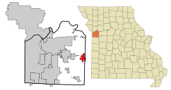 Location within Jackson County | |
| Coordinates: 39°0′15″N 94°7′42″W | |
| Country | United States |
| State | Missouri |
| County | Jackson |
| Area | |
| • Total | 6.43 sq mi (16.65 km2) |
| • Land | 6.41 sq mi (16.60 km2) |
| • Water | 0.02 sq mi (0.05 km2) |
| Population (2020) | |
| • Total | 8,157 |
| • Density | 1,272.34/sq mi (491.28/km2) |
| Time zone | UTC-6 (Central (CST)) |
| • Summer (DST) | UTC-5 (CDT) |
| FIPS code | 29-53624 |
| GNIS feature ID | 2395283 |
| Website | www |
History
A post office called Oak Grove has been in operation since 1840,[2] however the town was originally called Lickskillet.[3] The city was not platted until 1878.[4] It was named for a grove of oak trees near the original town site.[5]
2017 tornado
On March 6, 2017, just before 9:00 pm CDT (03:00 UTC),[6] a tornado touched down near the western edge of Oak Grove and tracked eastward across the city. 483 houses and 12 businesses were damaged,[7] particularly between 25th and Broadway Streets across the southern part of the city. A total of fifteen people suffered injuries, but remarkably there were no fatalities.[8] Communications were lost and power was knocked out to many areas. The National Weather Service rated the tornado EF3.[9] Missouri Governor Eric Greitens declared a state of emergency for the area, and traveled to Oak Grove on March 7, where he visited first responders and tornado victims.[10]
Geography
Oak Grove is located at 39°0′15″N 94°7′42″W (39.004181, -94.128299).[11]
According to the United States Census Bureau, the city has a total area of 6.19 square miles (16.03 km2), of which 6.17 square miles (15.98 km2) is land and 0.02 square miles (0.05 km2) is water.[12]
Demographics
| Historical population | |||
|---|---|---|---|
| Census | Pop. | %± | |
| 1880 | 208 | — | |
| 1900 | 408 | — | |
| 1910 | 641 | 57.1% | |
| 1920 | 634 | −1.1% | |
| 1930 | 702 | 10.7% | |
| 1940 | 680 | −3.1% | |
| 1950 | 761 | 11.9% | |
| 1960 | 1,100 | 44.5% | |
| 1970 | 2,025 | 84.1% | |
| 1980 | 4,067 | 100.8% | |
| 1990 | 4,565 | 12.2% | |
| 2000 | 5,535 | 21.2% | |
| 2010 | 7,795 | 40.8% | |
| 2020 | 8,157 | 4.6% | |
| U.S. Decennial Census[13] | |||
2010 census
As of the census[14] of 2010, there were 7,795 people, 2,791 households, and 2,068 families living in the city. The population density was 1,263.4 inhabitants per square mile (487.8/km2). There were 2,990 housing units at an average density of 484.6 per square mile (187.1/km2). The racial makeup of the city was 94.7% White, 1.1% African American, 0.8% Native American, 0.7% Asian, 0.1% Pacific Islander, 0.8% from other races, and 1.8% from two or more races. Hispanic or Latino of any race were 3.7% of the population.
There were 2,791 households, of which 44.3% had children under the age of 18 living with them, 51.1% were married couples living together, 15.8% had a female householder with no husband present, 7.2% had a male householder with no wife present, and 25.9% were non-families. 21.1% of all households were made up of individuals, and 9.1% had someone living alone who was 65 years of age or older. The average household size was 2.76 and the average family size was 3.16.
The median age in the city was 32.4 years. 30.6% of residents were under the age of 18; 8.8% were between the ages of 18 and 24; 28.3% were from 25 to 44; 20.4% were from 45 to 64; and 11.8% were 65 years of age or older. The gender makeup of the city was 48.5% male and 51.5% female.
2000 census
As of the census[15] of 2000, there were 5,535 people, 1,944 households, and 1,479 families living in the city. The population density was 1,140.3 people per square mile (440.6/km2). There were 2,016 housing units at an average density of 415.3 per square mile (160.5/km2). The racial makeup of the city was 97.07% White, 0.25% African American, 0.25% Native American, 0.42% Asian, 0.20% Pacific Islander, 0.76% from other races, and 1.05% from two or more races. Hispanic or Latino of any race were 1.66% of the population.
There were 1,944 households, out of which 45.1% had children under the age of 18 living with them, 57.9% were married couples living together, 13.3% had a female householder with no husband present, and 23.9% were non-families. 20.2% of all households were made up of individuals, and 8.7% had someone living alone who was 65 years of age or older. The average household size was 2.80 and the average family size was 3.21.
In the city the population was spread out, with 31.8% under the age of 18, 8.7% from 18 to 24, 32.3% from 25 to 44, 17.3% from 45 to 64, and 9.8% who were 65 years of age or older. The median age was 31 years. For every 100 females, there were 95.0 males. For every 100 females age 18 and over, there were 87.9 males.
The median income for a household in the city was $44,952, and the median income for a family was $49,136. Males had a median income of $35,644 versus $25,238 for females. The per capita income for the city was $17,738. About 8.3% of families and 10.1% of the population were below the poverty line, including 11.2% of those under age 18 and 7.2% of those age 65 or over.
Education
Oak Grove R-VI School District operates one primary school, one elementary school, one middle school, and Oak Grove High School.[16]
Oak Grove has a public library, a branch of the Mid-Continent Public Library.[17]
References
- "ArcGIS REST Services Directory". United States Census Bureau. Retrieved August 28, 2022.
- "Post Offices". Jim Forte Postal History. Retrieved 16 October 2016.
- Sharpe, Robert Q. and Nadine B. (1971). Highlights of Blue Springs History: For Bushwhacker Days 1971. Little Blue Press. p. 4.
- "Jackson County Place Names, 1928–1945 (archived)". The State Historical Society of Missouri. Archived from the original on 24 June 2016. Retrieved 16 October 2016.
{{cite web}}: CS1 maint: bot: original URL status unknown (link) - Eaton, David Wolfe (1916). How Missouri Counties, Towns and Streams Were Named. The State Historical Society of Missouri. pp. 178.
- "'It sounded like a bomb': Tornado severely damages Oak Grove neighborhoods". kansascity. Retrieved 2017-03-07.
- Press, 41 Action News Staff , Associated (2017-03-07). "Tornado damages hundreds of homes in Oak Grove, Missouri". KSHB. Retrieved 2017-03-07.
- "Hundreds of homes damaged in tornado-laden Midwest storm". ABC News. Retrieved 2017-03-07.
- "UPDATE: Preliminary EF-3 Oak Grove tornado leaves most damage Monday night". Missourinet. 2017-03-07. Retrieved 2017-03-07.
- Houts, Megg (2017-03-07). "Governor Greitens to Visit First Responders and Tornado Victims in Oak Grove". Governor Eric R. Greitens. Retrieved 2017-03-07.
- "US Gazetteer files: 2010, 2000, and 1990". United States Census Bureau. 2011-02-12. Retrieved 2011-04-23.
- "US Gazetteer files 2010". United States Census Bureau. Archived from the original on January 12, 2012. Retrieved 2012-07-08.
- "Census of Population and Housing". Census.gov. Retrieved June 4, 2015.
- "U.S. Census website". United States Census Bureau. Retrieved 2012-07-08.
- "U.S. Census website". United States Census Bureau. Retrieved 2008-01-31.
- "Schools". Oak Grove R-VI. Retrieved 18 March 2018.
- "Locations". Mid-Continent Public Library. Retrieved 17 March 2018.
External links
- Official website
- Historic maps of Oak Grove in the Sanborn Maps of Missouri Collection at the University of Missouri
Municipalities and communities of Jackson County, Missouri, United States | ||
|---|---|---|
| Cities |  | |
| Villages | ||
| Townships |
| |
| CDPs |
| |
| Other communities |
| |
| Footnotes | ‡This populated place also has portions in an adjacent county or counties | |
| ||
Municipalities and communities of Lafayette County, Missouri, United States | ||
|---|---|---|
County seat: Lexington | ||
| Cities |  | |
| Villages | ||
| Townships |
| |
| Unincorporated communities |
| |
| Ghost towns |
| |
| Footnotes | ‡This populated place also has portions in an adjacent county or counties | |
| ||
Kansas City metropolitan area's cities and counties | ||
|---|---|---|
| Central city |  | |
| Largest cities (over 100,000 in 2000) | ||
| Medium-sized cities (10,000 to 100,000 in 2000) | ||
| Smaller Cities (between 5,000 and 9,900 in 2010) | ||
| Counties | ||
Другой контент может иметь иную лицензию. Перед использованием материалов сайта WikiSort.org внимательно изучите правила лицензирования конкретных элементов наполнения сайта.
WikiSort.org - проект по пересортировке и дополнению контента Википедии