world.wikisort.org - USA
No Name is a census-designated place (CDP) in and governed by Garfield County, Colorado, United States. The CDP is a part of the Glenwood Springs, CO Micropolitan Statistical Area. The population of the No Name CDP was 123 at the United States Census 2010.[4] The Glenwood Springs post office (Zip Code 81601) serves the area.[3]
No Name, Colorado | |
|---|---|
Census-designated place | |
 Sign at Exit 119 of Interstate 70 | |
 Location of the No Name CDP in Garfield County, Colorado. | |
 No Name Location of the No Name CDP in the United States. | |
| Coordinates: 39°33′35″N 107°17′34″W[1] | |
| Country | |
| State | |
| County | Garfield County |
| Government | |
| • Type | unincorporated community |
| Area | |
| • Total | 0.179 sq mi (0.463 km2) |
| • Land | 0.179 sq mi (0.463 km2) |
| • Water | 0.000 sq mi (0.000 km2) |
| Elevation | 5,869 ft (1,789 m) |
| Population (2010) | |
| • Total | 123 |
| • Density | 687/sq mi (266/km2) |
| Time zone | UTC-7 (MST) |
| • Summer (DST) | UTC-6 (MDT) |
| ZIP Code[3] | Glenwood Springs 81601 |
| Area code | 970 |
| GNIS feature[2] | No Name CDP |
Geography
No Name is located east of Glenwood Springs, off Exit 119 of Interstate 70/U.S. Route 6 (I-70/US 6}}in Glenwood Canyon. It is named for No Name Creek and No Name Canyon. The No Name Tunnel of I-70/US 6 is nearby. It has frequently been noted on lists of unusual place names.[5]
The exit sign for No Name is visible in passing in the 1971 film Vanishing Point.
The No Name CDP has an area of 114 acres (0.463 km2), all land.[1]
Demographics
| Year | Pop. | ±% |
|---|---|---|
| 2010 | 123 | — |
| 2020 | — | |
| Source: United States Census Bureau | ||
The United States Census Bureau initially defined the No Name CDP for the United States Census 2010.
See also
- List of census-designated places in Colorado
References
- "State of Colorado Census Designated Places - BAS20 - Data as of January 1, 2020". United States Census Bureau. Retrieved December 22, 2020.
- "U.S. Board on Geographic Names: Domestic Names". United States Geological Survey. Retrieved December 19, 2020.
- "Zip Code 81601 Map and Profile". zipdatamaps.com. 2020. Retrieved December 22, 2020.
- "2010: DEC Summary File 1". United States Census Bureau. Retrieved December 22, 2020.
- Parker, Quentin (Jul 18, 2010). Welcome to Horneytown, North Carolina, Population: 15: An insider's guide to 201 of the world's weirdest and wildest places. Adams Media. p. xi.
External links
Municipalities and communities of Garfield County, Colorado, United States | ||
|---|---|---|
County seat: Glenwood Springs | ||
| Cities | 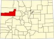 | |
| Towns | ||
| CDPs | ||
| Unincorporated communities |
| |
| ||
Другой контент может иметь иную лицензию. Перед использованием материалов сайта WikiSort.org внимательно изучите правила лицензирования конкретных элементов наполнения сайта.
WikiSort.org - проект по пересортировке и дополнению контента Википедии