world.wikisort.org - USA
The Town of New Castle is a home rule municipality in Garfield County, Colorado, United States. The population was 4,518 at the 2010 census,[8] up from 1,984 at the 2000 census.
New Castle, Colorado | |
|---|---|
Town | |
 Main Street, looking towards the Grand Hogback | |
| Motto: "Authentically Colorado" | |
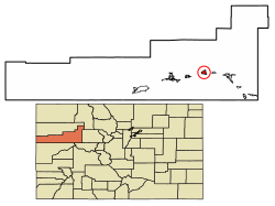 Location of New Castle in Garfield County, Colorado. | |
| Coordinates: 39°34′20″N 107°32′6″W | |
| Country | |
| State | |
| County | Garfield County[1] |
| Incorporated (town) | March 27, 1890[2] |
| Government | |
| • Type | Home rule municipality[1] |
| • Mayor | Art Riddile[3] |
| Area | |
| • Total | 2.61 sq mi (6.75 km2) |
| • Land | 2.52 sq mi (6.52 km2) |
| • Water | 0.09 sq mi (0.23 km2) |
| Elevation | 5,597 ft (1,706 m) |
| Population (2010) | |
| • Total | 4,518 |
| • Estimate (2019)[6] | 5,203 |
| • Density | 2,067.14/sq mi (798.06/km2) |
| Time zone | UTC-7 (Mountain (MST)) |
| • Summer (DST) | UTC-6 (MDT) |
| ZIP code[7] | 81647 |
| Area code | 970 |
| FIPS code | 08-53395 |
| GNIS feature ID | 0204658 |
| Website | www |
History
When New Castle was incorporated in 1888, its economy was largely based on mining coal that was needed by the silver-mining industry to fire silver smelters. On February 18, 1896, a methane explosion in the Vulcan Mine killed 49 men and started a coal fire that was still burning as of 2020. The Vulcan reopened and suffered additional explosions on December 12, 1913 (killing 37) and November 4, 1918 (killing 3).[9]
There are at least 25 coal fires burning near the town.[10] They are normally confined underground, but in 2002 the Coal Seam Fire destroyed thirty houses in New Castle.
From 2000 - 2014 the population grew 129%, much higher than the average growth in Colorado over the same period (20.8%).[11]
Geography
New Castle is located at 39°34′20″N 107°32′6″W (39.572304, -107.534941),[12] on the north side of the Colorado River, just east of where the river cuts through the Grand Hogback. Interstate 70 passes through the town following the river, with access from Exit 105. I-70 leads east 12 miles (19 km) to Glenwood Springs, the county seat, east 169 miles (272 km) to Denver, and west 74 miles (119 km) to Grand Junction. U.S. Route 6 is Main Street in New Castle and forms a parallel route to I-70 for local traffic. US-6 joins I-70 5 miles (8 km) to the east at Chacra and 17 miles (27 km) to the west at a point west of Rifle.
According to the United States Census Bureau, the town has a total area of 2.7 square miles (7.0 km2), of which 2.7 square miles (6.9 km2) is land and 0.04 square miles (0.1 km2), or 1.21%, is water.[8]
Demographics
| Historical population | |||
|---|---|---|---|
| Census | Pop. | %± | |
| 1890 | 311 | — | |
| 1900 | 431 | 38.6% | |
| 1910 | 493 | 14.4% | |
| 1920 | 447 | −9.3% | |
| 1930 | 470 | 5.1% | |
| 1940 | 484 | 3.0% | |
| 1950 | 483 | −0.2% | |
| 1960 | 447 | −7.5% | |
| 1970 | 499 | 11.6% | |
| 1980 | 563 | 12.8% | |
| 1990 | 679 | 20.6% | |
| 2000 | 1,984 | 192.2% | |
| 2010 | 4,518 | 127.7% | |
| 2019 (est.) | 5,203 | [6] | 15.2% |
| U.S. Decennial Census[13] | |||
As of the census[14] of 2000, there were 1,984 people, 705 households, and 537 families residing in the town. The population density was 850.6 inhabitants per square mile (328.4/km2). There were 731 housing units at an average density of 313.4 per square mile (121.0/km2). The racial makeup of the town was 94.61% White, 0.30% African American, 0.55% Native American, 0.35% Asian, 3.28% from other races, and 0.91% from two or more races. Hispanic or Latino of any race were 11.90% of the population.
There were 705 households, out of which 48.8% had children under the age of 18 living with them, 64.7% were married couples living together, 8.1% had a female householder with no husband present, and 23.7% were non-families. 16.7% of all households were made up of individuals, and 2.0% had someone living alone who was 65 years of age or older. The average household size was 2.81 and the average family size was 3.18.
In the town, the population was spread out, with 31.9% under the age of 18, 9.5% from 18 to 24, 38.9% from 25 to 44, 16.4% from 45 to 64, and 3.4% who were 65 years of age or older. The median age was 30 years. For every 100 females, there were 100.0 males. For every 100 females age 18 and over, there were 99.6 males.
The median income for a household in the town was $55,000, and the median income for a family was $58,889. Males had a median income of $39,597 versus $27,933 for females. The per capita income for the town was $21,356. About 2.9% of families and 4.4% of the population were below the poverty line, including 5.1% of those under age 18 and 13.3% of those age 65 or over.
Education
It is within Garfield Re-2 School District.[15] Coal Ridge High School is in New Castle.
See also
- List of municipalities in Colorado
References
- "Active Colorado Municipalities". State of Colorado, Department of Local Affairs. Archived from the original on 2009-12-12. Retrieved 2007-09-01.
- "Colorado Municipal Incorporations". State of Colorado, Department of Personnel & Administration, Colorado State Archives. 2004-12-01. Retrieved 2007-09-02.
- "Town Council". Archived from the original on 2007-09-12. Retrieved 2007-11-26.
- "2019 U.S. Gazetteer Files". United States Census Bureau. Retrieved July 1, 2020.
- "US Board on Geographic Names". United States Geological Survey. 2007-10-25. Retrieved 2008-01-31.
- "Population and Housing Unit Estimates". United States Census Bureau. May 24, 2020. Retrieved May 27, 2020.
- "ZIP Code Lookup". United States Postal Service. Archived from the original (JavaScript/HTML) on January 1, 2008. Retrieved November 26, 2007.
- "Geographic Identifiers: 2010 Demographic Profile Data (G001): New Castle town, Colorado". American Factfinder. U.S. Census Bureau. Retrieved November 16, 2016.[dead link]
- "Vulcan Mine Explosions". 8 February 2021.
- "Vulcan Mine".
- http://www.usa.com/new-castle-co.htm
- "US Gazetteer files: 2010, 2000, and 1990". United States Census Bureau. 2011-02-12. Retrieved 2011-04-23.
- "Census of Population and Housing". Census.gov. Retrieved June 4, 2015.
- "U.S. Census website". United States Census Bureau. Retrieved 2008-01-31.
- "About Garfield Re-2". Garfield Re-2 School District. Retrieved 2020-05-15.
External links
Municipalities and communities of Garfield County, Colorado, United States | ||
|---|---|---|
County seat: Glenwood Springs | ||
| Cities | 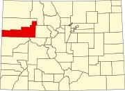 | |
| Towns | ||
| CDPs | ||
| Unincorporated communities |
| |
| ||
Authority control | |
|---|---|
| General | |
| National libraries | |
| Other |
|
Другой контент может иметь иную лицензию. Перед использованием материалов сайта WikiSort.org внимательно изучите правила лицензирования конкретных элементов наполнения сайта.
WikiSort.org - проект по пересортировке и дополнению контента Википедии