world.wikisort.org - USA
Chacra is a census-designated place (CDP) in and governed by Garfield County, Colorado, United States. The CDP is a part of the Glenwood Springs, CO Micropolitan Statistical Area. The population of the Chacra CDP was 329 at the United States Census 2010.[4] The Glenwood Springs post office (Zip Code 81601) serves the area.[3]
Chacra, Colorado | |
|---|---|
Census-designated place | |
 The Colorado River, Interstate 70, and Chacra. | |
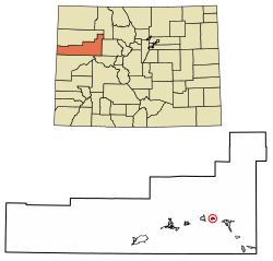 Location of the Chacra CDP in Garfield County, Colorado. | |
 Chacra Location of the Chacra CDP in the United States. | |
| Coordinates: 39°34′37″N 107°27′03″W[1] | |
| Country | |
| State | |
| County | Garfield County |
| Government | |
| • Type | unincorporated community |
| Area | |
| • Total | 0.984 sq mi (2.549 km2) |
| • Land | 0.946 sq mi (2.450 km2) |
| • Water | 0.038 sq mi (0.099 km2) |
| Elevation | 5,732 ft (1,747 m) |
| Population (2010) | |
| • Total | 329 |
| • Density | 348/sq mi (134/km2) |
| Time zone | UTC-7 (MST) |
| • Summer (DST) | UTC-6 (MDT) |
| ZIP Code[3] | Glenwood Springs 81601 |
| Area code | 970 |
| GNIS feature[2] | Chacra CDP |
Geography
Chacra is located on the north side of Colorado River, 8 miles (13 km) west of Glenwood Springs, the county seat. Interstate 70 passes through the community, with access from Exit 109.
The Chacra CDP has an area of 630 acres (2.549 km2), including 24 acres (0.099 km2) of water.[1]
Demographics
| Year | Pop. | ±% |
|---|---|---|
| 2010 | 329 | — |
| 2020 | — | |
| Source: United States Census Bureau | ||
The United States Census Bureau initially defined the Chacra CDP for the United States Census 2010.
See also
- List of census-designated places in Colorado
References
- "State of Colorado Census Designated Places - BAS20 - Data as of January 1, 2020". United States Census Bureau. Retrieved December 22, 2020.
- "U.S. Board on Geographic Names: Domestic Names". United States Geological Survey. Retrieved December 22, 2020.
- "Zip Code 81601 Map and Profile". zipdatamaps.com. 2020. Retrieved December 22, 2020.
- "2010: DEC Summary File 1". United States Census Bureau. Retrieved December 22, 2020.
External links
Wikimedia Commons has media related to Chacara, Colorado.
Municipalities and communities of Garfield County, Colorado, United States | ||
|---|---|---|
County seat: Glenwood Springs | ||
| Cities | 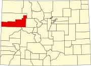 | |
| Towns | ||
| CDPs | ||
| Unincorporated communities |
| |
| ||
Текст в блоке "Читать" взят с сайта "Википедия" и доступен по лицензии Creative Commons Attribution-ShareAlike; в отдельных случаях могут действовать дополнительные условия.
Другой контент может иметь иную лицензию. Перед использованием материалов сайта WikiSort.org внимательно изучите правила лицензирования конкретных элементов наполнения сайта.
Другой контент может иметь иную лицензию. Перед использованием материалов сайта WikiSort.org внимательно изучите правила лицензирования конкретных элементов наполнения сайта.
2019-2026
WikiSort.org - проект по пересортировке и дополнению контента Википедии
WikiSort.org - проект по пересортировке и дополнению контента Википедии