world.wikisort.org - USA
New Princeton is an unincorporated community[1] in Harney County, in the U.S. state of Oregon. It is along Oregon Route 78 between Burns and Burns Junction[2] at an elevation of 4,111 feet (1,253 m) above sea level.[1] The South Fork Malheur River begins near Round Mountain, southeast of New Princeton.[3]
New Princeton, Oregon | |
|---|---|
Unincorporated community | |
 New Princeton Post Office | |
 New Princeton  New Princeton | |
| Coordinates: 43°16′59″N 118°34′58″W | |
| Country | United States |
| State | Oregon |
| County | Harney |
| Elevation | 4,111 ft (1,253 m) |
| Time zone | UTC-8 (PST) |
| • Summer (DST) | UTC-7 (PDT) |
| ZIP code | 97721 |
| Area code(s) | 458 and 541 |
| Coordinates and elevation from United States Geological Survey[1] | |
The Princeton rural post office was established in 1910 or about 1912, depending on the source consulted. When an upgrade of Route 78 bypassed the original community, it was re-located to New Princeton.[4]
Climate
According to the Köppen Climate Classification system, New Princeton has a semi-arid climate, abbreviated "BSk" on climate maps.[5]
References
- "New Princeton". Geographic Names Information System. United States Geological Survey, United States Department of the Interior. November 28, 1980. Retrieved November 2, 2010.
- Oregon Atlas and Gazetteer (Map) (1991 ed.). DeLorme Mapping. § 78. ISBN 0-89933-235-8.
- "United States Topographic Map". United States Geological Survey. Retrieved January 1, 2016 – via Acme Mapper.
- McArthur, Lewis A.; McArthur, Lewis L. (2003) [1928]. Oregon Geographic Names (7th ed.). Portland, Oregon: Oregon Historical Society Press. p. 785. ISBN 978-0875952772.
- Climate Summary for New Princeton, Oregon
Works cited
- McArthur, Lewis A., and McArthur, Lewis L. (2003) [1928]. Oregon Geographic Names, 7th ed. Portland: Oregon Historical Society Press. ISBN 0-87595-277-1.
External links
Municipalities and communities of Harney County, Oregon, United States | ||
|---|---|---|
County seat: Burns | ||
| Cities | 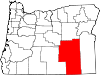 | |
| CDP | ||
| Other communities | ||
| Indian reservation |
| |
| Ghost towns | ||
| Desert |
| |
| ||
This Harney County, Oregon state location article is a stub. You can help Wikipedia by expanding it. |
Текст в блоке "Читать" взят с сайта "Википедия" и доступен по лицензии Creative Commons Attribution-ShareAlike; в отдельных случаях могут действовать дополнительные условия.
Другой контент может иметь иную лицензию. Перед использованием материалов сайта WikiSort.org внимательно изучите правила лицензирования конкретных элементов наполнения сайта.
Другой контент может иметь иную лицензию. Перед использованием материалов сайта WikiSort.org внимательно изучите правила лицензирования конкретных элементов наполнения сайта.
2019-2026
WikiSort.org - проект по пересортировке и дополнению контента Википедии
WikiSort.org - проект по пересортировке и дополнению контента Википедии