world.wikisort.org - USA
Andrews is a ghost town in Harney County, Oregon, United States.[1] It is located south of Steens Mountain and near the Alvord Desert.
Andrews, Oregon | |
|---|---|
Ghost town | |
 Andrews community school in 2007 | |
 Andrews  Andrews | |
| Coordinates: 42°27′51″N 118°36′48″W | |
| Country | United States |
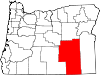
| State | Oregon |
| County | Harney |
| Elevation | 4,157 ft (1,267 m) |
| Population (as of 1996) | |
| • Total | 0 (ghost town) |
| Time zone | Pacific |
History
The community was named for Peter Andrews, who settled in the area about 1880.[2] A post office was established on Andrews' property in 1890.[2] The post office was moved north a short distance in 1900 and called "Wildhorse" or "Wild Horse".[2] Locals referred to it as "Wild Hog", however, so the postmaster changed the name to honor his friend Andrews.[2]
At its peak the community had about 150 residents. However, the population of Andrews slowly declined until only one house remained. When it burned down in 1996, the community became a ghost town.[2][3]
In 2011, artist John Simpkins moved into the abandoned school at Andrews. He set up residence in the teacher's cottage and turned the schoolhouse into his studio. He spent nearly a decade living and working at the school until 2020 when the property owner order him to vacate the buildings.[4][5]
Climate
According to the Köppen Climate Classification system, Andrews has a semi-arid climate, abbreviated "BSk" on climate maps.[6]
See also
- List of ghost towns in Oregon
References
- "Andrews, Oregon". Geographic Names Information System. United States Geological Survey.
- McArthur, Lewis A.; McArthur, Lewis L. (2003) [1928]. Oregon Geographic Names (7th ed.). Portland, Oregon: Oregon Historical Society Press. p. 24. ISBN 978-0875952772.
- Wallace, Kelsey, "Painter John Simpkins Creates Beauty From Solitude", Oregon Public Broadcasting, Portland, Oregon, 30 June 2017.
- Bird, Anna. https://1859oregonmagazine.com/think-oregon/art-culture/artist-john-simpkins Painting Big in the Playa], 1859 (magazine), Statehood Media, Bend, Oregon, 1 July 2016.
- McCurdy, Christen, This Artist Is the Sole Resident of an Oregon Ghost Town. He’s Just Been Told to Leave, Portland Monthly, Portland, Oregon, 18 December 2020.
- Climate Summary for Andrews, Oregon
External links
- Photo of Andrews school by chipsbuttie
- Historic images of Andrews from Salem Public Library
- Andrews listing on ghosttowns.com
Municipalities and communities of Harney County, Oregon, United States | ||
|---|---|---|
County seat: Burns | ||
| Cities |
|  |
| CDP |
| |
| Other communities | ||
| Indian reservation |
| |
| Ghost towns |
| |
| Desert |
| |
| ||
This Harney County, Oregon state location article is a stub. You can help Wikipedia by expanding it. |
This United States ghost town-related article is a stub. You can help Wikipedia by expanding it. |
Другой контент может иметь иную лицензию. Перед использованием материалов сайта WikiSort.org внимательно изучите правила лицензирования конкретных элементов наполнения сайта.
WikiSort.org - проект по пересортировке и дополнению контента Википедии