world.wikisort.org - USA
Leader otherwise known as lLeader area, or LA, is an unincorporated community in Cass County, Minnesota, United States, near Motley. It is along Highway 64 (MN 64) near 76th Street SW.
Leader | |
|---|---|
Unincorporated community | |
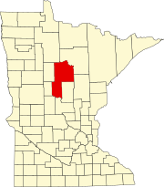
 Leader Location of the community of Leader within Cass County  Leader Leader (the United States) | |
| Coordinates: 46°31′43″N 94°39′18″W | |
| Country | United States |
| State | Minnesota |
| County | Cass |
| Township | Byron Township and Meadow Brook Township |
| Elevation | 1,365 ft (416 m) |
| Time zone | UTC-6 (Central (CST)) |
| • Summer (DST) | UTC-5 (CDT) |
| ZIP code | 56466 |
| Area code(s) | 218 |
| GNIS feature ID | 646556[1] |
Leader is known regionally for its draw to outdoor enthusiasts, including the Snoway 1 trailhead, as well as its relative isolation from the nearest incorporated community.
References
- "Leader, Minnesota". Geographic Names Information System. United States Geological Survey.
Текст в блоке "Читать" взят с сайта "Википедия" и доступен по лицензии Creative Commons Attribution-ShareAlike; в отдельных случаях могут действовать дополнительные условия.
Другой контент может иметь иную лицензию. Перед использованием материалов сайта WikiSort.org внимательно изучите правила лицензирования конкретных элементов наполнения сайта.
Другой контент может иметь иную лицензию. Перед использованием материалов сайта WikiSort.org внимательно изучите правила лицензирования конкретных элементов наполнения сайта.
2019-2025
WikiSort.org - проект по пересортировке и дополнению контента Википедии
WikiSort.org - проект по пересортировке и дополнению контента Википедии
