world.wikisort.org - USA
Federal Dam is a city in Cass County, Minnesota, United States, near Leech Lake. The population was 110 at the 2010 census.[4] It is part of the Brainerd Micropolitan Statistical Area.
Federal Dam | |
|---|---|
City | |
| Motto(s): The Best Little City By A Dam Site" | |
 Location of Federal Dam within Cass County, Minnesota | |
| Coordinates: 47°14′40″N 94°13′3″W | |
| Country | United States |
| State | Minnesota |
| County | Cass |
| Area | |
| • Total | 2.23 sq mi (5.77 km2) |
| • Land | 2.21 sq mi (5.72 km2) |
| • Water | 0.02 sq mi (0.05 km2) |
| Elevation | 1,309 ft (399 m) |
| Population (2020) | |
| • Total | 123 |
| • Density | 55.66/sq mi (21.49/km2) |
| Time zone | UTC-6 (Central (CST)) |
| • Summer (DST) | UTC-5 (CDT) |
| ZIP code | 56641 |
| Area code(s) | 218 |
| FIPS code | 27-20798[2] |
| GNIS feature ID | 0656214[3] |
History
A post office called Federal Dam was established in 1910.[5] The city took its name from a nearby dam constructed by the federal government of the United States.[6]
Geography
According to the United States Census Bureau, the city has a total area of 2.27 square miles (5.88 km2), of which 2.25 square miles (5.83 km2) is land and 0.02 square miles (0.05 km2) is water.[7] County Road 8 serves as a main route in the community. County Roads 4 and 63 are both nearby. The Leech Lake River flows nearby.
Demographics
| Historical population | |||
|---|---|---|---|
| Census | Pop. | %± | |
| 1920 | 332 | — | |
| 1930 | 278 | −16.3% | |
| 1940 | 269 | −3.2% | |
| 1950 | 225 | −16.4% | |
| 1960 | 185 | −17.8% | |
| 1970 | 147 | −20.5% | |
| 1980 | 192 | 30.6% | |
| 1990 | 118 | −38.5% | |
| 2000 | 101 | −14.4% | |
| 2010 | 110 | 8.9% | |
| 2020 | 123 | 11.8% | |
| U.S. Decennial Census[8] | |||
2010 census
As of the census[9] of 2010, there were 110 people, 49 households, and 26 families living in the city. The population density was 48.9 inhabitants per square mile (18.9/km2). There were 137 housing units at an average density of 60.9 per square mile (23.5/km2). The racial makeup of the city was 56.4% White, 23.6% Native American, and 20.0% from two or more races.
There were 49 households, of which 28.6% had children under the age of 18 living with them, 36.7% were married couples living together, 6.1% had a female householder with no husband present, 10.2% had a male householder with no wife present, and 46.9% were non-families. 32.7% of all households were made up of individuals, and 12.3% had someone living alone who was 65 years of age or older. The average household size was 2.24 and the average family size was 2.92.
The median age in the city was 48 years. 23.6% of residents were under the age of 18; 8.2% were between the ages of 18 and 24; 13.6% were from 25 to 44; 38.2% were from 45 to 64; and 16.4% were 65 years of age or older. The gender makeup of the city was 50.0% male and 50.0% female.
2000 census
As of the census[2] of 2000, there were 101 people, 43 households, and 23 families living in the city. The population density was 53.3 people per square mile (20.5/km2). There were 81 housing units at an average density of 42.7 per square mile (16.5/km2). The racial makeup of the city was 71.29% White, 18.81% Native American, 0.99% Asian, and 8.91% from two or more races.
There were 43 households, out of which 23.3% had children under the age of 18 living with them, 39.5% were married couples living together, 11.6% had a female householder with no husband present, and 44.2% were non-families. 41.9% of all households were made up of individuals, and 14.0% had someone living alone who was 65 years of age or older. The average household size was 2.35 and the average family size was 3.29.
In the city, the population was spread out, with 35.6% under the age of 18, 5.0% from 18 to 24, 18.8% from 25 to 44, 20.8% from 45 to 64, and 19.8% who were 65 years of age or older. The median age was 40 years. For every 100 females, there were 98.0 males. For every 100 females age 18 and over, there were 97.0 males.
The median income for a household in the city was $22,917, and the median income for a family was $27,188. Males had a median income of $11,250 versus $21,250 for females. The per capita income for the city was $12,414. There were 18.5% of families and 28.0% of the population living below the poverty line, including 45.7% of under eighteens and 17.2% of those over 64.
References
- "2020 U.S. Gazetteer Files". United States Census Bureau. Retrieved July 24, 2022.
- "U.S. Census website". United States Census Bureau. Retrieved 2008-01-31.
- "US Board on Geographic Names". United States Geological Survey. 2007-10-25. Retrieved 2008-01-31.
- "2010 Census Redistricting Data (Public Law 94-171) Summary File". American FactFinder. U.S. Census Bureau, 2010 Census. Retrieved 23 April 2011.[dead link]
- "Cass County". Jim Forte Postal History. Archived from the original on 13 April 2015. Retrieved 12 April 2015.
- Upham, Warren (1920). Minnesota Geographic Names: Their Origin and Historic Significance. Minnesota Historical Society. p. 89.
- "US Gazetteer files 2010". United States Census Bureau. Archived from the original on January 12, 2012. Retrieved 2012-11-13.
- "Census of Population and Housing". Census.gov. Retrieved June 4, 2015.
- "U.S. Census website". United States Census Bureau. Retrieved 2012-11-13.
External links
Municipalities and communities of Cass County, Minnesota, United States | ||
|---|---|---|
County seat: Walker | ||
| Cities |  | |
| Townships |
| |
| Unorganized territories |
| |
| CDP | ||
| Unincorporated communities | ||
| Indian reservation |
| |
| Ghost town |
| |
| Footnotes | ‡This populated place also has portions in an adjacent county or counties | |
| ||
Cities in the Brainerd Lakes area, Minnesota | |||||
|---|---|---|---|---|---|
| Core City | 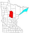 | ||||
| Surrounding communities |
| ||||
| Counties | |||||
† indicates a county seat. ‡ indicates that it is partially in the micropolitan area. § indicates a CDP. | |||||
Authority control | |
|---|---|
| General |
|
| National libraries | |
| Other | |
На других языках
- [en] Federal Dam, Minnesota
[ru] Федерал-Дам (город, Миннесота)
Федерал-Дам (англ. Federal Dam) — город в округе Касс, штат Миннесота, США. На площади 5 км² (4,9 км² — суша, водоёмов нет), согласно переписи 2002 года, проживают 101 человек. Плотность населения составляет 20,6 чел./км².Другой контент может иметь иную лицензию. Перед использованием материалов сайта WikiSort.org внимательно изучите правила лицензирования конкретных элементов наполнения сайта.
WikiSort.org - проект по пересортировке и дополнению контента Википедии