world.wikisort.org - USA
La Salle Township is a civil township of Monroe County in the U.S. state of Michigan. The population was 4,894 at the 2010 census.
La Salle Township, Michigan | |
|---|---|
Civil township | |
 La Salle Township Hall | |
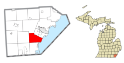 Location within Monroe County | |
 La Salle Township Location within the state of Michigan  La Salle Township Location within the United States | |
| Coordinates: 41°50′39″N 83°27′32″W | |
| Country | United States |
| State | Michigan |
| County | Monroe |
| Established | 1836 |
| Government | |
| • Supervisor | Alan Goldsmith |
| • Clerk | LaDeana Morr |
| Area | |
| • Total | 26.86 sq mi (69.57 km2) |
| • Land | 26.57 sq mi (68.82 km2) |
| • Water | 0.29 sq mi (0.75 km2) |
| Elevation | 604 ft (184 m) |
| Population (2010) | |
| • Total | 4,894 |
| • Density | 184.2/sq mi (71.1/km2) |
| Time zone | UTC-5 (Eastern (EST)) |
| • Summer (DST) | UTC-4 (EDT) |
| ZIP code(s) | |
| Area code | 734 |
| FIPS code | 26-46260[1] |
| GNIS feature ID | 1626593[2] |
| Website | Official website |
Communities
- Grand View is an unincorporated community along the shores of Lake Erie at 41°50′31″N 83°24′10″W.[3]
- La Salle is an unincorporated community centered at 41°52′04″N 83°27′09″W in the northern portion of the township at the intersection of South Dixie Highway (M-125) and LaPlaisance Road–North Otter Creek Road.[4] The community was first settled as early as 1831. A post office operated briefly from April 1832 to December 5, 1833. The post office was reestablished on May 21, 1834 and remains in operation.[5] The La Salle 48145 ZIP Code serves most of the township.
- North Shores is an unincorporated community along Lake Erie just south of Grand View at 41°50′11″N 83°24′27″W.[6]
- Toledo Beach is a former community located along the shores of Lake Erie just south of North Shores. It was settled as a summer resort and also had a station along the Toledo, O.B. & N. Railroad. Previously, the area was called the Ottawa Beach Resort until it was purchased by the Toledo Rail Light and Power Company, and the 400-acre (1.62 km2) Toledo Beach Amusement Park was built in 1907. A post office began operating on May 29, 1915.[7] The amusement park prospered and was accessible by a trolley line from Toledo, Ohio. By 1950, the park contained many attractions, a dance hall, train rides, and numerous other amenities. Financial hardships forced the closure and selling of the park, in which it was demolished and replaced with the Toledo Beach Marina in 1962.[8]
- Winchester is a former settlement located in the township at the mouth of Otter Creek at Lake Erie. It may have been named after James Winchester, who was a general whose militia protected the area during the War of 1812.[9] The community and post office can be seen on a historic 1876 map of La Salle Township.[10]
Geography
According to the U.S. Census Bureau, the township has a total area of 26.86 square miles (69.57 km2), of which 26.57 square miles (68.82 km2) is land and 0.29 square miles (0.75 km2) (1.08%) is water.[11]
Major highways
 I-75 runs south–north through the eastern section of township and has one access point along Otter Creek Road (exit 9).
 US 24 (Telegraph Road) runs south–north through the center of the township.
 M-125 (S. Dixie Highway) runs parallel along US 24.
 US 25 is a former U.S. highway from 1926–1973 that is now replaced with M-125.
Demographics
As of the census[1] of 2000, there were 5,001 people, 1,765 households, and 1,440 families residing in the township. The population density was 187.7 per square mile (72.5/km2). There were 1,852 housing units at an average density of 69.5 per square mile (26.8/km2). The racial makeup of the township was 97.96% White, 0.36% African American, 0.40% Native American, 0.26% Asian, 0.28% from other races, and 0.74% from two or more races. Hispanic or Latino of any race were 2.32% of the population.
There were 1,765 households, out of which 35.6% had children under the age of 18 living with them, 72.2% were married couples living together, 6.3% had a female householder with no husband present, and 18.4% were non-families. 14.9% of all households were made up of individuals, and 5.9% had someone living alone who was 65 years of age or older. The average household size was 2.83 and the average family size was 3.16.
In the township the population was spread out, with 25.4% under the age of 18, 7.7% from 18 to 24, 29.2% from 25 to 44, 27.4% from 45 to 64, and 10.2% who were 65 years of age or older. The median age was 38 years. For every 100 females, there were 106.5 males. For every 100 females age 18 and over, there were 103.1 males.
The median income for a household in the township was $63,693, and the median income for a family was $69,000. Males had a median income of $51,884 versus $30,875 for females. The per capita income for the township was $24,237. About 2.6% of families and 3.6% of the population were below the poverty line, including 2.6% of those under age 18 and 6.2% of those age 65 or over.
Education
La Salle Township is served by three separate public school districts. The northern portion is served by Monroe Public Schools. The southern portion is served by Mason Consolidated Schools, and small sections along the western border are served by Ida Public Schools.[12]
Images
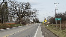 Community of La Salle along M-125
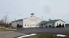 La Salle Township Fire Department
 U.S. Post Office in La Salle


References
- "U.S. Census website". United States Census Bureau. Retrieved 2008-01-31.
- U.S. Geological Survey Geographic Names Information System: La Salle Township, Michigan
- U.S. Geological Survey Geographic Names Information System: Grand View, Michigan
- U.S. Geological Survey Geographic Names Information System: La Salle, Michigan
- Romig 1986, p. 320.
- U.S. Geological Survey Geographic Names Information System: North Shores, Michigan
- Romig 1986, p. 556–557.
- Eby, David (19 October 2020). "History of Toledo Beach Amusement Park". The Monroe News. Retrieved October 10, 2022.
- Romig 1986, p. 607.
- Historic Map Works, LLC. (2022). "Lasalle Township, Winchester P.O." Retrieved October 19, 2022.
- "Michigan: 2010 Population and Housing Unit Counts 2010 Census of Population and Housing" (PDF). 2010 United States Census. United States Census Bureau. September 2012. p. 34 Michigan. Retrieved July 22, 2020.
- Michigan Geographic Framework (15 November 2013). "Monroe County School Districts" (PDF). Retrieved August 28, 2022.
Sources
- Romig, Walter (October 1, 1986) [1973]. Michigan Place Names: The History of the Founding and the Naming of More Than Five Thousand Past and Present Michigan Communities. Great Lakes Books Series (Paperback). Detroit, Michigan: Wayne State University Press. pp. 320, 556–557, 607. ISBN 978-0-8143-1838-6.
Places adjacent to La Salle Township, Michigan | |
|---|---|
Municipalities and communities of Monroe County, Michigan, United States | ||
|---|---|---|
County seat: Monroe | ||
| Cities |  | |
| Villages | ||
| Charter townships | ||
| Civil townships | ||
| CDPs | ||
| Other unincorporated communities |
| |
| Ghost towns |
| |
| Footnotes | ‡This populated place also has portions in an adjacent county or counties | |
| ||
Authority control | |
|---|---|
| General | |
| National libraries | |
Другой контент может иметь иную лицензию. Перед использованием материалов сайта WikiSort.org внимательно изучите правила лицензирования конкретных элементов наполнения сайта.
WikiSort.org - проект по пересортировке и дополнению контента Википедии