world.wikisort.org - USA
Exeter Township is a civil township of Monroe County in the U.S. state of Michigan. The population was 3,968 at the 2010 census.[4]
Exeter Township, Michigan | |
|---|---|
Civil township | |
 Exeter Township Hall in Scofield | |
 Location within Monroe County (red) and the administered village of Maybee (pink) | |
 Exeter Township Location within the state of Michigan  Exeter Township Location within the United States | |
| Coordinates: 42°02′06″N 83°28′42″W | |
| Country | United States |
| State | Michigan |
| County | Monroe |
| Organized | 1836 |
| Government | |
| • Supervisor | Bob Queen |
| • Clerk | Christina Bogoski |
| Area | |
| • Total | 36.64 sq mi (94.90 km2) |
| • Land | 36.53 sq mi (94.61 km2) |
| • Water | 0.11 sq mi (0.28 km2) |
| Elevation | 633 ft (193 m) |
| Population (2010) | |
| • Total | 3,968 |
| • Density | 108.6/sq mi (41.9/km2) |
| Time zone | UTC-5 (Eastern (EST)) |
| • Summer (DST) | UTC-4 (EDT) |
| ZIP code(s) | |
| Area code | 734 |
| FIPS code | 26-26880[1] |
| GNIS feature ID | 1626261[2] |
| Website | Official website |
| Exeter Township Hall | |
|---|---|
 | |
| Location | Southwest corner of Sumpter Road and Grant Street |
| Coordinates | 42.0230°N 83.4798°W |
| Built | 1890 |
Michigan State Historic Site | |
| Designated | September 3, 1998[3] |
Communities
- East Exeter is a former settlement within the township that briefly had its own post office from March 14, 1850 until October 2, 1851.[5]
- Exeter is a historic community located at 42°02′48″N 83°29′58″W.[6] Exeter contained its own post office from July 6, 1840 to June 28, 1842 and again from March 14, 1850 to September 14, 1903.[7]
- Maybee is a village in the southwestern portion of the township at 42°00′14″N 83°30′56″W.[8] Maybee has its own post office with the 48159 ZIP Code, which serves the village and portions of Exeter Township, as well as portions of several nearby townships.[9]
- Scofield is an unincorporated community located northeast of Maybee at 42°01′17″N 83°28′55″W.[10]
Geography
According to the United States Census Bureau, the township has a total area of 36.64 square miles (94.90 km2), of which 36.53 square miles (94.61 km2) is land and 0.11 square miles (0.28 km2) (0.30%) is water.[4]
Demographics
As of the census[1] of 2000, there were 3,727 people, 1,262 households, and 1,004 families residing in the township. The population density was 102.0 per square mile (39.4/km2). There were 1,307 housing units at an average density of 35.8 per square mile (13.8/km2). The racial makeup of the township was 91.82% White, 6.14% African American, 0.30% Native American, 0.38% Asian, 0.03% Pacific Islander, 0.40% from other races, and 0.94% from two or more races. Hispanic or Latino of any race were 0.94% of the population.
There were 1,262 households, out of which 37.1% had children under the age of 18 living with them, 68.8% were married couples living together, 6.7% had a female householder with no husband present, and 20.4% were non-families. 16.2% of all households were made up of individuals, and 5.6% had someone living alone who was 65 years of age or older. The average household size was 2.95 and the average family size was 3.33.
In the township the population was spread out, with 27.7% under the age of 18, 8.1% from 18 to 24, 31.1% from 25 to 44, 23.5% from 45 to 64, and 9.6% who were 65 years of age or older. The median age was 36 years. For every 100 females, there were 104.7 males. For every 100 females age 18 and over, there were 105.8 males.
The median income for a household in the township was $63,806, and the median income for a family was $69,429. Males had a median income of $50,718 versus $26,818 for females. The per capita income for the township was $24,308. About 2.7% of families and 4.8% of the population were below the poverty line, including 8.1% of those under age 18 and 5.0% of those age 65 or over.
Education
Exeter Township is served by four school districts. The majority of the township is served by Airport Community Schools. The southeastern portion of the township is served by Monroe Public Schools, which also includes the majority of the village of Maybee. The southwestern corner of the township, including a small western portion of the village of Maybee, is served by Dundee Community Schools. The northwestern portion of the township is served by Milan Area Schools.[11]
Notable people
- Lewis Welch (1814–1878), Michigan state senator[12]
Images
 Unincorporated community of Scofield
 McGowan School, built c. 1860
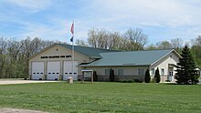 Volunteer fire department


References
- "U.S. Census website". United States Census Bureau. Retrieved 2008-01-31.
- U.S. Geological Survey Geographic Names Information System: Exeter Township, Michigan
- State of Michigan (2009). "Exeter Township Hall". Archived from the original on May 11, 2012. Retrieved August 2, 2010.
- "Michigan: 2010 Population and Housing Unit Counts 2010 Census of Population and Housing" (PDF). 2010 United States Census. United States Census Bureau. September 2012. p. 34 Michigan. Retrieved July 22, 2020.
- Romig 1986, p. 169.
- U.S. Geological Survey Geographic Names Information System: Exeter (historical)
- Romig 1986, p. 189.
- U.S. Geological Survey Geographic Names Information System: Maybee, Michigan
- Google (May 1, 2021). "48159 ZIP Code map" (Map). Google Maps. Google. Retrieved May 1, 2021.
- U.S. Geological Survey Geographic Names Information System: Scofield
- Michigan Geographic Framework (15 November 2013). "Monroe County School Districts" (PDF). Retrieved April 28, 2021.
- "Legislator Details - Lewis Welch". Library of Michigan. Retrieved May 18, 2020.
Sources
- Romig, Walter (October 1, 1986) [1973]. Michigan Place Names: The History of the Founding and the Naming of More Than Five Thousand Past and Present Michigan Communities. Great Lakes Books Series (Paperback). Detroit, Michigan: Wayne State University Press. pp. 169, 189. ISBN 978-0-8143-1838-6.
Municipalities and communities of Monroe County, Michigan, United States | ||
|---|---|---|
County seat: Monroe | ||
| Cities |  | |
| Villages |
| |
| Charter townships | ||
| Civil townships | ||
| CDPs |
| |
| Other unincorporated communities |
| |
| Ghost towns |
| |
| Footnotes | ‡This populated place also has portions in an adjacent county or counties | |
| ||
Другой контент может иметь иную лицензию. Перед использованием материалов сайта WikiSort.org внимательно изучите правила лицензирования конкретных элементов наполнения сайта.
WikiSort.org - проект по пересортировке и дополнению контента Википедии