world.wikisort.org - USA
Dundee is a village in Monroe County in the U.S. state of Michigan. The population was 5,323 at the 2020 census. The village is within Dundee Township and is served by Dundee Community Schools.
Dundee, Michigan | |
|---|---|
Village | |
| Village of Dundee | |
 Dundee Historic District along M-50 | |
 Location within Monroe County | |
 Dundee Location within the state of Michigan  Dundee Location within the United States | |
| Coordinates: 41°57′26″N 83°39′35″W | |
| Country | United States |
| State | Michigan |
| County | Monroe |
| Township | Dundee |
| Settled | 1823 |
| Incorporated | 1855 |
| Government | |
| • Type | Village council |
| • President | Andrea Hickey |
| • Clerk | Shirley Massingill |
| Area | |
| • Total | 5.28 sq mi (13.68 km2) |
| • Land | 5.24 sq mi (13.57 km2) |
| • Water | 0.04 sq mi (0.10 km2) |
| Elevation | 666 ft (203 m) |
| Population (2020) | |
| • Total | 5,323 |
| • Density | 1,015.26/sq mi (392.01/km2) |
| Time zone | UTC-5 (Eastern (EST)) |
| • Summer (DST) | UTC-4 (EDT) |
| ZIP code(s) | 48131 |
| Area code | 734 |
| FIPS code | 26-23380[3] |
| GNIS feature ID | 0624990[4] |
| Website | Official website |
Settled as early as 1823, Dundee was incorporated as a village in 1855.[5] The downtown Dundee Historic District is listed on the National Register of Historic Places, which also includes the Old Mill Museum and the Macon Reservation of the River Raisin National Battlefield Park. The village is nicknamed the "Hub of the Highways" due to the intersection of major historic thoroughfares at the village's center (specifically present-day M-50 and U.S. Route 23).
Geography
According to the U.S. Census Bureau, the village has a total area of 5.28 square miles (13.68 km2), of which 5.24 square miles (13.57 km2) is land and 0.04 square miles (0.10 km2) (0.76%) is water.[2] Dundee is the largest village by land area in the state of Michigan.
Major highways
 US 23
US 23 M-50
M-50
Demographics
| Historical population | |||
|---|---|---|---|
| Census | Pop. | %± | |
| 1880 | 932 | — | |
| 1890 | 1,166 | 25.1% | |
| 1900 | 1,118 | −4.1% | |
| 1910 | 1,070 | −4.3% | |
| 1920 | 1,108 | 3.6% | |
| 1930 | 1,364 | 23.1% | |
| 1940 | 1,699 | 24.6% | |
| 1950 | 1,975 | 16.2% | |
| 1960 | 2,377 | 20.4% | |
| 1970 | 2,472 | 4.0% | |
| 1980 | 2,575 | 4.2% | |
| 1990 | 2,664 | 3.5% | |
| 2000 | 3,522 | 32.2% | |
| 2010 | 3,957 | 12.4% | |
| 2020 | 5,323 | 34.5% | |
| source:[6] | |||
2010 census
As of the census[7] of 2010, there were 3,957 people, 1,539 households, and 1,035 families living in the village. The population density was 655.1 inhabitants per square mile (252.9/km2). There were 1,742 housing units at an average density of 288.4 per square mile (111.4/km2). The racial makeup of the village was 96.5% White, 0.9% African American, 0.4% Native American, 0.5% Asian, 0.5% from other races, and 1.2% from two or more races. Hispanic or Latino of any race were 2.6% of the population.
There were 1,539 households, of which 36.5% had children under the age of 18 living with them, 50.5% were married couples living together, 12.7% had a female householder with no husband present, 4.0% had a male householder with no wife present, and 32.7% were non-families. 27.5% of all households were made up of individuals, and 11.1% had someone living alone who was 65 years of age or older. The average household size was 2.55 and the average family size was 3.14.
The median age in the village was 34.3 years. 27% of residents were under the age of 18; 8% were between the ages of 18 and 24; 30.1% were from 25 to 44; 23.9% were from 45 to 64; and 11.2% were 65 years of age or older. The gender makeup of the village was 48.1% male and 51.9% female.
2000 census
As of the census[3] of 2000, there were 3,522 people, 1,389 households, and 913 families living in the village. The population density was 1,091.5 per square mile (421.0/km2). There were 1,477 housing units at an average density of 457.7 per square mile (176.6/km2). The racial makeup of the village was 96.91% White, 0.65% African American, 0.40% Native American, 0.40% Asian, 0.23% from other races, and 1.42% from two or more races. Hispanic or Latino of any race were 1.19% of the population.
There were 1,389 households, out of which 35.3% had children under the age of 18 living with them, 47.6% were married couples living together, 12.7% had a female householder with no husband present, and 34.2% were non-families. 28.5% of all households were made up of individuals, and 11.4% had someone living alone who was 65 years of age or older. The average household size was 2.53 and the average family size was 3.10.
In the village, the age distribution of the population was as follows: 28.9% were under the age of 18, 10.9% from 18 to 24, 32.2% from 25 to 44, 17.7% from 45 to 64, and 10.2% who were 65 years of age or older. The median age was 31 years. For every 100 females, there were 93.6 males. For every 100 females age 18 and over, there were 90.8 males.
The median income for a household in the village was $41,563, and the median income for a family was $49,479. Males had a median income of $40,612 versus $24,908 for females. The per capita income for the village was $18,389. About 5.5% of families and 9.0% of the population were below the poverty line, including 11.0% of those under age 18 and 2.6% of those age 65 or over.
Notable people
- Catharine Hitchcock Tilden Avery, author and educator who was born in Dundee
- Joel Dean, founder of Dean & DeLuca.
Gallery
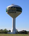 Municipal water tower constructed in 1999
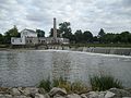 Old Mill Museum in 2008
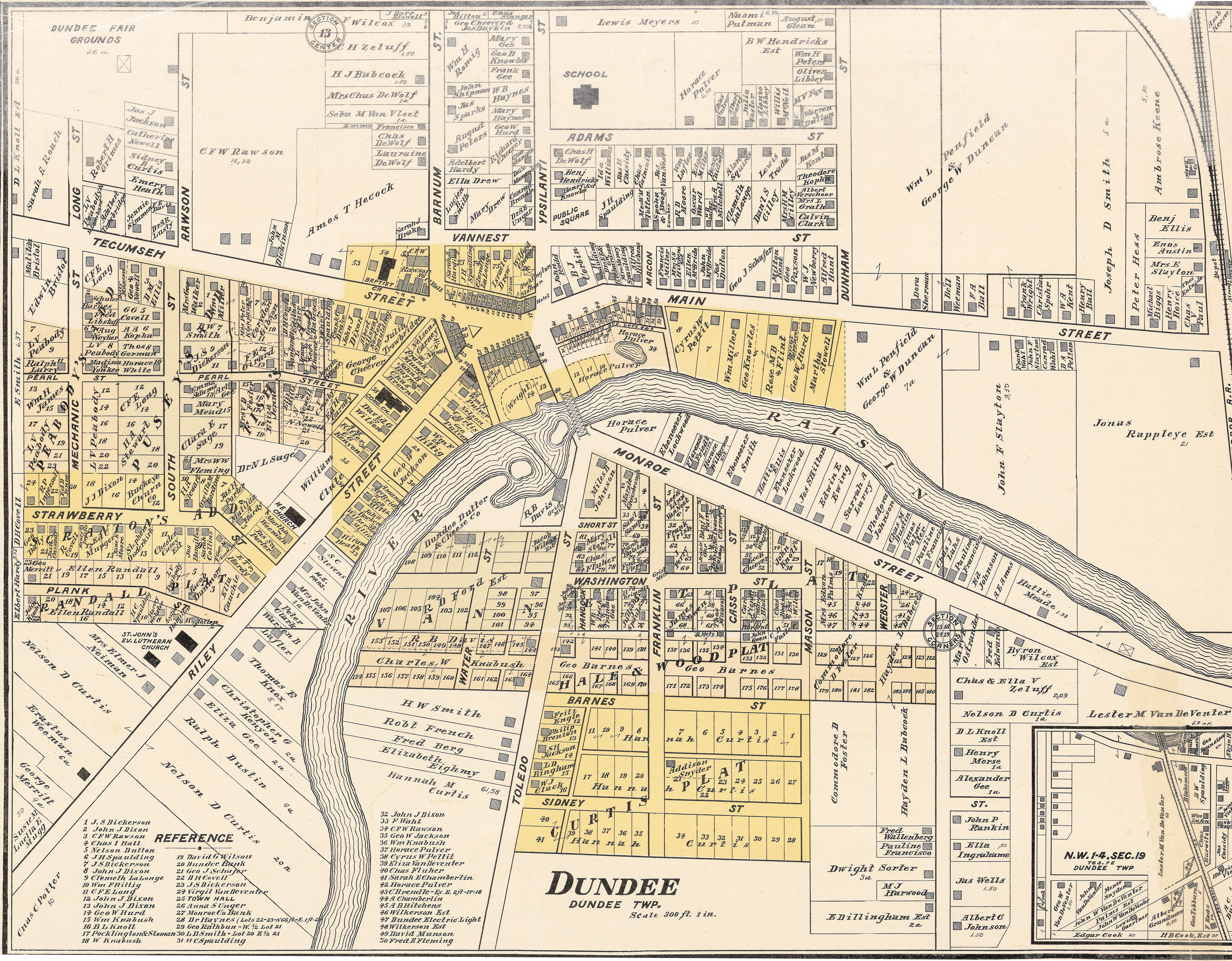
 1901 map of Dundee


References
- Village of Dundee (2020). "Village Council". Retrieved April 8, 2020.
- "2020 U.S. Gazetteer Files". United States Census Bureau. Retrieved May 21, 2022.
- "U.S. Census website". United States Census Bureau. Retrieved 2008-01-31.
- "US Board on Geographic Names". United States Geological Survey. 2007-10-25. Retrieved 2008-01-31.
- Romig, Walter (October 1, 1986) [1973]. Michigan Place Names: The History of the Founding and the Naming of More Than Five Thousand Past and Present Michigan Communities. Great Lakes Books Series (Paperback). Detroit, Michigan: Wayne State University Press. p. 165. ISBN 978-0-8143-1838-6.
- "Census of Population and Housing". United States Census Bureau. Retrieved 2014-01-19.
- "U.S. Census website". United States Census Bureau. Retrieved 2012-11-25.
External links
Municipalities and communities of Monroe County, Michigan, United States | ||
|---|---|---|
County seat: Monroe | ||
| Cities |  | |
| Villages | ||
| Charter townships | ||
| Civil townships | ||
| CDPs | ||
| Other unincorporated communities |
| |
| Ghost towns |
| |
| Footnotes | ‡This populated place also has portions in an adjacent county or counties | |
| ||
Authority control | |
|---|---|
| General |
|
| National libraries | |
Другой контент может иметь иную лицензию. Перед использованием материалов сайта WikiSort.org внимательно изучите правила лицензирования конкретных элементов наполнения сайта.
WikiSort.org - проект по пересортировке и дополнению контента Википедии