world.wikisort.org - USA
Kenmore is a city in King County, Washington, United States, along the northernmost shore of Lake Washington. It is a suburban commuter town at the mouth of the Sammamish River, 12 miles (19 km) northeast of downtown Seattle and 2 miles (3.2 km) west of Bothell. The population was 20,460 at the 2010 census. Kenmore Air Harbor is the largest seaplane-only passenger facility of its kind in the United States.[6]
City of Kenmore | |
|---|---|
City | |
 | |
 Flag | |
 | |
| Coordinates: 47°45′10″N 122°14′50″W | |
| Country | United States |
| State | Washington |
| County | King |
| Incorporated | August 31, 1998 |
| Government | |
| • Type | Council–manager[1] |
| • Mayor | Nigel Herbig[1] |
| Area | |
| • Total | 7.22 sq mi (18.69 km2) |
| • Land | 6.15 sq mi (15.92 km2) |
| • Water | 1.07 sq mi (2.77 km2) |
| Elevation | 30 ft (9 m) |
| Population (2010)[3] | |
| • Total | 20,460 |
| • Estimate (2019)[4] | 23,097 |
| • Density | 3,756.22/sq mi (1,450.40/km2) |
| Time zone | UTC-8 (PST) |
| • Summer (DST) | UTC-7 (PDT) |
| ZIP code | 98028 |
| Area code | 425 |
| FIPS code | 53-35170 |
| GNIS feature ID | 1512345[5] |
| Website | kenmorewa.gov |
Kenmore is connected to nearby areas by State Route 522 and the Burke-Gilman Trail, which both run east–west along the lakeshore. The city limits stretch north to the Snohomish County line and south to a border with Kirkland south of Saint Edward State Park and Bastyr University. Kenmore's official flower is the dahlia, bird the great blue heron, and evergreen the rhododendron.
History
Founded in 1901, Kenmore's name comes third-hand from the Scottish village of Kenmore, via town founder home town of Kenmore, Ontario. John McMasters and his wife Annie arrived in Puget Sound circa 1889 from Canada, intending to establish themselves in the shingle-making trade. They opened a shingle mill on the northern shore of Lake Washington on land leased from Watson C. Squire. By 1903, Kenmore had established a school system and post office,[7] but it did not formally incorporate as a city until August 31, 1998.[8]
Early 20th century
Despite cargo railway service passing through the area as early as 1887 via the Seattle, Lake Shore and Eastern Railway, most access to the city in its early days was by boat, with regular ferry service to Seattle, Bothell, and Woodinville starting in 1906. The city later gained a passenger railroad stop. The first improved road connection to Seattle and Bothell—the Red Brick Road—opened between 1913 and 1914, with bus service following the laying of the bricks. As a result, Kenmore became a country retreat for weekend gardeners with local landowners selling off clear-cut "garden plots" to Seattlites with automobiles and green thumbs. It attracted at least two short-lived nudist camps during the 1920s.
Far more striking, however, was the impact of Prohibition. Kenmore quickly became famous in Seattle for its fine country dining and, more importantly, its fine country drinking, as a substantial illegal alcohol industry developed to meet the demands of Jazz Age Seattle nightlife. Although relatively close to Seattle proper thanks to Bothell Way's status as one of the few improved roads then heading north from downtown it was nonetheless far enough out that Department of Revenue officers could, for the most part, ignore it.
The Blind Pig, a roadhouse on Shuter's Landing at Lake Washington, was probably the most famous of the Kenmore speakeasys. At the lakeside, its illegal hooch could be dumped into the lake quickly and easily should it become necessary. Few people were fooled; the name itself was, in fact, a well-known slang term meaning "speakeasy". But despite its notoriety, the Pig was not even the city's most infamous saloon. Routine violence and fist-fights at the Inglewood Tavern earned that establishment an alternative name: the Bucket of Blood.
This archipelago of dining and entertainment - over 30 different restaurants, dance halls, bars, and clubs in a three-block area - remained a major part of Kenmore's identity through the 1940s.
Post-war redevelopment
Once the Great Depression hit, Kenmore became home for a small settlement of workers under President Franklin D. Roosevelt's Back to the Land program. Paid by the Works Progress Administration, a small number of workers settled in an area of northwestern Kenmore which became known as "Voucherville", after the vouchers the WPA paid in lieu of a cash salary.
After the end of World War II, Kenmore became home to US Army Nike Hercules missile batteries as part of cold-war era defense plans. These nuclear-tipped anti-aircraft missiles were intended to protect Seattle and environs from Soviet bombers, should war break out. They were removed in 1974.[9]
The post-war era largely transformed downtown. Kenmore Air Harbor, which today is one of the world's largest seaplane-only airports, opened not far from the old location of the Blind Pig; Kenmore Air itself today runs a fleet of seaplanes serving waterside destinations throughout Cascadia. At the same time, Kenmore's immediate proximity to Seattle—just two miles (3 km) north of modern Seattle city limits— made it an early target of post-war housing development. The first plats in the new Uplake neighborhood were sold in 1954. Housing development continued throughout the Kenmore area for the next several decades, mostly following the postwar suburban model; industrial and commercial growth followed quickly behind, and within a few decades, most of the old Kenmore dining and drinking had vanished, replaced by shopping centers, industrial development, and housing. However, one part of this new development brought its own history along with it: the Jewel Box Building in downtown Kenmore is a Seattle World's Fair artifact, moved from Seattle Center to Kenmore after the end of the fair in October, 1962.
The city gained its first college in 1996, with the relocation of Bastyr University from Seattle onto the grounds of the former St. Edward Seminary.
Incorporation and downtown revitalization
Kenmore residents considered incorporation many times since the town's founding; one such incorporation vote failed in 1954.[10] The idea gained popular support through the 1990s, however, partly in response to the passage of the Washington State Growth Management Act of 1990. Formation of an exploration committee in 1995 led to a successful public vote shortly thereafter, and the city formally incorporated on August 31, 1998, 97 years after its original founding.
Following incorporation, the new government set about devising a local set of zoning codes and a downtown development plan with the intent of reviving and rebuilding the traditional core areas of the city. A significant component of this plan involves extensive use of land now owned by the city, in the area known within the plan as the Northwest Quadrant. An open invitation was extended to all architects and developers to submit development plans for this newly available area in December, 2005. The City Council chose to negotiate primarily with Kenmore Partners LLC in April 2006. Design plans were submitted to the city the following summer, with a conceptual overview made available to the public at the same time.[11]
Kenmore's oldest roads, now known most often by their county-assigned number systems, originally had more traditional names such as Cat's Whiskers Road (61st Avenue NE), Squire Boulevard (later Red Brick Road, now Bothell Way/SR 522), and Remington Drive (NE 181st Street). These traditional names were reinstated in 2007 as secondary names in the downtown area.[12]
Geography
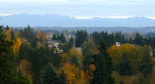
Kenmore is located at 47°45′10″N 122°14′50″W (47.752870, -122.247360),[13] with borders encompassing all of the north shore and a significant portion of the northeastern shore of Lake Washington. The local terrain is typical of the Puget Sound lowlands, consisting largely of rolling hills formed from glacial till, occasionally interrupted by flatlands typically found near substantial bodies of water. The largest river is the Sammamish, which connects Lake Sammamish to Lake Washington, and divides the city into northern and southern halves. Additionally, the northeastern corner of the city includes a narrow set of swamps and marshlands running north to south along Swamp Creek.
According to the United States Census Bureau, the city has a total area of 6.26 square miles (16.21 km2), of which, 6.15 square miles (15.93 km2) is land and 0.11 square miles (0.28 km2) is water.[14]
Surrounding cities & lake
Places adjacent to Kenmore, Washington | |
|---|---|
Climate
The climate of Kenmore is substantially similar to that of nearby Seattle, being defined principally by its latitude, proximity to the Pacific Ocean and Puget Sound, and inclusion in the Puget Sound Convergence Zone. As such, it is usually considered Marine west coast in nature, with damp, cool winters, and mild, dry summers, despite being further north than cities such as Toronto, Ontario and Montreal, Quebec.
Neighborhoods
Kenmore has several distinct neighborhoods. These include:

- Arrowhead, in southern Kenmore, on the west (or lake) side, saw its first house built in 1888. This was a small summer cabin; the oldest house still standing dates from 1929.
- Inglewood, in southern Kenmore, was first platted in 1953, with large-scale suburban development appearing by 1962.
- Lower Moorlands, in eastern Kenmore, saw its first house in 1904. The significant development occurring in this area after World War I included the 1927 landmark Charles and Elvera Thomsen House.[15]
- Upper Moorlands, also in eastern Kenmore, saw initial building in 1938-1939 but stayed quite rural due to the lack of a good water system until suburban development arrived in the mid-1950s.
- Central (or downtown) Kenmore hugs Bothell Way and formed the original core of the city. Today it is Kenmore's commercial and industrial core.
- Northlake Terrace, an early residential neighborhood just north of town, is now a mix of commercial and residential development. Much of the eastern portion of this area is to be redeveloped as part of the new Downtown Plan.
- Linwood Heights, in northwest Kenmore, was first founded as part of the "Back to the Land" movement during the Great Depression. Then derisively referred to as Voucherville, it has long since been redeveloped and is now largely suburban housing. Portions were annexed by Lake Forest Park in 1995, predating Kenmore's formal incorporation.
- Kenlake Vista, in northern Kenmore, is post-war residential suburban housing.
- Uplake Terrace, a suburban neighborhood developed started in 1953.[16]
- Kenmore Terrace
- Northshore Summit
Demographics
| Historical population | |||
|---|---|---|---|
| Census | Pop. | %± | |
| 1980 | 7,281 | — | |
| 1990 | 8,917 | 22.5% | |
| 2000 | 18,678 | 109.5% | |
| 2010 | 20,460 | 9.5% | |
| 2020 | 23,914 | 16.9% | |
| 2021 (est.) | 23,502 | [17] | −1.7% |
| U.S. Decennial Census[18] 2018 Estimate[19] | |||
In 2015 the median income for a household in the city was $90,588, and the median income for a family was $102,374. Males had a median income of $76,688 versus $58,281 for females. The per capita income for the city was $40,192. About 5.5% of families and 8.6% of the population were below the poverty line, including 10.4% of those under age 18 and 7.5% of those age 65 or over.[3]
2010 census
As of the census of 2010, there were 20,460 people, 7,984 households, and 5,487 families residing in the city. The population density was 3,326.8 inhabitants per square mile (1,284.5/km2). There were 8,569 housing units at an average density of 1,393.3 per square mile (538.0/km2). The racial makeup of the city was 79.9% White, 1.6% African American, 0.5% Native American, 10.5% Asian, 0.3% Pacific Islander, 2.5% from other races, and 4.5% from two or more races. Hispanic or Latino of any race were 7.0% of the population.
There were 7,984 households, of which 33.5% had children under the age of 18 living with them, 55.3% were married couples living together, 9.1% had a female householder with no husband present, 4.3% had a male householder with no wife present, and 31.3% were non-families. 23.4% of all households were made up of individuals, and 7.9% had someone living alone who was 65 years of age or older. The average household size was 2.55 and the average family size was 3.01.
The median age in the city was 39.5 years. 22.8% of residents were under the age of 18; 7.5% were between the ages of 18 and 24; 28.2% were from 25 to 44; 29.6% were from 45 to 64; and 11.9% were 65 years of age or older. The gender makeup of the city was 49.6% male and 50.4% female.
2000 census
As of the census of 2000, there were 18,678 people, 7,307 households, and 4,961 families residing in the city. The population density was 3,028.7 people per square mile (1,168.8/km2). There were 7,562 housing units at an average density of 1,226.2 per square mile (473.2/km2). The racial makeup of the city was 86.70% White, 1.39% African American, 0.37% Native American, 7.16% Asian, 0.18% Pacific Islander, 1.24% from other races, and 2.96% from two or more races. Hispanic or Latino of any race were 3.51% of the population.
There were 7,307 households, out of which 33.5% had children under the age of 18 living with them, 56.1% were married couples living together, 8.2% had a female householder with no husband present, and 32.1% were non-families. 24.1% of all households were made up of individuals, and 6.9% had someone living alone who was 65 years of age or older. The average household size was 2.54 and the average family size was 3.03.
In the city the population was spread out, with 24.5% under the age of 18, 7.5% from 18 to 24, 31.9% from 25 to 44, 25.8% from 45 to 64, and 10.3% who were 65 years of age or older. The median age was 38 years. For every 100 females, there were 98.7 males. For every 100 females age 18 and over, there were 96.7 males.
Economy
This section needs additional citations for verification. (July 2010) |


While in large part now a bedroom community for workers commuting to nearby Seattle, Bothell, and Redmond, Kenmore retains a significant independent economic core centered around durable goods (construction materials, concrete, asphalt) and special trade contracting (construction, heavy construction, and highways).[citation needed]
Kenmore also hosts one of the last industrial ports on Lake Washington, at the mouth of the Sammamish River. Larger local businesses near the port include Rinker Materials's Kenmore plant, Kenmore Ready-Mix (cements and asphalts, a division of Glacier Northwest), Pacific Topsoils (topsoils and landscape construction materials), Michael Homchick Stoneworks (stone fabrication and installation), Plywood Supply (lumber, plywood, and millwork, wholesale, retail, and company headquarters), and several others. As home to the James G. Murphy Company, one of the ten largest commercial/industrial auction houses in the United States, the city is also an auction center.[20]
Significant non-durable-goods businesses include the headquarters of Kenmore Air, a large private seaplane-based airline;[21] Alaska General Seafoods's company headquarters and processing plant; Bastyr University, a school of naturopathic medicine.
Education
Kenmore is part of the Northshore School District,[22] and the local high school is Inglemoor High School. Inglemoor High School is known for its IB program. The nonprofit group Saint Edward Environmental Learning Center provides quarterly environmental education classes to the public in conjunction with Washington State Parks and Saint Edward State Park. They also operate the ALEAFA Model Public High School. The Kenmore Library Association, a volunteer group affiliated with the local library, plans and sponsors library programming.
There is a portion of Kenmore extending into the Lake Washington School District, but it consists of portions of the Saint Edward State Park.[22]
Kenmore is home to Bastyr University, a leading private school of naturopathic medicine founded in 1978 and accredited by the Northwest Commission on Colleges and Universities (NWCCU). The city is also situated between the University of Washington's main Seattle campus and UW Bothell and Cascadia College, both in nearby Bothell, Washington. Paved bike trails and express bus service connect the city to all three schools. The city also has a bus connection directly to Shoreline Community College.
Government and politics
| Year | Republican | Democratic | Third Parties |
|---|---|---|---|
| 2020 | 23.25% 3,310 | 73.65% 10,485 | 3.10% 442 |
Kenmore has a Council–manager government, being governed by a city council consisting of seven councilmembers, each of whom is elected to a four-year term. Council elections are held every two years, with either three or four positions standing, depending upon year. All positions are nonpartisan and at-large, elected by the entire city voting population. The Council passes ordinances, sets policies, and elects from its own membership a Mayor and Deputy Mayor for two-year terms. The Council holds regular meetings on the second, third, and fourth Mondays of each month, with special meetings added as needed.
Day-to-day operations of the city are administered by a City Manager, hired by the City Council. City code also stipulates the hiring of a full-time City Clerk. Major committees included in Kenmore Municipal Code are the Landmarks and Heritage Commission, the Planning Commission, and the Library Advisory Board.
City of Kenmore police duties are subcontracted through the King County Sheriff's Office; the original City of Kenmore Fire Department's duties were expanded via agreement with nearby Lake Forest Park, becoming the Northshore Fire Department.
Shortly after its incorporation in 1998, the city passed a moratorium on cardrooms and other gambling establishments; at the time, Kenmore had a single cardroom, which was later grandfathered into an expanded ban in 2003.[24] After the ban was struck down and reinstated, the issue was decided in a public referendum in September 2004 that did not pass a ban on cardrooms, but the city council kept its ban in place. The moratorium was overturned by the King County Superior Court following a lawsuit from the cardroom's owner, but a new ban was passed in 2005 and appealed to the federal Ninth Circuit, where the ban was upheld.[25][26] Following negotiations between the city, the state gambling commission, and the owner, the cardroom closed in 2009.[27]
Police
Kenmore contracts with the King County Sheriff's Office for police services. Deputies assigned to Kenmore wear city uniforms and drive patrol cars marked with the city logo. There are currently 9 patrol officers, one traffic officer, one storefront officer, and one chief assigned full-time to the city.
Culture
Civic events and festivals
Major annual civic events include:
- The Kenmore Summer Concert Series, hosted at the former St. Edward Seminary, now Saint Edward State Park[28]
- The annual Kenmore Art Show, a juried art exhibition sponsored by the Arts of Kenmore.
- The Kenmore Spring Egg Hunt
- Fourth of July Fireworks, a fireworks display at Log Boom Park, starting in 2006.
Media
Kenmore is served by Seattle-area media, but town and neighborhood events are covered primarily by the Bothell/Kenmore Reporter, a weekly and online newspaper published by Sound Publishing. Once a month, a Kenmore city government update is printed within the newspaper as a two- to four-page supplement. For its part, the city also sends out a quarterly eight-page newsletter to all residents discussing government activities, development project status reports, budgetary summaries, and a community events calendar.
Family Circle Magazine selected Kenmore, Washington as one of the "10 Best Towns for families" in their August 2009 edition. Seattle Magazine also ranked Kenmore as the best Seattle-area neighborhood or surrounding city for 2008–2009.[29]
Parks

Not all parks within city limits are operated by city government; the Burke-Gilman Trail is a King County park, and St. Edward State Park is operated by the Washington State Parks and Recreation Commission. Extant parks within city limits include:
- Burke-Gilman Trail, a King County park which, combined with the Sammamish River Trail, connects Marymoor Park just outside downtown Redmond through the downtowns of Woodinville, Bothell, Kenmore, and Lake Forest Park to Gas Works Park in Seattle and points west. Several other trails and bike routes branch off of this trail backbone;
- Squires Landing Park, soon to be re-developed; along the Sammamish River;
- Linwood Park, a small 3-acre (12,000 m2) park in northwest Kenmore with grass commons, playground, and picnic tables;
- Moorlands Park, a 5-acre (20,000 m2) park including baseball and basketball facilities in southeastern Kenmore;
- Rhododendron Park, formerly Kenmore Park, a 13-acre (53,000 m2) park planted with hundreds of species of rhododendron, many rare;
- Saint Edward State Park, the largest park in Kenmore at 365 acres (1.48 km2); it includes over half a mile of undeveloped Lake Washington shoreline, the historic Saint Edward Seminary and gymnasium, and the Carole Ann Wald Memorial Pool (closed indefinitely), a year-round indoor swimming facility, which has been the home practice pool for both Inglemoor High School Viking swim teams and Seattle Synchro, the Seattle Synchronized Swim Team; a playground ranked 2nd in 2009 by KING5 TV's Best of Washington competition.
- Swamp Creek Park, along the Sammamish River, consists of city-purchased farmland currently left in an undeveloped state;
- Tracy Owen Station at Log Boom Park, Kenmore's smaller Lake Washington park, includes 16 acres (65,000 m2) of shoreline and a large walking dock extending out into the lake;
- Wallace Swamp Creek Park, 17 acres (69,000 m2) surrounding Swamp Creek in northeast Kenmore, which features some walking trails.
References
- "City Council". City of Kenmore. Retrieved April 1, 2022.
- "2019 U.S. Gazetteer Files". United States Census Bureau. Retrieved August 7, 2020.
- "U.S. Census website". United States Census Bureau. Retrieved November 20, 2017.
- "Annual Estimates of the Resident Population for Incorporated Places in Washington: April 1, 2010 to July 1, 2019". United States Census Bureau. May 2020. Retrieved May 27, 2020.
- "Kenmore". Geographic Names Information System. United States Geological Survey, United States Department of the Interior.
- Kenmore "Kenmore Air Harbor". Washington State Department of Transportation.
{{cite web}}: Check|url=value (help) - "Kenmore Post Office opens on November 12, 1903." HistoryLink. Essay 583. Retrieved on March 24, 2007.
- "Kenmore votes to incorporate on September 16, 1997." HistoryLink. Essay 4092. Retrieved on March 24, 2007.
- "Seattle tests a super siren during the Cold War on February 27, 1952." HistoryLink.org. Essay 3688. Retrieved on April 2, 2007.
- Kenmore Heritage Society Timeline, Kenmore Heritage Society. Retrieved on April 15, 2007.
- "Revitalizing Downtown Kenmore." Kenmore Partners, LLC. Retrieved on March 24, 2007.
- "Street Signs." Kenmore Heritage Society Spring 2007 Newsletter. Retrieved on April 2, 2007.
- "US Gazetteer files: 2010, 2000, and 1990". United States Census Bureau. 2011-02-12. Retrieved 2011-04-23.
- "US Gazetteer files 2010". United States Census Bureau. Archived from the original on July 2, 2012. Retrieved December 19, 2012.
- Heather MacIntosh, "King County Landmarks: Charles and Elvera Thomsen House (1927), Kenmore." HistoryLink.org Essay 2360, 2000-01-01, Retrieved 2007-03-24 says this is a King County Landmark. However, King County and Local Landmarks List[permanent dead link], King County (undated, last modified 2003-02-26, retrieved 2009-05-08), a document from the County government, says the house is a City of Kenmore landmark, not a county landmark.
- Uplake Neighborhood Association Historical Photos[permanent dead link] Uplake Neighborhood Association, from a December 1953 aerial photograph. Retrieved 28 July 2008.
- "City and Town Population Totals: 2020-2021". United States Census Bureau. August 11, 2022. Retrieved August 11, 2022.
- United States Census Bureau. "Census of Population and Housing". Retrieved July 31, 2013.
- "Population Estimates". United States Census Bureau. Retrieved June 16, 2019.
- http://www.djc.com/news/co/11131878.html "Murphy sells more than backhoes and bulldozers",Seattle Daily Journal of Commerce, 20 March 2002
- "Company Contact Info Archived December 26, 2010, at the Wayback Machine." Kenmore Air. Retrieved on July 18, 2010.
- U.S. Census Bureau Geography Division (December 21, 2020). 2020 Census – School District Reference Map: King County, WA (PDF) (Map). 1:80,000. U.S. Census Bureau. p. 2. Retrieved August 3, 2022.
- King County Elections
- Bain, Lara (June 18, 2005). "City Council to decide future of Kenmore's only cardroom". The Seattle Times. Retrieved August 20, 2019.
- Whitely, P., "Federal judge says lone cardroom has to go," Seattle Times, 5 August 2006.
- Hicks, Joshua, "Court upholds Kenmore ban on card rooms Archived 2008-06-20 at the Wayback Machine", Bothell Reporter, 11 June 2008
- Corrigan, T., "It's not in the cards: Kenmore spot to close Archived 2009-07-06 at the Wayback Machine", "Kenmore Reporter," 29 June 2009
- Kenmore Summer Concert Series
- "Kenmore nabs No. 1 ranking from Seattle Magazine Archived 2011-07-17 at the Wayback Machine." Kenmore Reporter. August 13, 2009. Retrieved on August 17, 2009.
- Further reading
- Priscilla Droge, et al., Kenmore by the Lake: A Community History, Kenmore Heritage Society, Kenmore, Washington, 2003
- Alan J. Stein, et al., John McMaster names the Village of Kenmore on January 10, 1901, HistoryLink.org, Seattle, Washington, 2001
- PI Staff, Rich in history: Homemade beer, 'Voucherville,' stills and nudists, Seattle Post-Intelligencer, Seattle, Washington, 2006
External links
- City of Kenmore
- Kenmore Heritage Society
- HistoryLink.org article on the founding and naming of Kenmore
- Kenmore, Washington at Curlie

State of Washington | |||||||
|---|---|---|---|---|---|---|---|
Olympia (capital) | |||||||
| Topics |
| ||||||
| Society |
| ||||||
| Politics |
| ||||||
| Regions |
| ||||||
| Largest cities |
| ||||||
| Counties |
| ||||||
| |||||||
Authority control | |
|---|---|
| General | |
| National libraries | |
| Other |
|
На других языках
[de] Kenmore (Washington)
Kenmore (gelegentlich Kenmore by the Lake genannt) ist eine Stadt (city) im King County im US-Bundesstaat Washington, die am nördlichen Ufer des Lake Washington liegt. Als eine Mischung aus Schlafstadt, Landruhesitz und Binnen-Industriehafen bietet die Stadt als herausragende Merkmale mit Kenmore Air Harbor den landesweit größten nur für Wasserflugzeuge ausgelegten kommerziellen Flughafen,[1] die Bastyr University, mehrere Parks am See und Marinas sowie einen einfachen Zugang zum Burke-Gilman Trail und dem Radwegenetz des King County. Orte mit Bezug zur lokalen Geschichte sind das frühere St. Edward Seminary – heutzutage der Saint Edward State Park – sowie der Log Boom Park. Kenmores offizielle Wappenblume ist die Dahlie, der Wappenvogel der Stadt ist der Kanadareiher und die offizielle Immergrüne Pflanze der Rhododendron. Zum United States Census 2020 hatte Kenmore 23.914[2] Einwohner.- [en] Kenmore, Washington
Другой контент может иметь иную лицензию. Перед использованием материалов сайта WikiSort.org внимательно изучите правила лицензирования конкретных элементов наполнения сайта.
WikiSort.org - проект по пересортировке и дополнению контента Википедии