world.wikisort.org - USA
Helmville is an unincorporated community in Powell County, Montana, United States. Helmville is located in the central section of the county near Montana Highway 141, 13 miles (21 km) southeast of Ovando. The community has a post office with ZIP code 59843.[3][4]
Helmville, Montana | |
|---|---|
Unincorporated community | |
 Helmville, Montana  Helmville, Montana | |
| Coordinates: 46°52′00″N 112°57′40″W | |
| Country | United States |
| State | Montana |
| County | Powell |
| Area | |
| • Total | 0.33 sq mi (0.85 km2) |
| • Land | 0.33 sq mi (0.85 km2) |
| • Water | 0.00 sq mi (0.00 km2) |
| Elevation | 4,308 ft (1,313 m) |
| Population (2020) | |
| • Total | 38 |
| • Density | 115.50/sq mi (44.56/km2) |
| Time zone | UTC-7 (Mountain (MST)) |
| • Summer (DST) | UTC-6 (MDT) |
| ZIP code | 59843 |
| Area code | 406 |
| GNIS feature ID | 784755[2] |
The community is named for J. H. Helms, who applied for a post office. It was granted in 1872.[5]
Helmville is near the confluence of Nevada Creek and the Blackfoot River.
Demographics
| Historical population | |||
|---|---|---|---|
| Census | Pop. | %± | |
| 2020 | 38 | — | |
| U.S. Decennial Census[6] | |||
References
- "ArcGIS REST Services Directory". United States Census Bureau. Retrieved September 5, 2022.
- "Helmville". Geographic Names Information System. United States Geological Survey, United States Department of the Interior.
- United States Postal Service (2012). "USPS - Look Up a ZIP Code". Retrieved 2012-02-15.
- "Postmaster Finder - Post Offices by ZIP Code". United States Postal Service. Retrieved July 9, 2014.
- "Helmville". Montana Place Names Companion. Montana Historical Society. Retrieved 5 April 2021.
- "Census of Population and Housing". Census.gov. Retrieved June 4, 2016.
Municipalities and communities of Powell County, Montana, United States | ||
|---|---|---|
County seat: Deer Lodge | ||
| City | 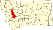 | |
| CDPs | ||
| Other community |
| |
| ||
This Powell County, Montana state location article is a stub. You can help Wikipedia by expanding it. |
Текст в блоке "Читать" взят с сайта "Википедия" и доступен по лицензии Creative Commons Attribution-ShareAlike; в отдельных случаях могут действовать дополнительные условия.
Другой контент может иметь иную лицензию. Перед использованием материалов сайта WikiSort.org внимательно изучите правила лицензирования конкретных элементов наполнения сайта.
Другой контент может иметь иную лицензию. Перед использованием материалов сайта WikiSort.org внимательно изучите правила лицензирования конкретных элементов наполнения сайта.
2019-2026
WikiSort.org - проект по пересортировке и дополнению контента Википедии
WikiSort.org - проект по пересортировке и дополнению контента Википедии