world.wikisort.org - USA
Goldcreek is an unincorporated community and census-designated place (CDP) in Powell County, Montana, United States. It is in the southwestern part of the county, 0.4 miles (0.6 km) south of Interstate 90's Exit 166. Via I-90, Garrison is 8 miles (13 km) to the southeast and Drummond is 12 miles (19 km) to the northwest.
Goldcreek, Montana | |
|---|---|
Census-designated place | |
 Goldcreek  Goldcreek | |
| Coordinates: 46°35′5″N 112°55′41″W | |
| Country | United States |
| State | Montana |
| County | Powell |
| Area | |
| • Total | 0.20 sq mi (0.51 km2) |
| • Land | 0.20 sq mi (0.51 km2) |
| • Water | 0.00 sq mi (0.00 km2) |
| Elevation | 4,190 ft (1,280 m) |
| Population (2020) | |
| • Total | 9 |
| • Density | 46.15/sq mi (17.80/km2) |
| Time zone | UTC-7 (Mountain (MST)) |
| • Summer (DST) | UTC-6 (MDT) |
| ZIP Code | 59733 (Gold Creek) |
| Area code | 406 |
| FIPS code | 30-31825 |
| GNIS feature ID | 2806661[2] |
Goldcreek is in the valley of the Clark Fork River, about 1 mile (1.6 km) downstream (west) of the confluence of Gold Creek with the river.
The community was first listed as a CDP prior to the 2020 census.[2]
Demographics
| Historical population | |||
|---|---|---|---|
| Census | Pop. | %± | |
| 2020 | 9 | — | |
| U.S. Decennial Census[3] | |||
References
- "ArcGIS REST Services Directory". United States Census Bureau. Retrieved September 5, 2022.
- "Goldcreek Census Designated Place". Geographic Names Information System. United States Geological Survey, United States Department of the Interior.
- "Census of Population and Housing". Census.gov. Retrieved June 4, 2016.
Municipalities and communities of Powell County, Montana, United States | ||
|---|---|---|
County seat: Deer Lodge | ||
| City | 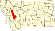 | |
| CDPs | ||
| Other community |
| |
| ||
This Powell County, Montana state location article is a stub. You can help Wikipedia by expanding it. |
Текст в блоке "Читать" взят с сайта "Википедия" и доступен по лицензии Creative Commons Attribution-ShareAlike; в отдельных случаях могут действовать дополнительные условия.
Другой контент может иметь иную лицензию. Перед использованием материалов сайта WikiSort.org внимательно изучите правила лицензирования конкретных элементов наполнения сайта.
Другой контент может иметь иную лицензию. Перед использованием материалов сайта WikiSort.org внимательно изучите правила лицензирования конкретных элементов наполнения сайта.
2019-2026
WikiSort.org - проект по пересортировке и дополнению контента Википедии
WikiSort.org - проект по пересортировке и дополнению контента Википедии