world.wikisort.org - USA
Field is a neighborhood in the Nokomis community in south Minneapolis, Minnesota, United States. The neighborhood is bordered by East 46th Street on the north, Chicago Avenue on the east, Minnehaha Parkway on the south, and Interstate 35W on the west. Field shares a neighborhood organization with the Regina and Northrop neighborhoods.
Field | |
|---|---|
Neighborhood | |
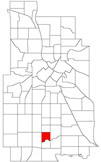 Location of Field within the U.S. city of Minneapolis | |
| Country | United States |
| State | Minnesota |
| County | Hennepin |
| City | Minneapolis |
| Community | Nokomis |
| Area | |
| • Total | 0.346 sq mi (0.90 km2) |
| Population (2010)[2] | |
| • Total | 2,366 |
| • Density | 6,800/sq mi (2,600/km2) |
| Time zone | UTC-6 (CST) |
| • Summer (DST) | UTC-5 (CDT) |
| ZIP code | 55407, 55409, 55417, 55419 |
| Area code(s) | 612 |
| Historical population | |||
|---|---|---|---|
| Census | Pop. | %± | |
| 1980 | 2,757 | — | |
| 1990 | 2,591 | −6.0% | |
| 2000 | 2,526 | −2.5% | |
| 2010 | 2,366 | −6.3% | |
Field takes its name from a local school, which in turn was named for Eugene Field, a writer of children's poetry. The largely residential neighborhood is characterized by small, two-bedroom pre-1940s stucco, brick, and stone houses. Chicago Avenue is the main commercial thoroughfare. Field features the Arthur and Edith Lee House historic place.
References
- "Field neighborhood in Minneapolis, Minnesota (MN), 55407, 55409, 55417, 55419 detailed profile". City-Data. 2011. Retrieved 2013-11-17.
- "Minneapolis Neighborhood Profile: Field" (PDF). Minnesota Compass. October 2011. Retrieved 2013-11-15.
- Field, Minneapolis, MN. Google Earth. Retrieved 2011-03-09.
External links
Places adjacent to Field, Minneapolis | ||||||||||||||||
|---|---|---|---|---|---|---|---|---|---|---|---|---|---|---|---|---|
| ||||||||||||||||
Текст в блоке "Читать" взят с сайта "Википедия" и доступен по лицензии Creative Commons Attribution-ShareAlike; в отдельных случаях могут действовать дополнительные условия.
Другой контент может иметь иную лицензию. Перед использованием материалов сайта WikiSort.org внимательно изучите правила лицензирования конкретных элементов наполнения сайта.
Другой контент может иметь иную лицензию. Перед использованием материалов сайта WikiSort.org внимательно изучите правила лицензирования конкретных элементов наполнения сайта.
2019-2026
WikiSort.org - проект по пересортировке и дополнению контента Википедии
WikiSort.org - проект по пересортировке и дополнению контента Википедии