world.wikisort.org - USA
Colburn is a small unincorporated census-designated place in northeastern Washington Township, Tippecanoe County, in the U.S. state of Indiana.[3]
Colburn, Indiana | |
|---|---|
Census-designated place | |
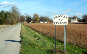 Looking east toward Colburn along County Road 700 North. Welcome sign made by Bill Fitzmaurice, a resident of Colburn for 25 years. | |
 Location of Colburn in Tippecanoe County, Indiana. | |
| Coordinates: 40°31′07″N 86°42′51″W | |
| Country | United States |
| State | Indiana |
| County | Tippecanoe |
| Township | Washington |
| Founded | 1858 |
| Founder | Jacob H. Chapman |
| Area | |
| • Total | 0.10 sq mi (0.26 km2) |
| • Land | 0.10 sq mi (0.26 km2) |
| • Water | 0.00 sq mi (0.00 km2) |
| Elevation | 663 ft (202 m) |
| Population (2020) | |
| • Total | 164 |
| • Density | 1,640.00/sq mi (632.23/km2) |
| Time zone | UTC-5 (Eastern (EST)) |
| • Summer (DST) | UTC-4 (EDT) |
| Zip Code | 47905 |
| Area code(s) | 765 |
| GNIS feature ID | 432745, 2583448 |
It is part of the Lafayette, Indiana Metropolitan Statistical Area.
History
Colburn was originally called Chapmanville.[4]
A post office was established at Colburn in 1860, and remained in operation until it was discontinued in 1988.[5]
Geography
Colburn is located at 40°31'07" North, 86°42'51" West (40.518611, -86.714167) in Washington Township, at an elevation of 662 feet. Nearby communities include Lafayette (12 miles southwest), Delphi (6 miles north), Buck Creek (4 miles south) and Americus (3.5 miles west).
Demographics
| Historical population | |||
|---|---|---|---|
| Census | Pop. | %± | |
| 2020 | 164 | — | |
| U.S. Decennial Census[6] | |||
References
- "2020 U.S. Gazetteer Files". United States Census Bureau. Retrieved March 16, 2022.
- "US Board on Geographic Names". United States Geological Survey. October 25, 2007. Retrieved 2016-07-25.
- "Colburn, Indiana". Geographic Names Information System. United States Geological Survey. Retrieved 2016-07-25.
- "USGS detail on Colburn - Variant Citation". Retrieved 2016-07-25.
- "Tippecanoe County". Jim Forte Postal History. Retrieved July 25, 2016.
- "Census of Population and Housing". Census.gov. Retrieved June 4, 2016.

Municipalities and communities of Tippecanoe County, Indiana, United States | ||
|---|---|---|
County seat: Lafayette | ||
| Cities |
|  |
| Towns |
| |
| Townships | ||
| CDPs |
| |
| Other communities |
| |
| Ghost towns |
| |
| Footnotes | ‡This populated place also has portions in an adjacent county or counties | |
| ||
Текст в блоке "Читать" взят с сайта "Википедия" и доступен по лицензии Creative Commons Attribution-ShareAlike; в отдельных случаях могут действовать дополнительные условия.
Другой контент может иметь иную лицензию. Перед использованием материалов сайта WikiSort.org внимательно изучите правила лицензирования конкретных элементов наполнения сайта.
Другой контент может иметь иную лицензию. Перед использованием материалов сайта WikiSort.org внимательно изучите правила лицензирования конкретных элементов наполнения сайта.
2019-2026
WikiSort.org - проект по пересортировке и дополнению контента Википедии
WikiSort.org - проект по пересортировке и дополнению контента Википедии