world.wikisort.org - USA
Perry Township is one of thirteen townships in Tippecanoe County, Indiana, United States. As of the 2010 census, its population was 7,161 and it contained 2,782 housing units.[2]
Perry Township | |
|---|---|
Township | |
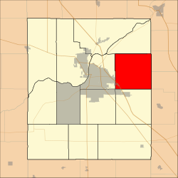 Location in Tippecanoe County | |
| Coordinates: 40°25′54″N 86°45′06″W | |
| Country | United States |
| State | Indiana |
| County | Tippecanoe |
| Government | |
| • Type | Indiana township |
| Area | |
| • Total | 36.24 sq mi (93.9 km2) |
| • Land | 36.08 sq mi (93.4 km2) |
| • Water | 0.15 sq mi (0.4 km2) 0.41% |
| Elevation | 659 ft (201 m) |
| Population (2010) | |
| • Total | 7,161 |
| • Density | 198.5/sq mi (76.6/km2) |
| Time zone | UTC-5 (Eastern (EST)) |
| • Summer (DST) | UTC-4 (EDT) |
| ZIP codes | 47905 |
| Area code(s) | 765 |
| GNIS feature ID | 453725 |
History
Hershey House was listed on the National Register of Historic Places in 1978.[3]
Geography
According to the 2010 census, the township has a total area of 36.24 square miles (93.9 km2), of which 36.08 square miles (93.4 km2) (or 99.56%) is land and 0.15 square miles (0.39 km2) (or 0.41%) is water.[2]
Cities, towns, villages
- Lafayette (east edge)
Unincorporated communities
- Heath at 40.4611470°N 86.7333397°W
- Meadowbrook at 40.4203135°N 86.8097301°W
- Monitor at 40.4197581°N 86.7563958°W
- Pettit at 40.4175359°N 86.7091721°W
(This list is based on USGS (United States Geological Survey) data and may include former settlements.)
Adjacent townships
- Washington Township (north)
- Clay Township, Carroll County (east)
- Ross Township, Clinton County (east)
- Madison Township, Clinton County (southeast)
- Sheffield Township (south)
- Wea Township (southwest)
- Fairfield Township (west)
Cemeteries
The township contains these three cemeteries: Swank, Union and Zion.
Major highways
 Interstate 65
Airports and landing strips
- Halsmer Airport
- Wildcat Air Landing Area
School districts
- Tippecanoe School Corporation
Political districts
- Indiana's 4th congressional district
- State House District 41
- State Senate District 22
References
- United States Census Bureau 2007 TIGER/Line Shapefiles
- United States Board on Geographic Names (GNIS)
- United States National Atlas
- "US Board on Geographic Names". United States Geological Survey. October 25, 2007. Retrieved 2017-05-09.
- "Population, Housing Units, Area, and Density: 2010 - County -- County Subdivision and Place -- 2010 Census Summary File 1". United States Census. Archived from the original on 2020-02-12. Retrieved 2013-05-10.
- "National Register Information System". National Register of Historic Places. National Park Service. July 9, 2010.
External links
Municipalities and communities of Tippecanoe County, Indiana, United States | ||
|---|---|---|
County seat: Lafayette | ||
| Cities |
|  |
| Towns |
| |
| Townships | ||
| CDPs |
| |
| Other communities | ||
| Ghost towns |
| |
| Footnotes | ‡This populated place also has portions in an adjacent county or counties | |
| ||
Текст в блоке "Читать" взят с сайта "Википедия" и доступен по лицензии Creative Commons Attribution-ShareAlike; в отдельных случаях могут действовать дополнительные условия.
Другой контент может иметь иную лицензию. Перед использованием материалов сайта WikiSort.org внимательно изучите правила лицензирования конкретных элементов наполнения сайта.
Другой контент может иметь иную лицензию. Перед использованием материалов сайта WikiSort.org внимательно изучите правила лицензирования конкретных элементов наполнения сайта.
2019-2026
WikiSort.org - проект по пересортировке и дополнению контента Википедии
WikiSort.org - проект по пересортировке и дополнению контента Википедии