world.wikisort.org - USA
Cherry Creek (Lakota: čhaŋpȟá wakpála;[3] "Chokecherry Creek") is an unincorporated community and census-designated place (CDP) in Ziebach County, South Dakota, United States.[4] The population was 282 at the 2020 census.[5] Cherry Creek has been assigned the ZIP code of 57622.
Cherry Creek, South Dakota
čhaŋpȟá wakpála | |
|---|---|
Unincorporated community | |
 Cherry Creek, South Dakota Location within the state of South Dakota  Cherry Creek, South Dakota Cherry Creek, South Dakota (the United States) | |
| Coordinates: 44°36′20″N 101°29′58″W | |
| Country | United States |
| State | South Dakota |
| County | Ziebach |
| Area | |
| • Total | 0.61 sq mi (1.59 km2) |
| • Land | 0.61 sq mi (1.59 km2) |
| • Water | 0.00 sq mi (0.00 km2) |
| Population (2020)[2] | |
| • Total | 282 |
| • Density | 459.28/sq mi (177.41/km2) |
| Time zone | UTC-6 (Central (CST)) |
| • Summer (DST) | UTC-5 (CDT) |
| ZIP codes | 57622 |
| Area code | 605 |
| FIPS code | 46-11540 |
The community takes its name from Cherry Creek.[6]
Demographics
| Historical population | |||
|---|---|---|---|
| Census | Pop. | %± | |
| 2020 | 282 | — | |
| U.S. Decennial Census[7] | |||
References
- "ArcGIS REST Services Directory". United States Census Bureau. Retrieved October 15, 2022.
- "Census Population API". United States Census Bureau. Retrieved Oct 15, 2022.
- Ullrich, Jan F. (2014). New Lakota Dictionary (2nd ed.). Bloomington, IN: Lakota Language Consortium. ISBN 978-0-9761082-9-0. Archived from the original on 2016-10-18. Retrieved 2014-02-12.
- U.S. Geological Survey Geographic Names Information System: Cherry Creek, South Dakota
- "U.S. Census Bureau: Cherry Creek CDP, South Dakota". www.census.gov. United States Census Bureau. Retrieved 28 June 2022.
- Federal Writers' Project (1940). South Dakota place-names, v.1-3. University of South Dakota. p. 30.
- "Census of Population and Housing". Census.gov. Retrieved June 4, 2016.
Municipalities and communities of Ziebach County, South Dakota, United States | ||
|---|---|---|
County seat: Dupree | ||
| Cities | 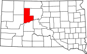 | |
| Unorganized territories |
| |
| CDPs | ||
| Other communities |
| |
| Indian reservations |
| |
| Footnotes | ‡This populated place also has portions in an adjacent county or counties | |
| ||
Authority control | |
|---|---|
| General |
|
| National libraries | |
This South Dakota state location article is a stub. You can help Wikipedia by expanding it. |
Текст в блоке "Читать" взят с сайта "Википедия" и доступен по лицензии Creative Commons Attribution-ShareAlike; в отдельных случаях могут действовать дополнительные условия.
Другой контент может иметь иную лицензию. Перед использованием материалов сайта WikiSort.org внимательно изучите правила лицензирования конкретных элементов наполнения сайта.
Другой контент может иметь иную лицензию. Перед использованием материалов сайта WikiSort.org внимательно изучите правила лицензирования конкретных элементов наполнения сайта.
2019-2025
WikiSort.org - проект по пересортировке и дополнению контента Википедии
WikiSort.org - проект по пересортировке и дополнению контента Википедии