world.wikisort.org - Uruguay
Rocha (Spanish pronunciation: [ˈrotʃa]) is a department in the east of Uruguay. Its capital is the city of Rocha. It borders Maldonado Department to its west, Lavalleja Department to its northwest, Treinta y Tres Department to its north, while to its northeast Laguna Merín forms part of its border with Brazil and at the south end of the lake it also borders the southernmost end of Brazil, with the city of Chuy "shared" between both countries, the border passing through its main commercial avenue.
Rocha Department | |
|---|---|
 Flag  Coat of arms | |
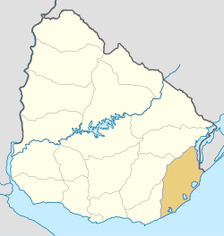 Location of Rocha Department and its capital | |
| Coordinates (Rocha): 34°29′0″S 54°21′0″W | |
| Country | |
| Capital of Department | Rocha |
| Government | |
| • Intendant | Alejo Umpiérrez |
| • Ruling party | Partido Nacional |
| Area | |
| • Total | 10,551 km2 (4,074 sq mi) |
| Population (2011 census) | |
| • Total | 68,088 |
| • Density | 6.5/km2 (17/sq mi) |
| Demonym(s) | Rochense |
| Time zone | UTC-3 (UYT) |
| ISO 3166 code | UY-RO |
| Website | www |
Rocha has natural beauties like Cabo Polonio, Valizas, Santa Teresa National Park. It is well known for its beach resorts, like Punta del Diablo or La Esmeralda, which swell with visitors during the summer holidays. Inland, the primary economy of Rocha is based on large cattle ranches.
History
On 7 July 1880, the department of Rocha was formed from territory that had belonged to the department of Maldonado since the first division of the Republic in departments in 1819.
In literature
Rocha department features in Carlos Maria Dominguez's 2004 novel Casa de Papel (trs English, 2005, The House of Paper). The narrator visits the ruins of a house of books ergo, 'house of paper', which had been built and then destroyed by an obsessive book collector on the sand spit separating Rocha lagoon from the ocean.
Population and Demographics
As of the census of 2011, Rocha Department had a population of 68,088 (33,269 male and 34,819 female) and 46,071 households.[2]
Demographic data for Rocha Department in 2010:
- Population growth rate: -0.082%
- Birth Rate: 14.04 births/1,000 people
- Death Rate: 10.44 deaths/1,000 people
- Average age: 35.0 (34.0 male, 36.0 female)
- Life Expectancy at Birth:
- Total population: 75.82 years
- Male: 72.17 years
- Female: 79.43 years
- Average per household income: 19,978 pesos/month
- Urban per capita income: 8,635 pesos/month
2010 Data Source:[3]
Main Urban Centres
Population stated as per 2011 census. [4]
| City / Town | Population |
|---|---|
| Rocha | 25,422 |
| Chuy | 9,675 |
| Castillos | 7,541 |
| Lascano | 7,645 |
| La Paloma | 3,495 |
| Cebollatí | 1,609 |
| La Aguada y Costa Azul | 1,090 |
| Velázquez | 1,022 |
Other towns and villages
Population stated as per 2011 census.[2]
| Town / Village | Population |
|---|---|
| 18 de Julio | 977 |
| Punta del Diablo | 823 |
| San Luis al Medio | 598 |
| La Coronilla | 510 |
| Puimayen | 505 |
Rural population
According to the 2011 census, Rocha department has an additional rural population of 4,146.

See also
- List of populated places in Uruguay#Rocha Department
References
- "Población por sexo y ascendencia étnico racial, según departamento" (in Spanish). National Institute of Statistics. Archived from the original on 30 November 2020.
- "Censos 2011 Rocha (needs flash plugin)". INE. 2012. Retrieved 30 August 2012.
- "Uruguay en cifras" (PDF) (in Spanish). INE. 2011. Retrieved 25 October 2012.
- "Censos 2011 Cuadros Rocha". INE. 2012. Archived from the original on 10 October 2012. Retrieved 25 August 2012.
External links
- Official site of the Department of Rocha - About the Department
- INE map of Rocha Department
- Tourism in Uruguay, Rocha
- Nuestra Terra, Colección Los Departamentos, Vol.10 "Rocha"
Capital: Rocha | ||
| Towns and villages | 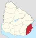 | |
| Sights | ||
| Resorts and Landforms |
|
|---|---|
| |
Departments of Uruguay | ||
|---|---|---|
| Authority control |
|
|---|
На других языках
- [en] Rocha Department
[ru] Роча (департамент)
Роча (исп. Rocha) — департамент в восточной части Уругвая, протянулся на 170 км вдоль побережья Атлантического океана. Площадь составляет 10 551 км² (5,98 % от общей площади страны). Административный центр — город Роча, расположен в 210 км от Монтевидео.Другой контент может иметь иную лицензию. Перед использованием материалов сайта WikiSort.org внимательно изучите правила лицензирования конкретных элементов наполнения сайта.
WikiSort.org - проект по пересортировке и дополнению контента Википедии