world.wikisort.org - Uruguay
Aguas Dulces is a resort in the Rocha Department of southeastern Uruguay.
Aguas Dulces | |
|---|---|
Resort | |
 | |
 Aguas Dulces Location in Uruguay | |
| Coordinates: 34°16′35″S 53°47′0″W | |
| Country | |
| Department | Rocha Department |
| Population (2011) | |
| • Total | 417 |
| Time zone | UTC -3 |
| Postal code | 27202 |
| Dial plan | +598 4475 (+4 digits) |
| Climate | Cfa |
Location
The resort is located at the east end (on Km. 277.5) of Route 10 and the south end of Route 16, on the coast of the Atlantic Ocean, about 11 kilometres (6.8 mi) southeast of Castillos and between the lagoons Laguna de Castillos and Laguna Negra. Its nominal distance from Montevideo is 288 km, using Ruta Interbalnearia, Route 9 and Route 16 (via Castillos).
Population
In 2011 Aguas Dulces had a population of 417 permanent inhabitants and 1,596 dwellings.[1]
| Year | Population | Dwellings |
|---|---|---|
| 1963 | 74 | 562 |
| 1975 | 120 | 1,027 |
| 1985 | 145 | 989 |
| 1996 | 247 | 1,183 |
| 2004 | 409 | 1,437 |
| 2011 | 417 | 1,596 |
Source: Instituto Nacional de Estadística de Uruguay[2]
References
- "Censos 2011 Rocha (needs flash plugin)". INE. 2012. Archived from the original on 11 November 2012. Retrieved 30 August 2012.
- "1963–1996 Statistics / A". Instituto Nacional de Estadística de Uruguay. 2004. Archived from the original (DOC) on 21 July 2011. Retrieved 25 July 2011.
External links
| Resorts and Landforms |
|
|---|---|
| |
Capital: Rocha | ||
| Towns and villages | 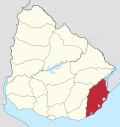 | |
| Sights | ||
This article about a place in Rocha Department is a stub. You can help Wikipedia by expanding it. |
Текст в блоке "Читать" взят с сайта "Википедия" и доступен по лицензии Creative Commons Attribution-ShareAlike; в отдельных случаях могут действовать дополнительные условия.
Другой контент может иметь иную лицензию. Перед использованием материалов сайта WikiSort.org внимательно изучите правила лицензирования конкретных элементов наполнения сайта.
Другой контент может иметь иную лицензию. Перед использованием материалов сайта WikiSort.org внимательно изучите правила лицензирования конкретных элементов наполнения сайта.
2019-2026
WikiSort.org - проект по пересортировке и дополнению контента Википедии
WikiSort.org - проект по пересортировке и дополнению контента Википедии