world.wikisort.org - Uruguay
La Coronilla is a village in the Rocha Department of southeastern Uruguay.
This article may be expanded with text translated from the corresponding article in Spanish. (June 2011) Click [show] for important translation instructions.
|
La Coronilla | |
|---|---|
Village | |
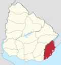
 La Coronilla Location in Uruguay | |
| Coordinates: 33°54′0″S 53°31′0″W | |
| Country | |
| Department | Rocha Department |
| Population (2011) | |
| • Total | 510 |
| Time zone | UTC -3 |
| Postal code | 27201 |
| Dial plan | +598 4476 (+4 digits) |
| Climate | Cfa |

Location
The village is located on the Atlantic coast on Route 9, about 23 kilometres (14 mi) south of Chuy and the border with Brazil. Across Route 9, as a western extension of the village is the hamlet Capacho and as a northern extension the neighbourhood Barrio Pereira. Together they form a populated centre of 1,153 inhabitants, according to the 2011 census.[1]
History
On 13 November 1951, the populated nucleus previously named "Las Maravillas" was renamed and its status was elevated to "Pueblo" (village) by the Act of Ley Nº 11.763.[2]
Population
In 2011 La Coronilla had a population of 510.[1]
| Year | Population |
|---|---|
| 1963 | 488 |
| 1975 | 626 |
| 1985 | 593 |
| 1996 | 586 |
| 2004 | 541 |
| 2011 | 510 |
Source: Instituto Nacional de Estadística de Uruguay[3]
According to the 2011 census, Capacho had a population of 457 and Barrio Pereira of 186.
References
- "Censos 2011 Rocha (needs flash plugin)". INE. 2012. Archived from the original on 11 November 2012. Retrieved 5 September 2012.
- "LEY N° 11.763". República Oriental del Uruguay, Poder Legislativo. 1951. Archived from the original on 23 May 2013. Retrieved 5 September 2012.
- "Statistics of urban localities (1963–2004)". INE. 2012. Archived from the original (PDF) on 23 March 2015. Retrieved 5 September 2012.
External links
- INE map of Capacho, Barrio Pereira and La Coronilla
- Article on La Coronilla, Official Portal of the Uruguayan Government
| Resorts and Landforms |
|
|---|---|
| |
Capital: Rocha | ||
| Towns and villages |
|  |
| Sights | ||
This article about a place in Rocha Department is a stub. You can help Wikipedia by expanding it. |
На других языках
[de] La Coronilla
La Coronilla ist ein Badeort in Uruguay.- [en] La Coronilla
[ru] Ла-Коронилья
Ла-Коронилья (исп. La Coronilla) — населённый пункт в юго-восточной части Уругвая, в департаменте Роча.Другой контент может иметь иную лицензию. Перед использованием материалов сайта WikiSort.org внимательно изучите правила лицензирования конкретных элементов наполнения сайта.
WikiSort.org - проект по пересортировке и дополнению контента Википедии