world.wikisort.org - Uruguay
Brazo Oriental is a barrio (neighbourhood or district) of Montevideo, the capital of Uruguay. Brazo Oriental is a residential zone located approximately 5 kilometres (3.1 mi) from Montevideo's centre.
Brazo Oriental | |
|---|---|
Barrio | |
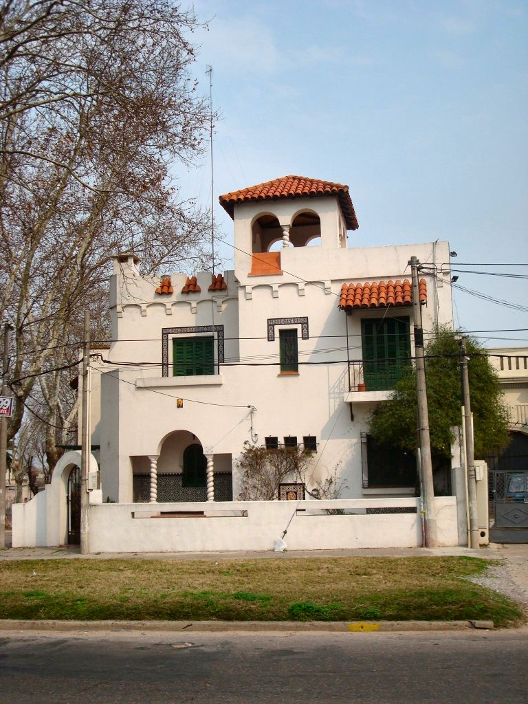
 The historical residence of Dr. Luís Alberto de Herrera | |
 Street map of Brazo Oriental | |
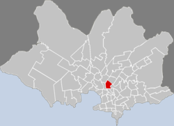 Map of Montevideo highlighting the barrio | |
| Coordinates: 34°51′54″S 56°10′43″W | |
| Department | Montevideo Department |
| City | Montevideo |
Location and origin of name
Brazo Oriental borders La Figurita and Jacinto Vera to the south, Bolívar to the east, Cerrito de la Victoria to the northeast, Aires Puros to the northwest and Atahualpa to the west. It is delimited by Artigas Boulevard to the south, Burgues Avenue to the west and José Batlle y Ordóñez Boulevard to the north.
It was reported in the press around 1910 that there had been a mortal fight with knives between a "Porteño" (Argentinian) and an "Oriental" (Uruguayan) at the corner of the actual avenues San Martín and Luis Alberto de Herrera. Although the Argentinian was younger and more agile, the fight was won by the Uruguayan thanks to the power of his arm (brazo). For many years following the event this place was called "la esquina del brazo del Oriental" (the corner of the arm of the Oriental), which finally gave its name to the barrio.[1]
Landmarks
The most important landmarks of the barrio are the Museo de la Casa de Luis Alberto de Herrera, historical leader of the Partido Nacional, the Escuela Superior de Comercio of the Universidad del Trabajo del Uruguay (UTU) the headquarters of the Colón F.C. sports club and the public sports facilities of "Plaza de deportes 12", which include a closed gymnasium, a 25-meter open air swimming pool, two basket courts and a 100m sprinting stripe.[2]
Places of worship
- Armenian Evangelical Church (Armenian Evangelical)
Transportation
The bus lines that pass through Brazo Oriental are the following: 76, 185, 186, 526 (Artigas Boulevard); 155, 156, 396, 404, 456 (San Martín avenue); 150, 158 (Burgues avenue); 169, 175, 199, 505 (General Flores avenue); 181, 182, 183, 306 (Luis Alberto de Herrera avenue); 2, 173 (José Batlle y Ordóñez Boulevard).
Historical maps

See also
- Barrios of Montevideo
References
- Sofia B & Lautaro N. "Presentation Transcript" (in Spanish). Retrieved 2 September 2013.
- "Se inauguró gimnasio de plaza de deportes Nº 12" (in Spanish). Intendencia Municipal de Montevideo. 2012. Archived from the original on 22 October 2014. Retrieved 19 January 2013.
External links
Barrios of Montevideo | ||
|---|---|---|
 |
| |
На других языках
- [en] Brazo Oriental
[es] Brazo Oriental
Brazo Oriental es un barrio de la ciudad de Montevideo, capital de Uruguay. Esta zona residencial, ubicada a doce minutos del centro de la ciudad, tiene por límites las siguientes calles: Bulevar Artigas al sur, Avenida General Flores al este, Avenida Burgues al oeste y Bulevar José Batlle y Ordóñez (ex Propios) al norte.Другой контент может иметь иную лицензию. Перед использованием материалов сайта WikiSort.org внимательно изучите правила лицензирования конкретных элементов наполнения сайта.
WikiSort.org - проект по пересортировке и дополнению контента Википедии